

Deserts of Atacama, Chile
Pink Flamingos, Red Rocks & Blue Lagoons
Officially known as the Republic of Chile, Chile is a wildly diverse country that sits along the western coast of South America, extending 2,653 miles down its edge like a ribbon. Reaching north is the driest desert on Earth, the Atacama Desert, while the southern region is home to Patagonia with its high mountain peaks, icebergs and penguin colonies. At the center of the country, is Chile’s capital, Santiago, an urban sprawl of modern art, street markets and fine dining. The world’s longest mountain range, the Andes Mountains, run through Chile’s spine and encompasses varied landscapes of forests, lakes, glaciers, volcanoes and grasslands. And Easter Island is one of Chile’s most well-known mysteries, where the famous moai, large stone statues carved from volcanic rock, sit proudly. With such diversity, Chile boasts an incredibly vibrant culture, with art, history and cuisine among its strong suits.
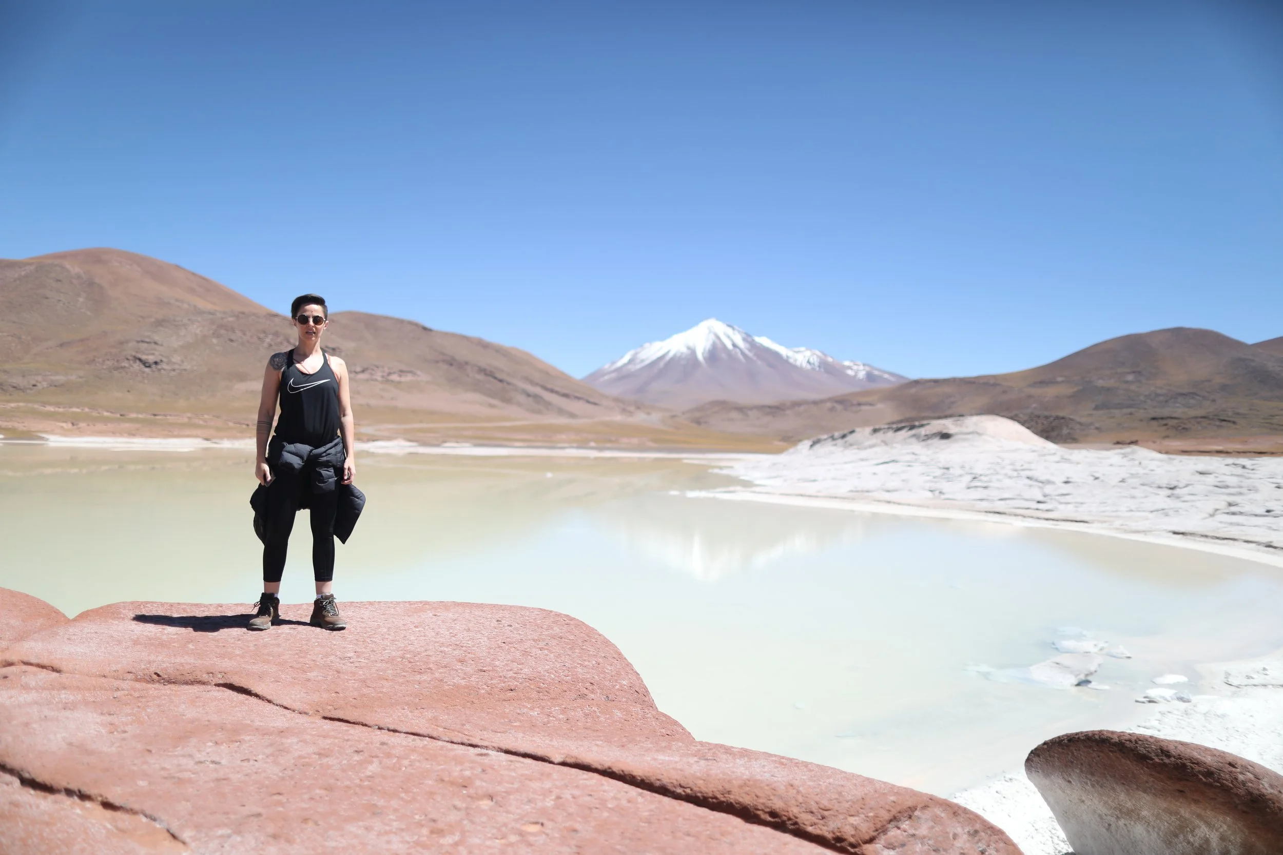
The Atacama Desert is a cool, arid region in northern Chile some 600 to 700 miles long; its limits are not exactly determined. It’s the driest nonpolar desert in the world and the second driest overall. The area has even been used to simulate life on Mars, as an expedition location and Martian environment. Within the desert are varied landscapes like the Chaxa Lagoon, Piedras Rojas and Altiplanic Lagoons. The Chaxa Lagoon is located at the center of the Salar de Atacama and is part of the Los Flamencos National Reserve, hence the best location to witness flamingoes in Chile. Translated to “red stones,” Piedras Rojas is a landscape that sits 13,000 feet above sea level and is made of red saturated stones formed by iron oxidation. The Altiplanic Lagoons are intensly blue colored bodies of water formed by cooling lava from nearby volcanoes.
Our time in Chile lasted two weeks and was quite an adventure. With eight flights, countless bus and taxi rides and even a ferry, we visited the central, north and south regions. First up was the capital city of Santiago, for Chilean Wine, World Class Cuisine & an Undeniable Art Scene and then we moved north to San Pedro de Atacama, the Driest Place on Earth. While in Atacama, we joined several incredible tours including the deserts of Atacama for pink flamingos, red rocks and blue lagoons, the Andes Mountains to experience El Tatio Geysers, northern Atacama to Moonwalk at Valle de la Luna and Atacama Desert to Stargaze Like You Mean It. Then, we flew to Chile's southernmost Patagonia region and Gateway to Antarctica, Punta Arenas, moving on to Torres del Paine, Chile’s Patagonia, with a special opportunity to admire Patagonia’s Waterfalls, Icebergs and Glaciers. Lastly, our journey lead us to Castro on Chiloé Island: Land of Myth & Sea.
Our stay in San Pedro de Atacama, the Driest Place on Earth, had us diving into every experience possible. In town, moving between two different tour agencies, Turismo Gato Andino and Horizons, we booked every tour we had our hearts set on for the next few days; it would be a lot but there was no other way to experience it all in such a short time.
At 6 a.m. we’d head out to Laguna Chaxa, Piedras Rojas and Altiplanic Lagoons for an all day excursion. The following day we planned for three tours back to back. Before sunrise, we’d travel to El Tatio Geysers, in the afternoon we’d visit Valle de la Luna and finally the Atacama Desert for stargazing with an astronomer, in the evening. The tour prices were affordable, ranging from $40-$90 USD each, depending on duration and offerings.
Breakfast at Toconao Plaza
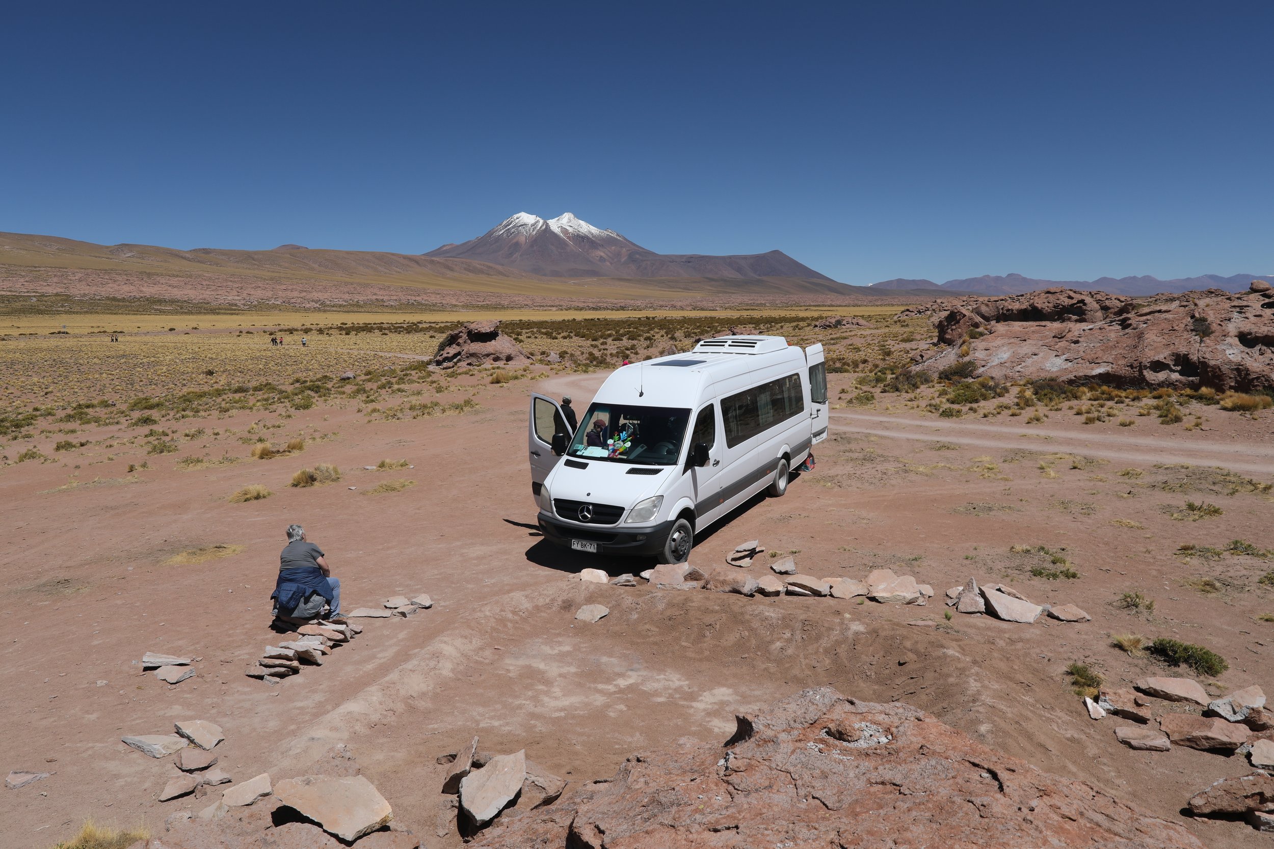
Beginning the day around 5:30 a.m., we made coffee and toast at our hotel. Our guide, Layra Silva, arrived about an hour later for pick up. The night before, a chat was started on What’s App suggesting the supplies we’d need for the day: cash for entrance fees (not covered by the tour), trekking shoes, water (a minimum of one liter), sunscreen, hat, sun glasses and warm clothes in case of low temperatures. The chat also allowed us to see a live update of the bus, so we weren’t left wondering if we’d missed it altogether. Our tour would also include breakfast and lunch with a drop off around 5:30 p.m. in the town center.


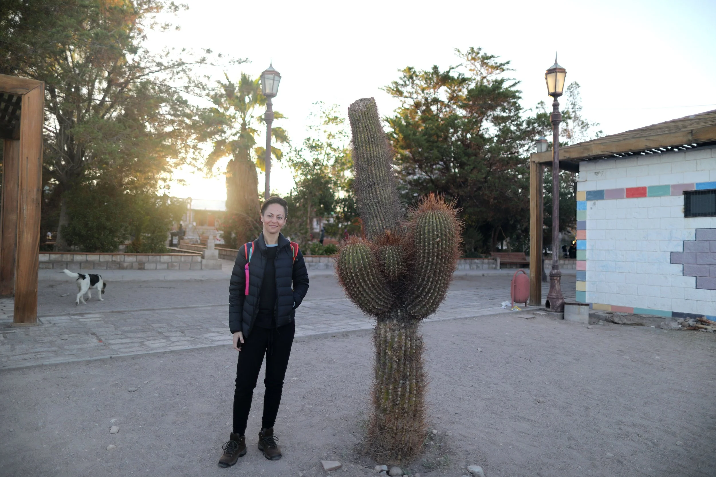
Our first stop, after gathering the other tour members around town, would be a tiny square at the center of Toconao about 30 minutes away, Toconao Plaza. Toconao is a small village south of San Pedro de Atacama in Chile’s northern Antofagasta Region. It sits at al elevation of 8,153 feet above sea level and is close to the northeast border of Salar de Atacama, the largest salt flat in Chile and our destination later in the day.
The most notable building in Toconao is its church. A bell tower stands separate from the main church structure and dates to 1750. Toponao is a quaint village and considered an oasis, with caves and houses made of volcanic rock.

Arriving in the plaza, the morning was soft and silent. The sun had just begun to reach the sky, warming everything in its path, including us. Our guide needed a moment to set up breakfast so we all wandered about the area in search of anything interesting.


The plaza was filled with hot pink flowers, tall palms and cacti. There was a tall white bell tower made of stone and clay with a tiny wooden door at its front; a plaque describing the tower. White rocks circled many of the plants, creating a beautiful desert garden.
Stray dogs roamed about, looking for scraps, while a few of us searched for someplace discrete to use the restroom. Anxious to get the day moving, we couldn’t wait to see what was in store for breakfast.

Soon enough, our meal we ready. The guide had pulled out a hot plate and prepared scrambled eggs, French bread, ham, cheese, fresh fruit, guacamole, coffee and tea.


Breakfast was delicious, especially the bread which was made by a local Frenchman living in the area. I put down as much as I could, making a few bite sized sandwiches stuffed with eggs and guacamole.
Get Pink with Flamingos at Chaxa Lagoon
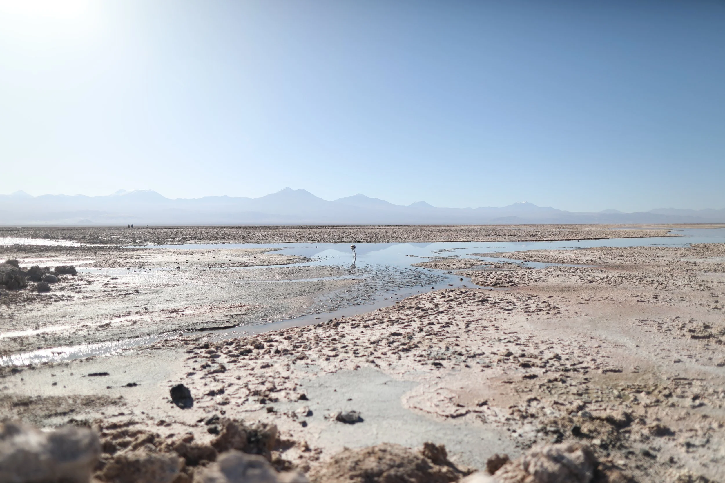
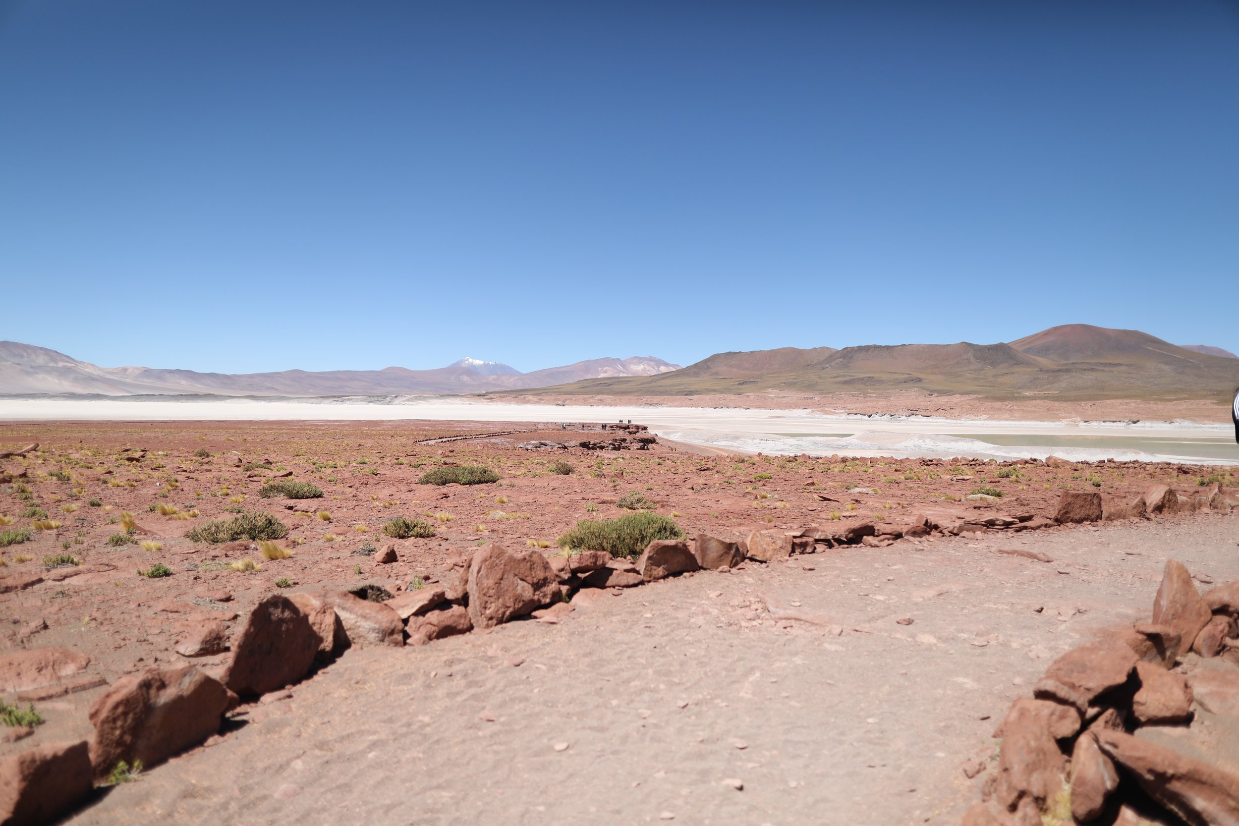
Satisfied and feeling more alive, our group loaded back into the van and headed an hour southwest to Laguna Chaxa. The Chaxa Lagoon is part of the Los Flamencos National Reserve and sits in the middle of Salar de Atacama. Salar de Atacama, the largest salt flat in Chile, is surrounded by mountains, lacking any drainage outlets. On the east, are the Andes Mountains, while on the west lies a mountain range called Cordillera de Domeyko. Several imposing volcanoes dominate the area, including Licancabur, Acamarachi, Aguas Calientes and Láscar, one of Chile’s most active volcanoes, last erupting in 2022.
Created in 1990, the reserve is comprised of seven sectors that preserve valuable high Andean biological diversity and honor the indigenous inhabitants of Salar de Atacama, the Likan Antay. Each one of the regions has a different geography, flora and fauna and can be enjoyed for its diversity. Upon arrival, we walked along a narrow path toward a small shack sitting alone in the desert. There, at the visitor’s center, we purchased tickets to enter the reserve, costing $8,000 CLP (Chilean peso) or about $9 USD.

First, we took a moment to see what flamingos gorge themselves on and why they turn the pinkish color they do. Floating in a plastic bottle were the smallest shrimp I’d ever seen. Flamingoes eat a combination of algae and brine shrimp, its body metabolizes the pigments, turning the feathers pink. Depending on the carotenoid (organic pigment) levels in the algae and crustaceans, the color varies. Here, in such a dry area, flamingoes tend to be a paler pink.

Chile is home to three of the worlds six species of flamingos which arrive here during summer to migrate, moving north. Typically found in lakes, lagoons, wetlands and salt flats they come to have sexy time and usually produce one baby each year. Flamingo pairs are monogamous and during this time both parents help build a volcano-shaped mound, where the momma lays a single egg, incubating it for approximately 28 days. When chicks hatch they are covered with white down, taking several years and molts to become pink. A molt is a time during which flamingos shed and replace their feathers, occurring irregularly but typically once every two years to twice a year.

The three types of flamingos found in Chile are the Chilean flamingo, Andean flamingo and James’s flamingo. The Chilean flamingo is the largest of the three and has a black bill, pink tail feathers and white and pink legs. It’s one of the most common throughout Chile and is closely related to the American and greater flamingos. The Andean flamingo, also known as the Large Parina, is the tallest flamingo species with yellow legs, black tail feathers, pale yellow faces and black and yellow bills. The last type, the James’s flamingo, also known as the Small Parina, is the rarest flamingo species with red legs and stubby bills with black tips.
As we entered the area, our guide made sure to stress the importance of taking care to always keep inside the marked paths. Chile takes its environmental protection very seriously and insists on following the rules that protect its natural treasures.


So, how did the salt flat form, anyway? The Atacama salt flat is located in a depression formed by the rising of the Andes and Domeyko mountain ranges. The central area sank and was then covered by a layer of volcanic material.


Over the years, a salt deposit nearly 4,750 feet deep was formed in the sunken area. The salt deposits originated from the precipitation of salts and minerals washed down from the hills of the Andes through flowing water.

Historically, during extremely humid seasons, superficial lagoons will form. When those waters evaporate, the salt remains. In dryer periods, the salts crystalize on the surface from the brine’s evaporation.

A salt and mineral treasure, the salt flat core is mainly composed of halite (NaCl) and characterized by a rugged crust. In other areas there are various kinds of crusts, some with hexagonal shapes caused by the cracks produced on the salt flat surface when it dries.


The pores and cavities are filled with brine and high amounts of sodium, potassium, magnesium, lithium and boron. The brine can be used to obtain potassium sulfate, potassium chloride, boric acid and lithium. In the region, the Lithium Triangle, is a zone in Salar de Atacama with the world’s largest and purest active source of lithium, containing 27% of the world’s lithium reserve base. This extraction has created much conflict with the indigenous people concerning water use by local communities and damage caused to local ecosystems, including the Andean flamingo.


Thankfully, zoning according to environmental sensitivity allows for the protection of important bird nesting and breeding sites and provides opportunities like our group had to enjoy the natural attractions of this high altitude salt flat.

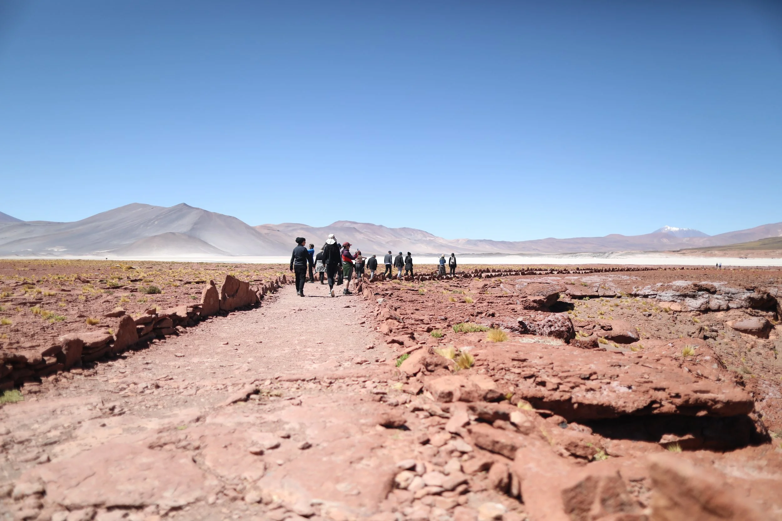
Our group spent time walking up and down the marked paths to get as close to the flamingos as possible. They could be found in all directions, ignoring the onlookers and only focusing on sustenance, eating as much as 18 hours a day.

It was also interesting to see where the flamingos chose to dine. Some gathered in large groups, or flamboyances, out in deeper waters, while others wandered off alone in less watered areas.

Though many of the flamingos were too far away to really get up close and personal, the most beautiful part of the view were the reflections of the snow capped volcanoes beyond. The views were absolutely stunning.

And way off in the distance, I could see other visitors on walking paths. They were so far out I didn’t know how they got there and sadly, we had less than an hour to explore so we didn’t get the chance to go too far.


So, after a short time, our guide rounded up the group and we headed back toward our vehicle.

Our next stop would be Piedras Rojas about two hours southeast.
Explore Piedras Rojas
On the way to Piedras Rojas we stopped off in a small town called Socaire about 40 minutes drive. Socaire is a village located 62 miles southwest of San Pedro de Atacama that offers views overlooking the Salar de Atacama. The village is famous for a special reddish purple potato and has a higher altitude with a different ecosystem and biodiversity. And though Chile has a whopping 97 active volcanoes, it’s Chiliques Volcano that looks after this small village. Its highest point towers at 18,957 feet above sea level and is capped by a 1,600 foot wide summit crater containing two crater lakes.
After using the restrooms and purchasing tickets for Piedras Rojas costing $15,000 CLP or $16.50 USD, we were on our way. Note, it does matter which tickets you buy, including the order of visitation. We selected the Southern Hot Water Salt Flats & Miscanti and Miñiques Lagoons package, meaning we’d be visiting Piedras Rojas first and then the twin lagoons.

On the way, we got lucky and spotted a bird similar to an ostrich, as well as several vicuñas along the roadside. Vicuñas are one of the two wild South American camelids that live in the high alpine areas of the Andes, the other being the guanaco, which live at lower elevations. Our guide was very protective of the vicuñas, saying that breeding season was upon us and therefore, we had to be cautious as any stress could cause a miscarriage. We were only able to check them out from inside the van but they do tend to get pretty close to the roadside.

As the smallest members of the camel family, vicuñas were historically held in high regard by the ancient Inca for their super-soft, fine and resilient wool. However, after South America was conquered by Spain, uncontrolled hunting for wool and meat almost destroyed the species. Still coveted today, their fur is scarce because the vicuña is an endangered species. They have also proven to be nearly impossible to domesticate due to their unique mating habits and bullish character.


On the other side of Atacama basin is another mountain range. The Salt Mountains, also known as the Cordillera de la Sal, were formed millions of years ago when the bottom of an ancient lake rose due to movement of the terrestrial coast, the primary coasts shaped by rivers, glaciers and volcanoes. This mountain range is famous for Valle de la Luna, an area known for its moonlike landscape of dunes, rugged mountains and distinctive rock formations, that we’d visit later on. It’s red, smaller in size and often appears to be covered in salt due to its high calcium sulfate content which has been shaped by the Atacama Desert's sun, wind and rain.

This region is also famous for the largest astrological project in the world, ALMA or Atacama Large Millimeter/submillimeter Array. The ALMA Observatory is an astronomical interferometer of 66 radio telescopes that observe electromagnetic radiation at millimeter and submillimeter wavelengths. Located on the Chajnantor plateau at an altitude of 16,500 feet, the area is one of the highest and driest places on Earth making it an ideal location for astronomical observation.


At the edge of Salar de Aguas Calientes lies Piedras Rojas. Meaning “red stones,” Piedras Rojas is a majestic volcanic landscape located in the heart of the Chilean altiplano like nothing you’ve seen before. The Aguas Calientes salt lake belongs to the biggest Talar salt lake with a surface of 18 square miles and an altitude of 12,960 feet.


As part of the Central Andean dry puna, or highland, Salar de Talar is characterized by thick bunches of grassy vegetation and an arid climate, with an average annual precipitation of only six inches.


Even in the early afternoon, it was already incredibly hot and dry. The increased elevation had also reached new heights, which is known to cause altitude sickness, drowsiness, nausea or shortness of breath. We were instructed to move slowly on the hike and hydrate often. Additionally, it’s important to cover up from the sun and wear sunscreen and sunglasses for protection, as the heat can be quite intense and overcome suddenly.

Arriving at Piedras Rojas was simple and straight forward with a guide but I have read there can be some confusion with ticketing, so be sure you have the correct tickets before arrival. After passing a small stone structure marked as the visitors center, continue along the dusty trail on foot, as if walking directly into the middle of nowhere. A short hike down into the valley, lasting about 30 minutes, is marked with small rocks on each side and graphic signage.


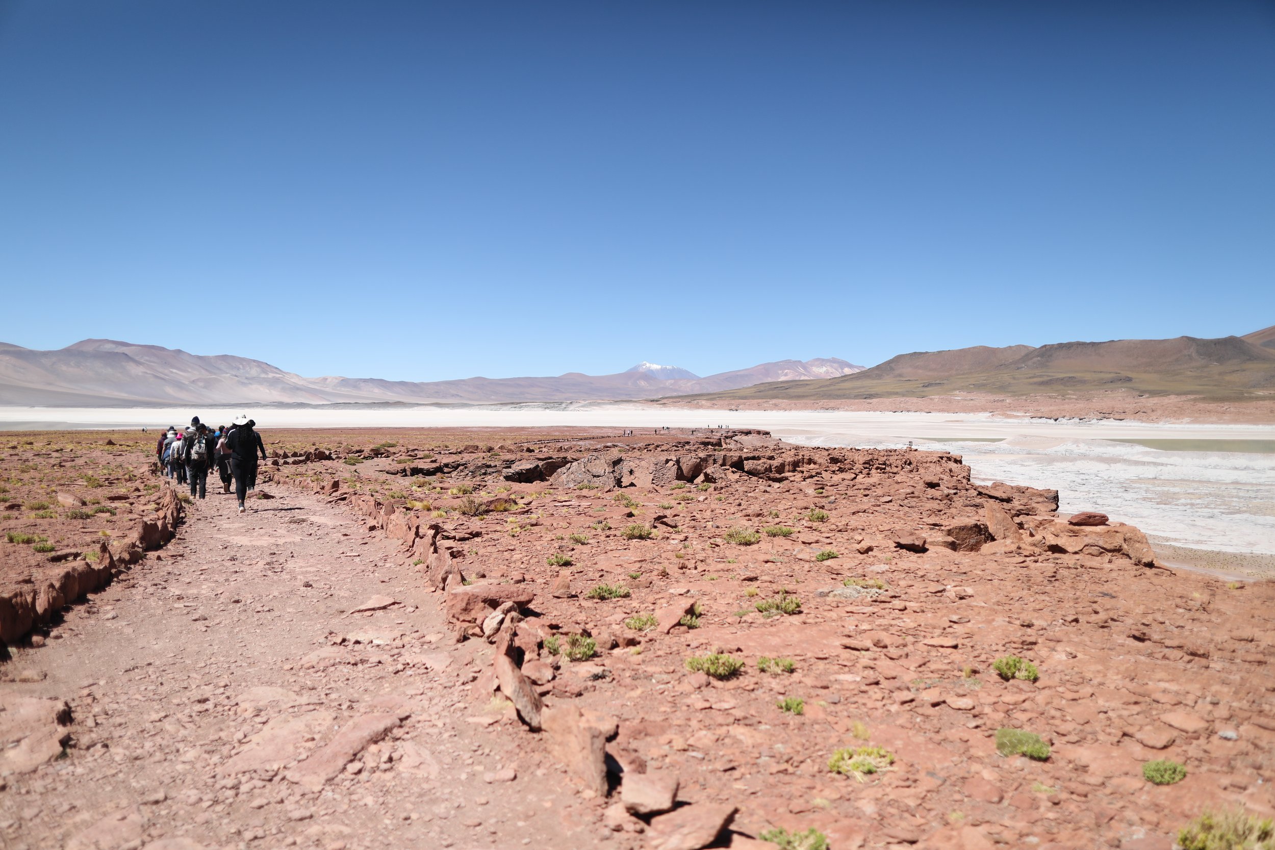
The flat plain of the landscape is surrounded by towering mountain ranges and snowy peaks in all directions, with rocks and soil in shades of red and terra cotta. Located in the high plateau of northern Chilean Andes, Salar de Talar is part of a series of salt flats at the foothills of a chain of volcanoes that stretch along the eastern side of the much greater Salar de Atacama.

The drainage basin of Salar de Talar, though closed, stretches nearly 185 square miles and lies next to Laguna Miscanti, Laguna Tuyajto and Salar de Capur basins, the first of which we’ll visit next. In the past, it was also once filled with a large lake connected to Salar Purisunchi.

The salty flat is flanked on the west by Caichinque, a volcanic complex lying between Salar de Talar and Salar de Capur, and Cerro Medano on the east. Cerro Medano is a striking mountain colored in shades of grey and brown, which contrast greatly against the bright white of the salt flat’s surface and powdery blue and sea foam green ponds at its shores. Incredibly, lava flow from the Caichinque volcanic complex has formed two nodes that spread into Salar de Talar.


Set as the backdrop to such a gorgeous landscape is the awe-inspiring Cerro Miscanti, also known as Ipira. A mountain of volcanic origin located in the Antofagasta Region, it towers over Laguna Miscanti. The structure covers 15 square miles and shows traces of a westward collapse exposing the interior of the volcano. Inside that scar, grew another volcano where any new eruptions are likely flow to the shores of Laguna Miscanti.


The mountain range in the distance with three small snowy summits is Cerros de Incahuasi. The present-day mountain is the result of a partial collapse of an ancient volcano. The Incahuasi Sur volcano in this range was active 10.5 million years ago and is associated with a volcanic belt and fault that extends southeastward.


The scenery at Piedras Rojas is breathtaking. A trail creates a loop, stopping off at various viewpoints that are not to be missed. The path begins with a straight shot out into the wilderness and meets a lookout point over a salty white landscape and soft green-hued lake that almost looks like a mirage.

The red rocks are formed from oxidation of iron and give an incredible contrast next to the aqua waters and white crystals formed by the salt. The round shaped red rocks look as if they’ve been dropped from another planet and help make the view unforgettable. A simple 360 turn gives unlimited sight lines in all directions.

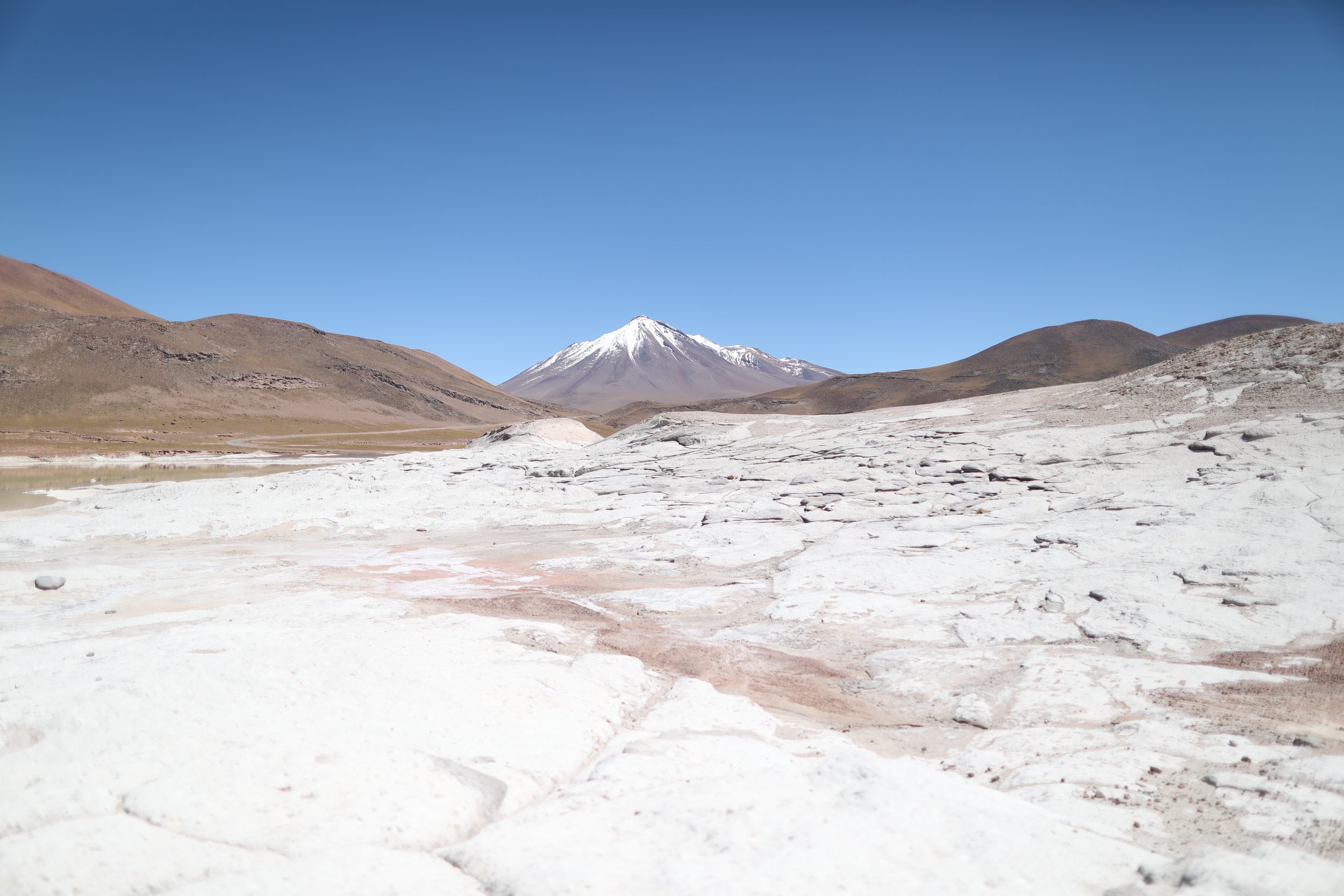
One of the first areas we came upon was covered with white salt crystals, especially at the dryer edges of the lake. We were only able to view from a vantage point but it was special nonetheless. The wind is also guaranteed to blow you away so make sure to keep your belongings secured at all times.
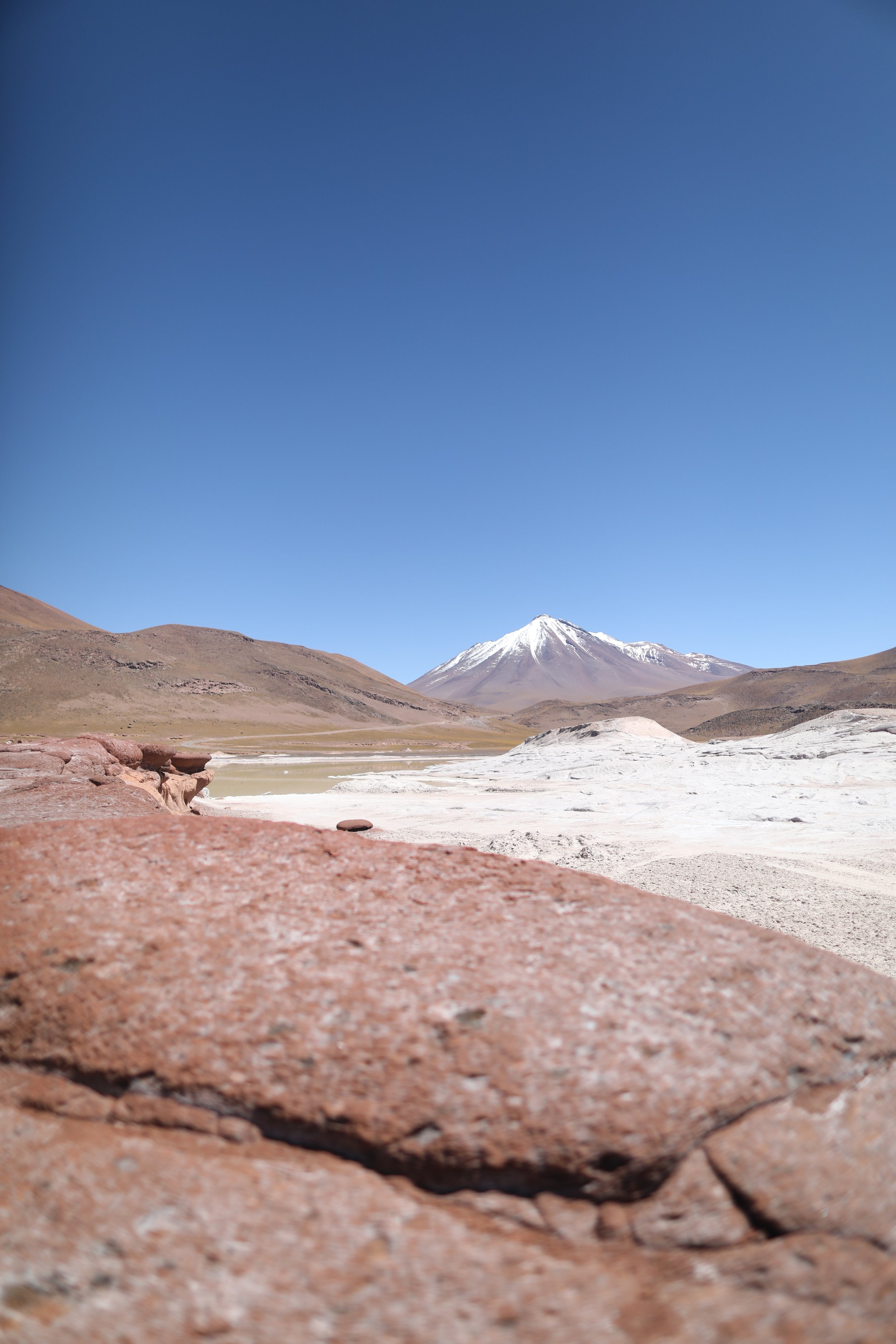

Just at the waters edge, on a small cliff, was a perfect opportunity for a photo with the gorgeous Cerro Miscanti in the background.


After some time, we’d continue along the path moving toward the left, leaving the giant drop shaped rocks behind for others to discover.


On the second half of the trail, we reached views overlooking Cerro Medano, the brownish grey mountain range that looked as if it’d been dusted with powered sugar at its base.

And we moved only slightly closer to the snow covered triple peaked Cerros de Incahuasi near Sico Pass, a mountain pass on the border between Argentina and Chile.

There, we reached another stunning view of the salty plains and sea foam green lake contrasted against the deep red rocks.


Using caution not to leave the trail, we took in views from this vantage point which continued to impress.


I guess it’s also important to note that this area can be filled with visitors, as many tours arrive simultaneously. I did my best to keep either one step ahead of the group or a few behind in order to capture images without crowds, often turning around to capture views from behind.

And with that, we’d nearly reached the end of the trail. Completing the loop, tired and overheated, our group made its way back to the stone structure for a much needed restroom break and shade.


Next up, we’d move to the Altiplanic Lakes which include the side-by-side lagoons of Miscanti and Miñiques.
Admire the Altiplanic Lagoons
Laguna Miscanti is a lake located in the altiplano of the Antofagasta Region, with both Cerro Miñiques Volcano and Cerro Miscanti towering above. It’s also part of one of the seven sectors of Los Flamencos National Reserve.


Five square miles, the heart shaped lake is a rich blue color and has taken shape in a basin formed by a volcanic fault. It has a depth of 33 feet and has clear brackish water. At first sight, the lake was almost shocking, an anomaly in such a dry atmosphere.

Once a single lagoon but now divided into two separate lagoons, Laguna Miscanti is the larger of the two and among the largest bodies of water in the Atacama Altiplano. The mountains, Cerro Miscanti at an altitude of 18,445 feet and Cerro Miñiques reaching 19,390 feet, lie northeast and south of the lake.


The lake has a peninsula protruding from the northern shore with a lava flow that separates the otherwise flat lake floor into the two basins. Just south of Miscanti lies Laguna Miñiques, the another lake that’s separated from Miscanti by the lava flow which occurred during the last ice age.

The lagoon’s waters are renewed by the seepage of rainwater and thermal groundwater with its release through groundwater and evaporation; its surface completely freezing over in winter.


In the surrounding hills, we saw several vicuñas running and playing with their families. Nimble and quick to scare, they were tough to capture in images. A soft brown color, they also blend in seamlessly with the landscape.

We also began to see many types of birds flying overhead, swooping in and out. Our guide mentioned a special bird that needs protection because it takes an entire year to make a nest.


From there we drove over the hill to the other smaller lagoon, Miñiques Lagoon.

This time, we didn’t get as close to the lagoon but observed from a distance.


The entire lagoon could almost be captured in a single image. There were also several vicuñas at its edge, cooling off in the dry heat (tiny dots below). These days, the areas climate is arid and cold. Meadows around the lake and sparse vegetation attract fauna such as birds and mammals toward the lagoons.


Birds like flamingos, the Andean coot, Horned coot, Andean gull, Crested duck and silvery grebe, along with mammals like the Highland tuco-tuco, Southern viscacha, Darwin’s leaf-eared mouse, culpeo and vicuña can be seen in the area. The lagoons are also an important breeding site for the horned coot.

Leaving the lagoons behind and ready for some downtime and a moment to recharge, we loaded back into the van.


We’d be moving to another location for lunch.
Feed on a Delicious Desert Spread
Just a short ride away, our guide selected a clearing with a gorgeous view to set up for lunch. Within minutes he and the driver set up an incredible spread.

Each of us grabbed a mason jar filled with chicken, pasta, beets, carrots and lettuce topped with fresh oregano, lime, oil and vinegar, along with French bread and homemade hummus and two types of juice, lemonade and pineapple with rica-rica.

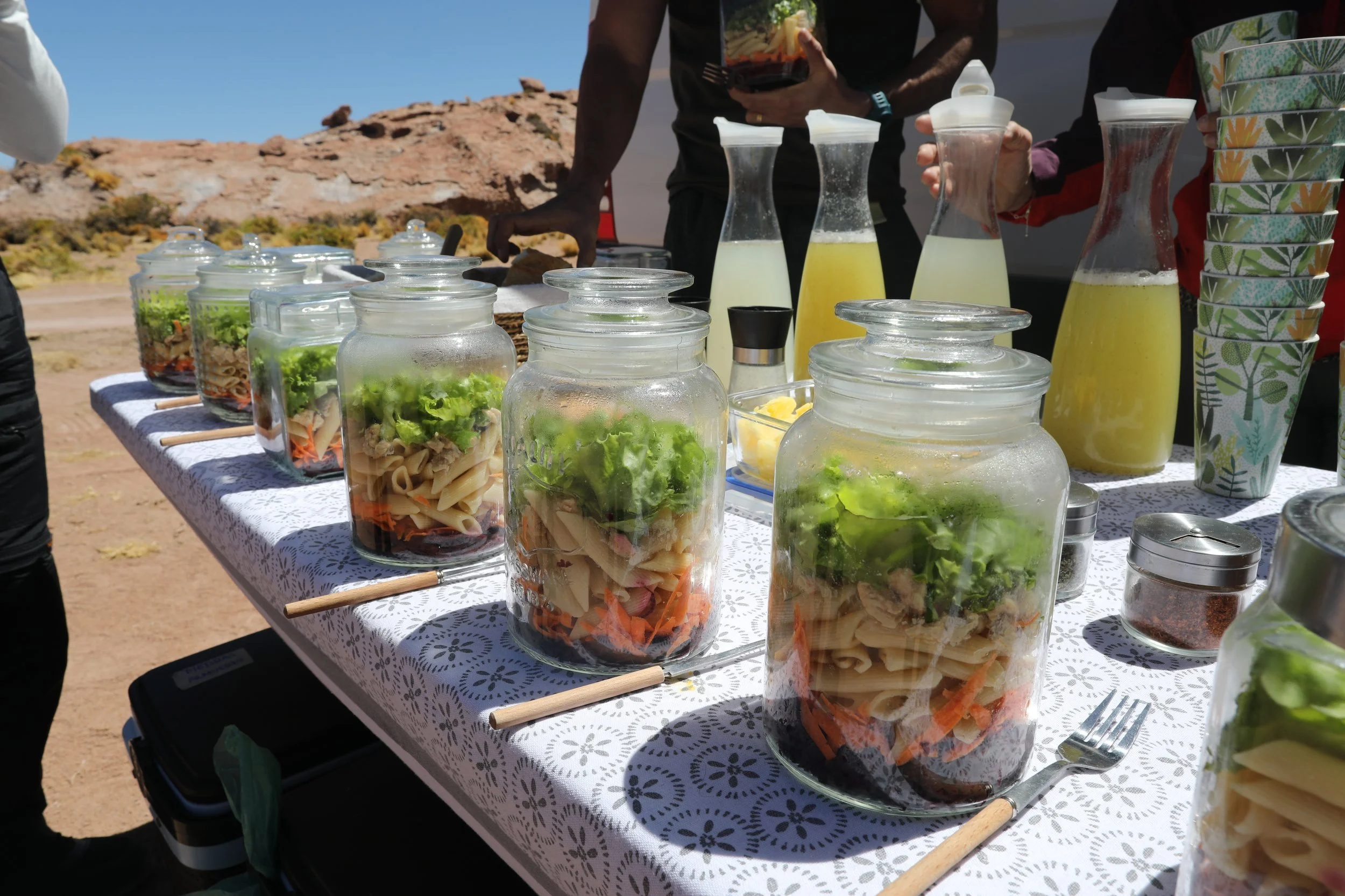
Rica-rica, also known as kore, is an aromatic shrub native to the Andean Altiplano, concentrated in the Chilean regions of Arica y Parinacota, Tarapacá and Antofagasta. It tastes fresh and minty and adds a wonderful flavor to any drink or herbal infusion.

Unable to describe how delicious this lunch was, it was among my favorite parts of the day. It felt like a much needed shavasana after a grueling hot yoga class. It was finally time to let go and honor the hard work you’d put in.

Another favorite from our tour was the incredibly unique local music. Our guide sent out a playlist including Poranguí, Rodrigo Gallardo, Matanza, Nicola Cruz and Indómita. It was a blast to experience such a warm welcome to the Deserts of Atacama.

Exhausted but pleased more than anything, we headed back to town and were dropped off by our guide, eventually crashing at our hotel.


