San Pedro de Atacama Desert Tours: Valle de la Luna
Atacama’s Valley of the Moon: wander among sand‑sculpted wonders and otherworldly dunes with this enchanting travel guide — including tours of Atacama Desert highlights to make your visit unforgettable.
Updated | July 2026

Why You Can’t Miss El Valle de la Luna — A San Pedro de Atacama Desert Tour
El Valle de la Luna — the Valley of the Moon — is the kind of place that makes you stop mid-step and whisper, whether out of awe or sheer disbelief. It sits about eight miles west of San Pedro de Atacama in northern Chile, tucked into the Cordillera de la Sal in the Atacama Desert, officially protected within Los Flamencos National Reserve and declared a Nature Sanctuary in 1982.
The name is no romantic exaggeration: this is one of the driest places on Earth, a landscape so sculpted by wind and the rare touch of water that it could be mistaken for a film set on another planet. Strange and beautiful, El Valle de la Luna feels otherworldly — a raw, unforgiving place that commands quiet respect and it’s one of the best Atacama desert tours you can join.
Two-Week Travel Itinerary
Our Chilean chapter felt like a string of brilliant postcards stitched together — eight flights, dozens of buses and taxis, one ferry and a few unforgettable detours. We began in Santiago, a lively hub where late-morning markets, impeccable restaurants and surprisingly gentle Chilean wines made it easy to fall in love (and recover from jetlag). The city’s art-filled streets set a joyful tone for the long road ahead.
Northbound to San Pedro de Atacama, we slipped into a landscape that seemed to change with every turn. We joined small, spirited tours to Laguna Chaxa’s reflective salt flats, wandered among the rust-red spires of Piedras Rojas and lost our breath at the Altiplanic Lagoons. At dawn, the El Tatio geysers exploded steam against the Andes — an unearthly wake-up call — while evenings in Valle de la Luna invited us to moonwalk across windswept dunes and then lie back beneath an impossibly clear, star-heavy sky.
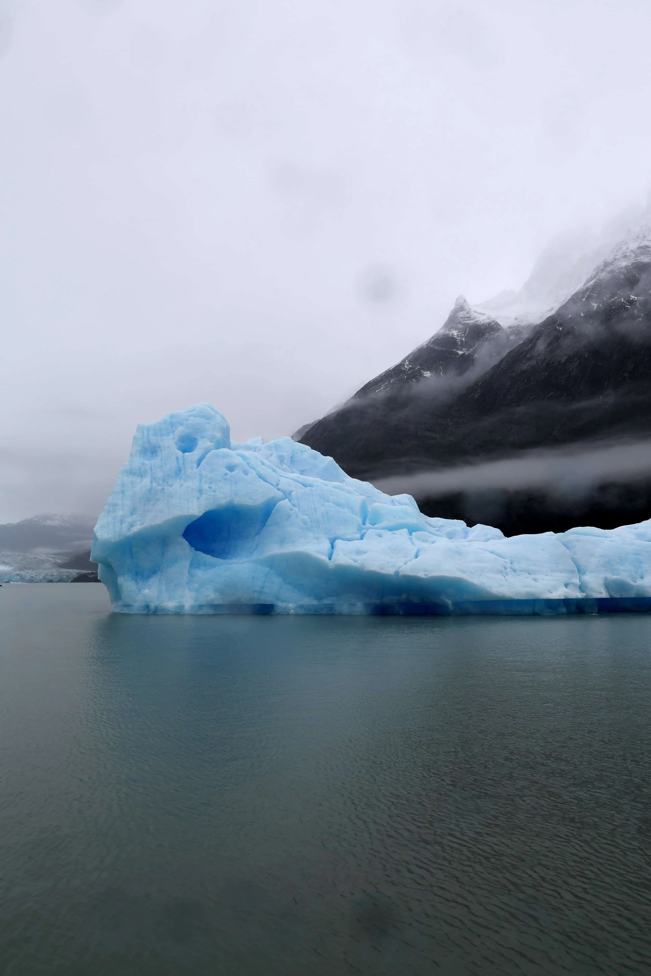
Then, the map flipped as we flew to the far south. Punta Arenas, the gateway to Antarctica, felt windswept and bold — an ideal prelude to Torres del Paine, where waterfalls thundered, icebergs drifted like slow sculptures and glaciers carved the land into dramatic memories.
Finally, we drifted to Chiloé Island and the cozy town of Castro, where wooden churches, salt-scented air and local myths wrapped our trip in a warm, sea-sprayed finish.
Chile moved around us like a neverending story — each stop a new chapter, every journey between them a small adventure.
What’s Inside | Roadmap
01 | How to get to San Pedro de Atacama
02 | Schedule your Atacama desert adventures; book with Turismo Gato Andino & Horizons
03 | Gaze upon the enchanting Three Mary’s rock formation
04 | Wander the awe-inspiring Moon Valley Amphitheater
05 | Summit Moon Valley’s peak for breathtaking views
06 | Catch panoramic vistas at Piedra del Coyote
07 | Relish sunset over Valley of Atacama
Day Trip | Explore more delightful day trips from the San Pedro de Atacama series: Flamingos in Pink, Rusty Red Rocks & the Sapphire Lagoons of the Atacama, Steam, Sunlight & Surreal Silence at El Tatio & Stargazing Magic in the Atacama
Read On | San Pedro de Atacama is filled with so many more incredible sights & bites — San Pedro de Atacama’s Serene Desert Magic
Valle de la Luna Wonders: Unmissable Experiences on Atacama Desert Tours
Wander across otherworldly dunes, watch salt flats shimmer at sunset and follow lunar-like ridges that invite quiet exploration with this travel guide. Whether you’re chasing golden light, tracing fossilized formations or drifting along soft sand on a clear night, these are the must-do experiences to savor in Moon Valley.
But first, the essentials — how to reach San Pedro de Atacama and which tours to book. If you’ve already got that covered, skip ahead to marvel at Valle de la Luna in all its lunar splendor.
01 | How to Get to San Pedro de Atacama
San Pedro de Atacama is the gateway to some of Chile’s most otherworldly landscapes. Most travelers arrive via Calama, the nearest city with the region’s main airport (El Loa — CJC). From Calama airport, you can reach San Pedro by bus, shared transfer, private transfer or rental car. Expect total travel time from the airport to San Pedro to be about one to one and a half hours, depending on traffic and stops. The road is paved and well-traveled; scenery transitions quickly from urban outskirts to arid high desert.
Keep reading for full travel outlines, along with alternate ways to reach San Pedro de Atacama.
Plane (to Calama, then Transfer) | Flight time to Calama from Santiago ~2 hours; transfer from Calama Airport to San Pedro de Atacama 1.5–2 hours. Flights from Santiago–Calama one-way economy cost 30,000–90,000 CLP ($35–105 USD) depending on season and deals; airport-to-San Pedro transfer shuttle costs 7,000–20,000 CLP ($8–23 USD) per person; private transfer costs 30,000–60,000 CLP ($35–70 USD).
This option is the fastest long-distance option and most comfortable. Domestic flights are frequent but can fill up during high season; arrive at El Loa Airport (CJC) where altitude (2,400 meters/7,875 feet) and sunshine greet you. Shared shuttles are economical and timed to flights — expect a minivan, basic comfort and possible wait for other passengers. Private transfers are door-to-door and useful if you have heavy luggage or arrive late. You’ll experience a scenic drive through desert plains and dusty vistas, with a gradual approach to the ochre town. Bring sunscreen and a light jacket for the windy, high-altitude air.
Long-Distance Bus (from Santiago or Other Chilean Cities) | The Santiago–San Pedro de Atacama overnight bus lasts 20–24 hours; Calama–San Pedro 1–1.5 hours if transferring from Calama bus terminal. Costs for Santiago–San Pedro one-way 25,000–55,000 CLP ($29–64 USD) depending on company and class (semi-cama vs. cama); Calama–San Pedro local bus 1,500–3,500 CLP ($2–4 USD).
This option is economical and scenic if you like slow travel. Overnight buses offer reclining seats (semi-cama or cama) with blankets and sometimes meals; bring earplugs and a neck pillow. The route traverses changing landscapes — vineyards, altiplano and salt flats — often under very clear skies. Expect basic stops for food and restrooms. Arrival at San Pedro’s small terminal puts you within walking distance of town. Consider altitude acclimatization upon arrival if you came up quickly.
Car (Self-Drive from Calama or Longer Road Trip) | The duration from Calama–San Pedro lasts 1.5–2 hours; Santiago–San Pedro driving time is 20–24 hours split over multiple days. Fuel costs for Calama–San Pedro 5,000–12,000 CLP ($6–14 USD) depending on vehicle consumption; rental car from Calama or Santiago costs 40,000–120,000 CLP a day ($47–140 USD) depending on season and vehicle type.
This option allows ultimate freedom to explore at your own pace. The drive from Calama is straightforward on paved roads; farther routes cross open desert with long distances between services. Rental 4x4 is recommended if you plan off-road excursions or side trips to remote geysers, salt flats or altiplano lagoons. Expect dramatic vistas, minimal traffic and strong sun — carry extra water, spare tire and a paper map or downloaded offline route. Parking in San Pedro is generally simple but narrow streets and adobe architecture mean you’ll likely park in small lots or on the street.
Train (Indirect + Bus) | There is no direct passenger train to San Pedro; combining a train to a northern city (e.g., Antofagasta) plus bus can take 18–30+ hours depending on connections. Train portions (where available) vary widely on cost; total combined cost typically 30,000–80,000 CLP ($35–94 USD). Routes are fairly limited and uncommon — Chile’s north has few regular passenger rail services.
Any rail travel is more for the novelty than practicality and requires careful timing with onward buses. Expect infrequent schedules, basic facilities and long waits at transfer points. This is for travelers who enjoy piecing together a slower, more unusual overland route.
A dusty road and a few extra hours of travel stand between you and San Pedro de Atacama — but once you arrive, the otherworldly landscapes and starlit nights make every mile feel worth it. Once in town, book your Atacama tours.
02 | Schedule Your Atacama Desert Adventures
Exploring northern Chile from the charming adobe hub of San Pedro de Atacama feels like stepping into a live atlas. With so much desert drama to squeeze into a short stay, choosing local tour operators is the easiest way to turn every hour into discovery. Between the town’s friendly agencies — Turismo Gato Andino and Horizons are go-to planners — cobble together the desert adventures you crave.
Morning might begin before dawn for a magical, caffeine-fueled trek to the steaming El Tatio geysers; evenings are reserved for another kind of spectacle, lying back under a vault of impossible stars on a stargazing excursion. Tours in the area are refreshingly varied — basic to indulgent — and typically run between 40,000-80,000 CLP ($40 and $90 USD) depending on length and extras, making it simple to mix and match experiences without breaking the bank.
Tip | Book excursions online or better yet, pop into an agency in town to chat with a local guide. You usually don’t need to prebook most Atacama tours — San Pedro has plenty of local agencies and booking on arrival keeps things flexible. A few exceptions, though:
Certain park entries: For independent visits to places like Valle de la Luna or the Lagunas Altiplánicas/Piedras Rojas, buy entrance tickets online in advance.
Multi-day salt-flat trips: Uyuni expeditions benefit from booking weeks ahead to lock in reputable guides.
Peak seasons: In summer (Dec–Feb) and winter holidays (July–Aug), book 2–4 weeks early to secure guides and standard rates.
Most Popular Atacama Desert Tours
For a snapshot of Atacama’s best-loved adventures — from otherworldly salt flats and geyser sunrises to starlit lagoons and rainbow-hued rock formations — read on for a detailed tours.
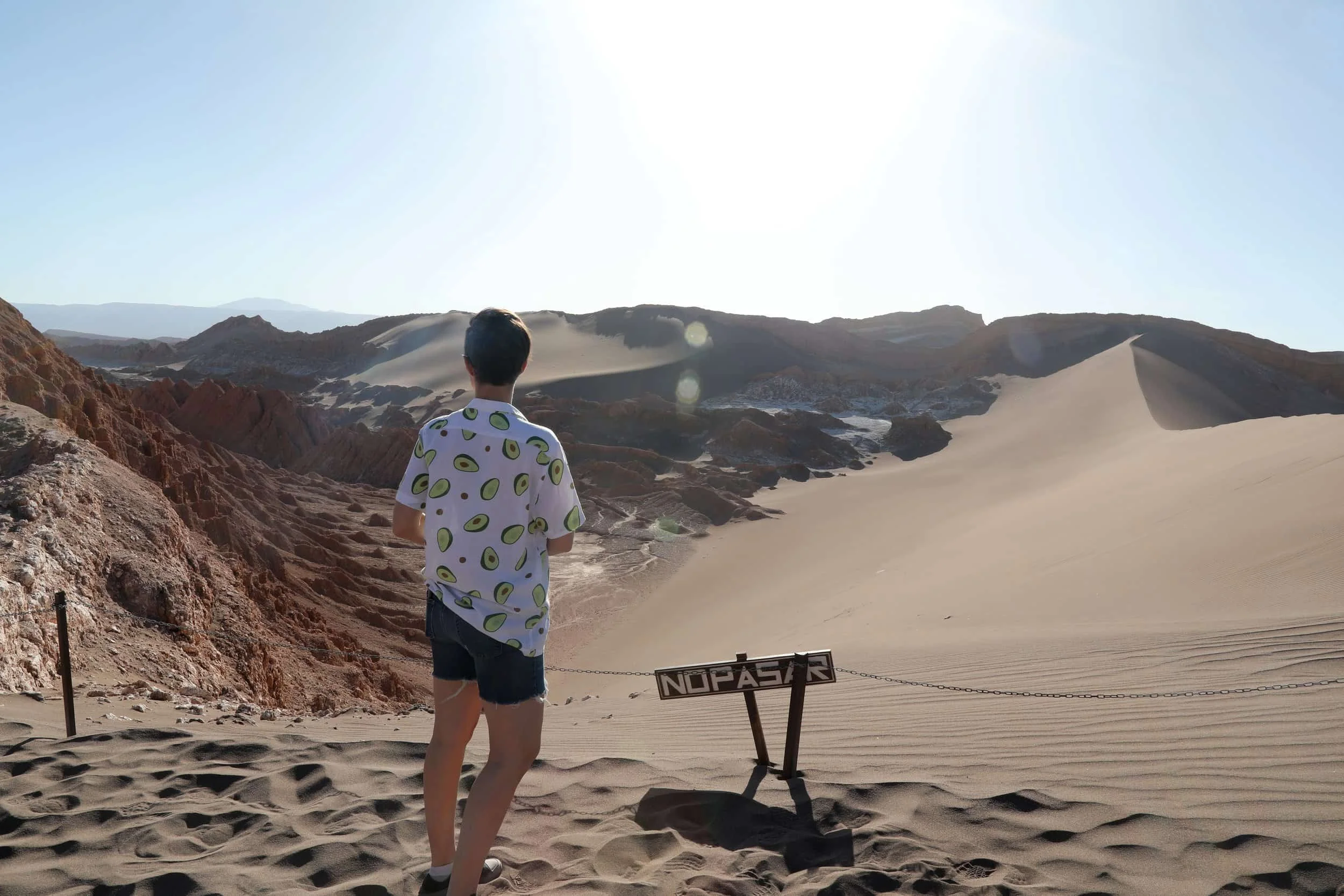
Valle de la Luna (Moon Valley) | The duration is a half-day (3–4 hours) and costs roughly 20,000–35,000 CLP ($20–40 USD). Expect a surreal landscape of sculpted dunes, salt crusts and jagged rock formations carved by wind and time. Walk narrow paths between otherworldly ridges, pause at the viewpoints that face the vast salt pan and time your visit for late afternoon to watch the sky turn pink and orange as the sun sets behind the Andes.
Small guided groups often include geological and cultural context, telling stories about indigenous use of the land and the valley’s formation. Wear sturdy walking shoes or light hiking boots, a warm layer (evenings are chilly), sun protection — hat, sunglasses, high-SPF sunscreen — and bring a refillable water bottle. Photography enthusiasts should bring a wide-angle lens and extra batteries; if you go at sunset expect crowds and bring patience. The altitude is moderate; take it easy the first day.
Geysers del Tatio | This tour is early morning and half-day (4–6 hours, typically leaving around 3–5 a.m.). The cost is 35,000–55,000 CLP ($45–90 USD). Expect one of the highest geyser fields in the world, where steaming fumaroles burst through a frozen desert dawn. You’ll watch dramatic plumes of steam against pink sunrise light, walk boardwalks among active vents and often have an opportunity to soak in nearby thermal pools (check operator specifics).
Guides explain geothermal activity and local wildlife like vicuñas and Andean birds. Dress in warm layers — temperatures can be well below freezing before sunrise — plus a waterproof outer layer for spray. Comfortable closed shoes, gloves and a headlamp are helpful. Bring snacks and water; many tours include breakfast. Be aware of the high altitude (4,300+ meter/14,000+ feet); if you have heart or respiratory conditions, consult a doctor and consider acclimatizing in town first.
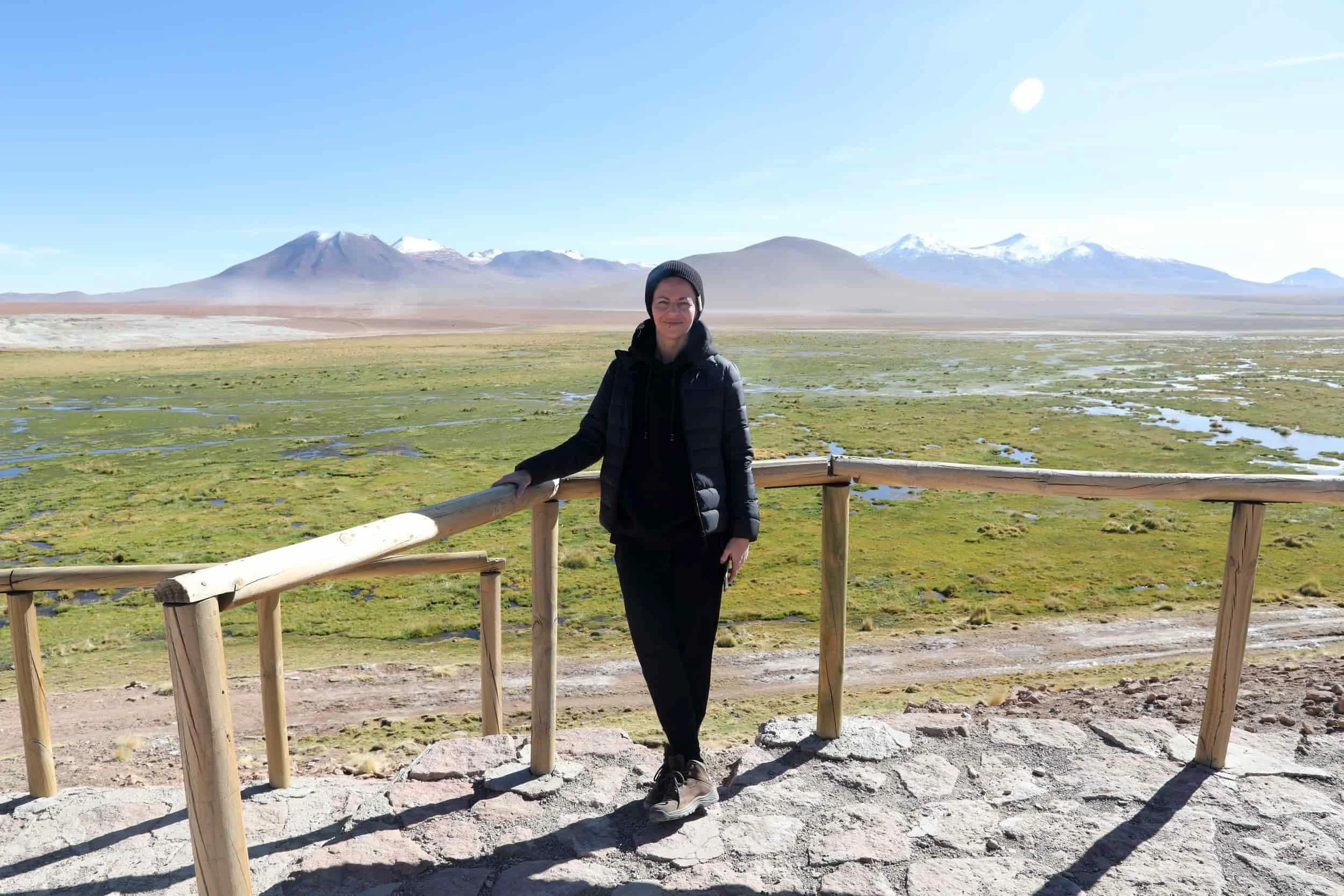
Lagunas Altiplánicas (Miscanti & Miñiques) & Salar de Atacama | This tour is a full day (7–9 hours) and costs 40,000–60,000 CLP ($60–120 USD). Expect expansive high-altitude vistas: turquoise lagoons rimmed by volcanoes, flocks of flamingos feeding on saline waters and the stark white salt flats that stretch to the horizon. Tours typically include wildlife viewing, photo stops at lookout points and an explanation of local ecosystems and salt-harvesting traditions.
Expect long drives over gravel roads punctuated by short walks. Wear high-SPF sunscreen, sunglasses, hat, windproof jacket and sturdy shoes. Bring water and light snacks; altitude can make exertion feel harder. Respect protected areas — stay on marked trails and follow guide instructions to avoid disturbing flamingos and fragile microbial mats.
El Tatio to Puritama Hot Springs (Combined Options) | This tour lasts a full day (8–10 hours) if combined; shorter options exist (4–6 hours) for just Puritama. The cost is 30,000–60,000 CLP ($40–100 USD). Expect a relaxing counterpoint to dry salt pans: thermal rivers and pools set in a narrow canyon fed by geothermal springs. Many operators combine a Tatio sunrise visit with an afternoon or late-morning soak at Puritama, offering both spectacles and relaxation.
Puritama’s stepped pools are maintained and often have facilities and changing rooms. Bring swimwear, towel, flip-flops or water shoes and a change of warm clothes for post-soak. If combining with Tatio, prepare for an early start and bring warm layers for the morning segment. Check whether access is regulated and whether pools are family-friendly or limited in capacity.
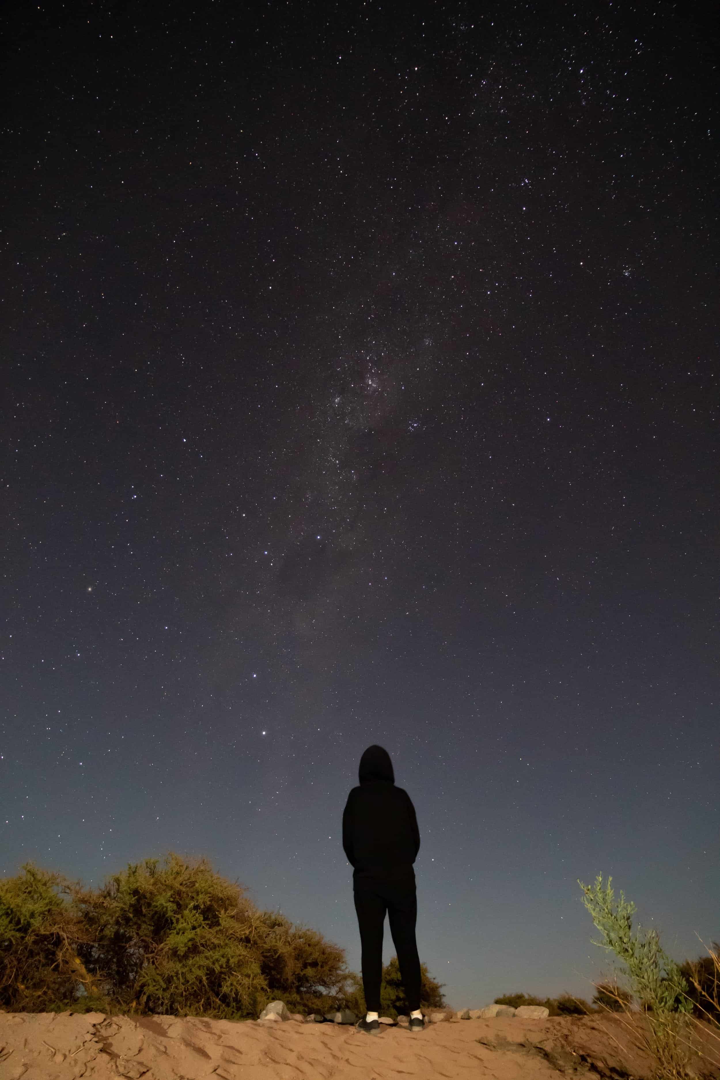
Stargazing Tours | This evening-to-night tour (2–3 hours) costs 15,000–30,000 CLP ($25–60 USD). Atacama’s clear, high-altitude skies make for world-class astronomy: small groups meet at observatories or remote vantage points where guides and telescopes reveal planets, star clusters, nebulae and the Milky Way in staggering detail. Tours range from casual sky talks to high-end observatory experiences with large telescopes and expert astronomers. Bring a warm jacket and blanket — nights can be very cold — dress in layers, and carry a flashlight with spare batteries for walking between viewing sites.
Tip | Every tour is wonderful — we were fortunate to experience them all except for the Puritama springs. Oh, and don’t forget to pack sunscreen, a big bottle of water, snacks and a cozy jacket for when the air turns cool — your future self will thank you.
03 | Gaze Upon the Enchanting Three Marys Rock Formation
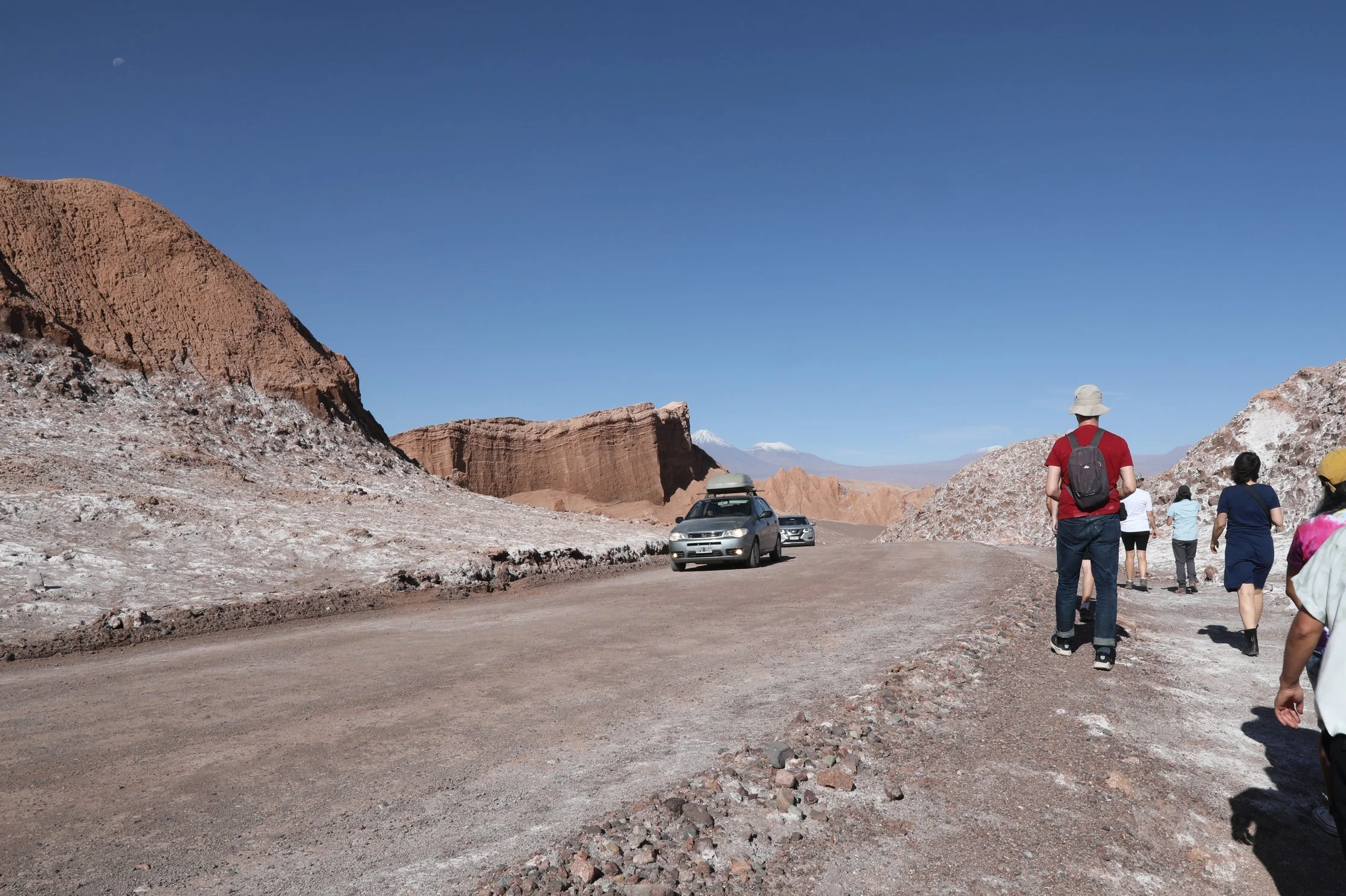
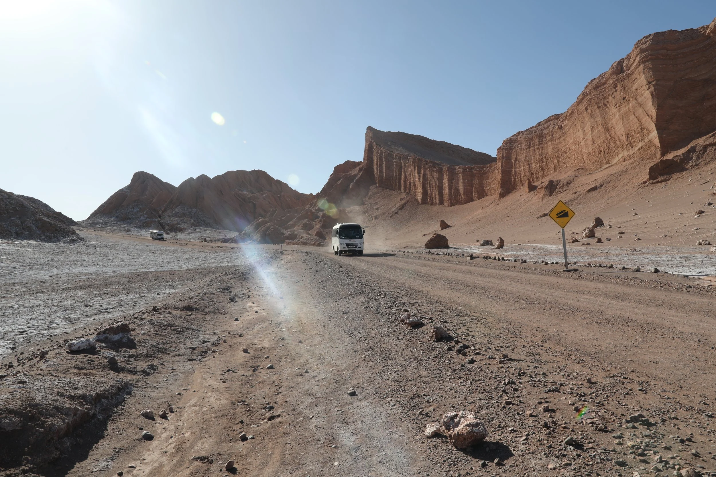
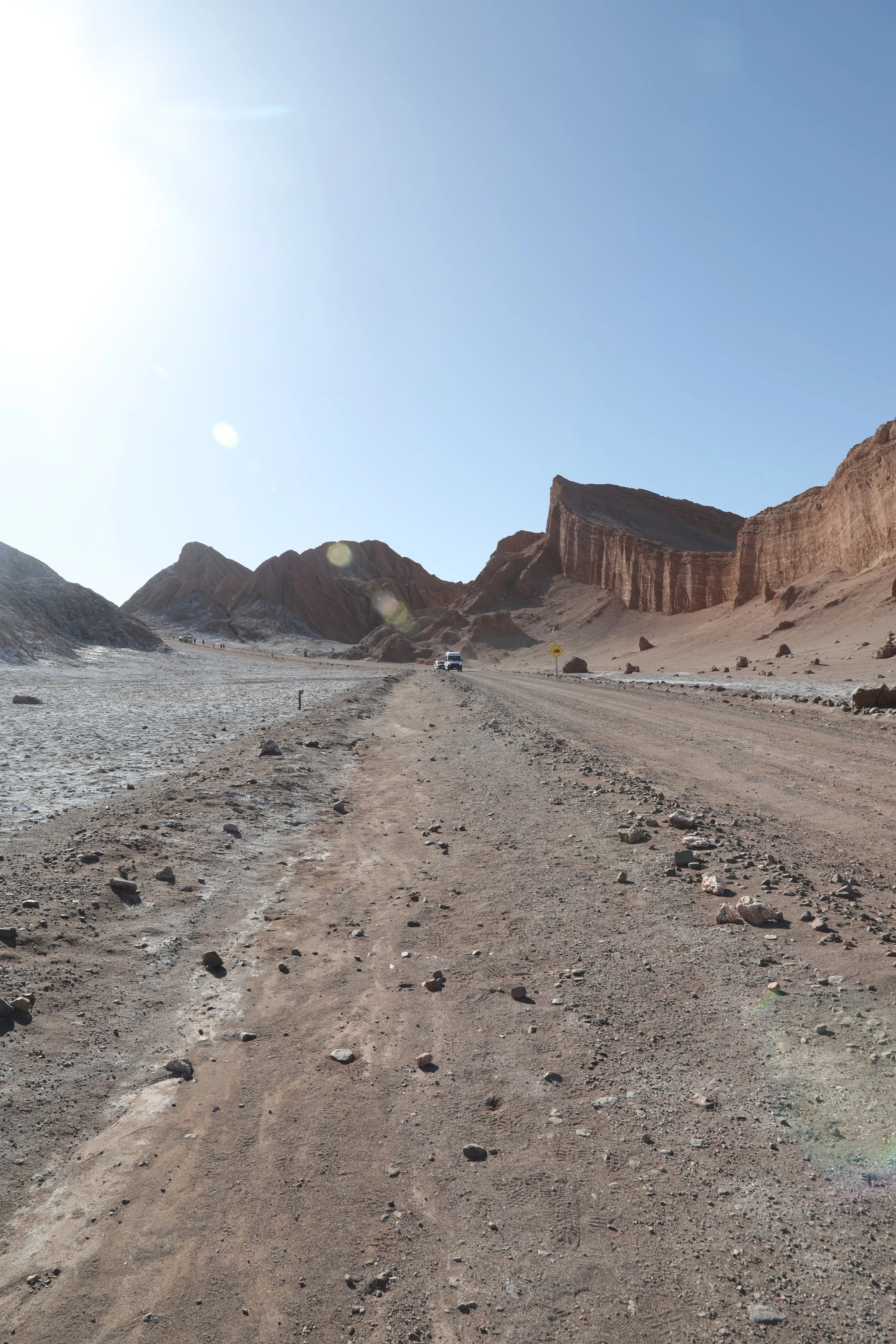
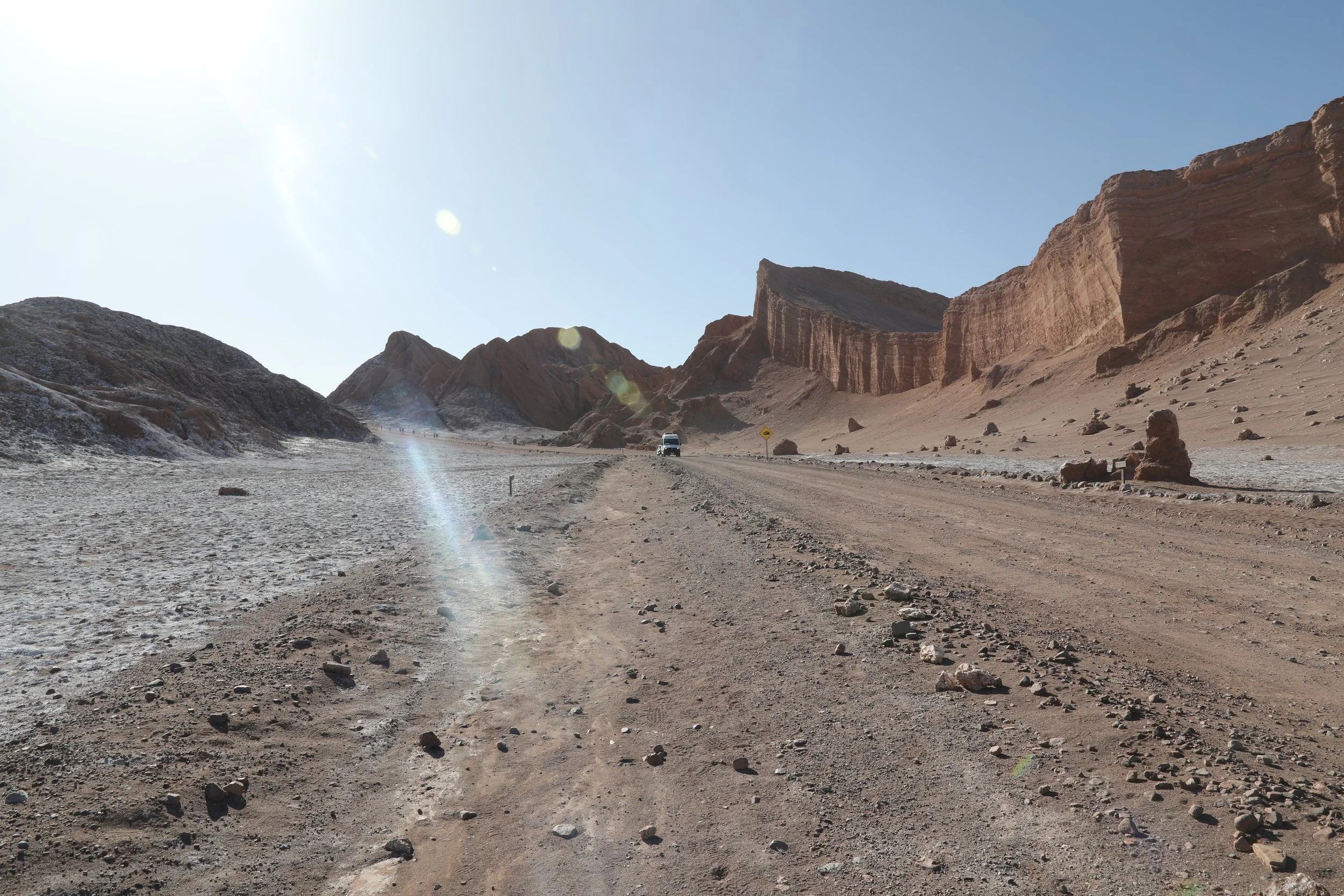
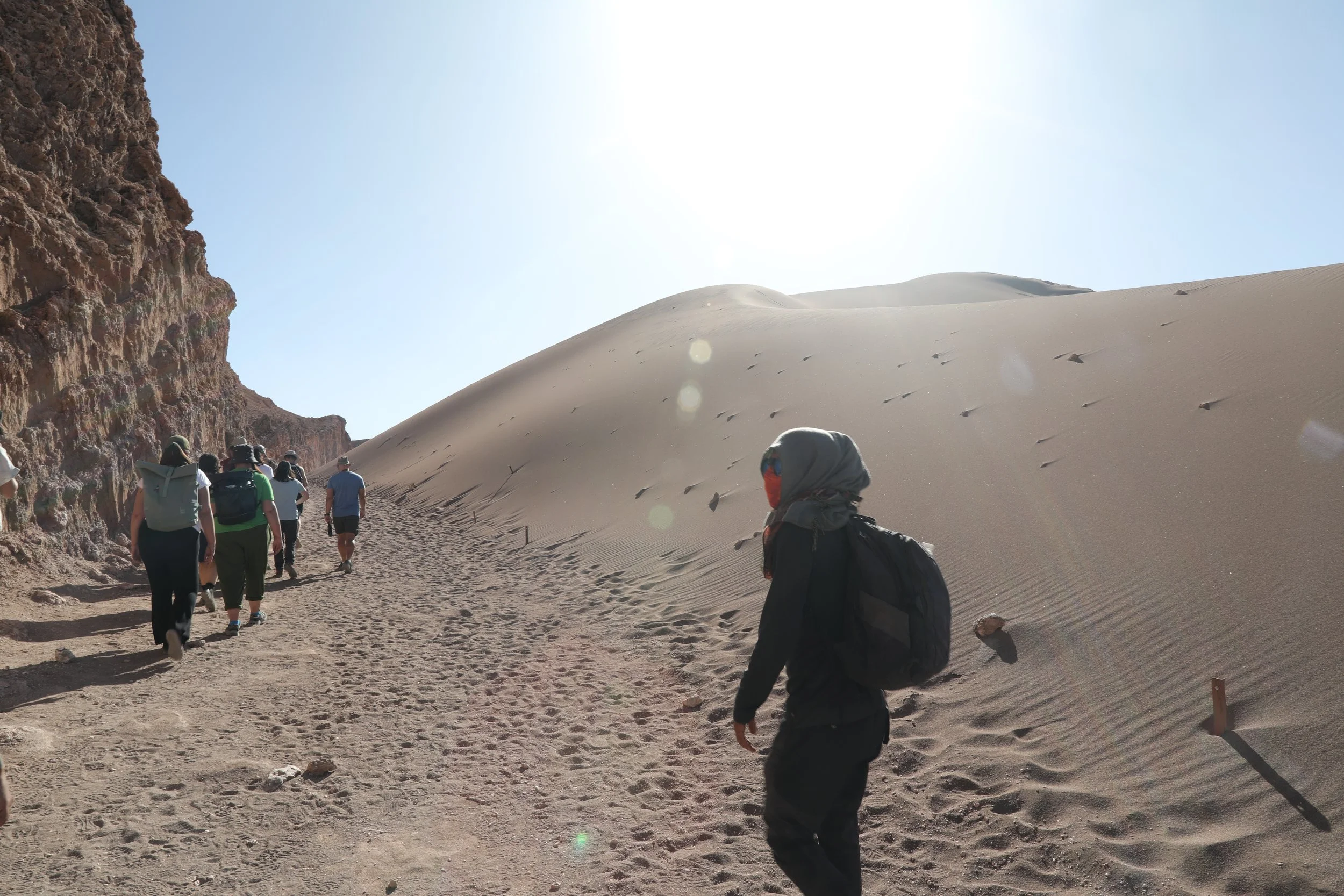
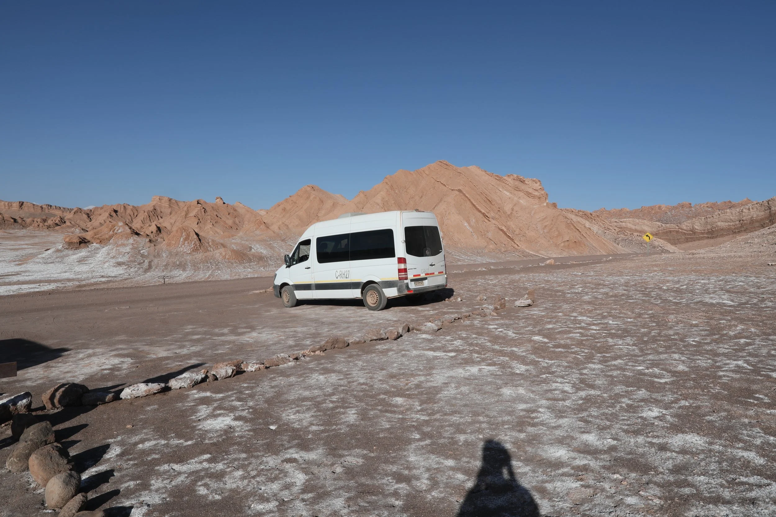
In the afternoon, set off on a Valle de la Luna tour with expert guides — ours were called Constantine and Marco. A short 10-minute drive from town deposits you at the valley’s rim, where the landscape opens into heavenly ridges and salt-streaked dunes. Your guides will outline the route: first a wander toward the valley’s quieter, more dramatic rear, then a slow return along the trail that leads back to the entrance.
Along the way, pause at several panoramic viewpoints to drink in the sculpted geology and shifting light. The tour finishes perfectly: settle in at a nearby lookout as the desert sky deepens, enjoying simple snacks while the sun slips below the horizon and the valley takes on its evening magic.
The three Mary’s (Las Tres Marías) rises from the earth like a quiet, stone chorus — three graceful formations of granite and clay that jut from the landscape as if sculpted by a patient hand. Clustered closely and fused at their bases, they stand together like figures in a timeless tableau, each with its own silhouette and personality.
From a distance, they read as elegant sentinels; up close, the textures and layered colors of rock and clay reveal a whisper of the geological stories that shaped them. Whether bathed in golden dawn light or softened by evening shadow, Three Mary’s feels less like a landmark and more like a poetic meeting of earth and imagination.
Tip| Stay within the marked paths and honor the landscape — this place deserves your care. Take everything you brought, tread lightly and relish the silence.
04 | Wander Through the Awe-Inspiring Moon Valley Amphitheater
Next up on your Atacama desert tour — the Amphitheater.
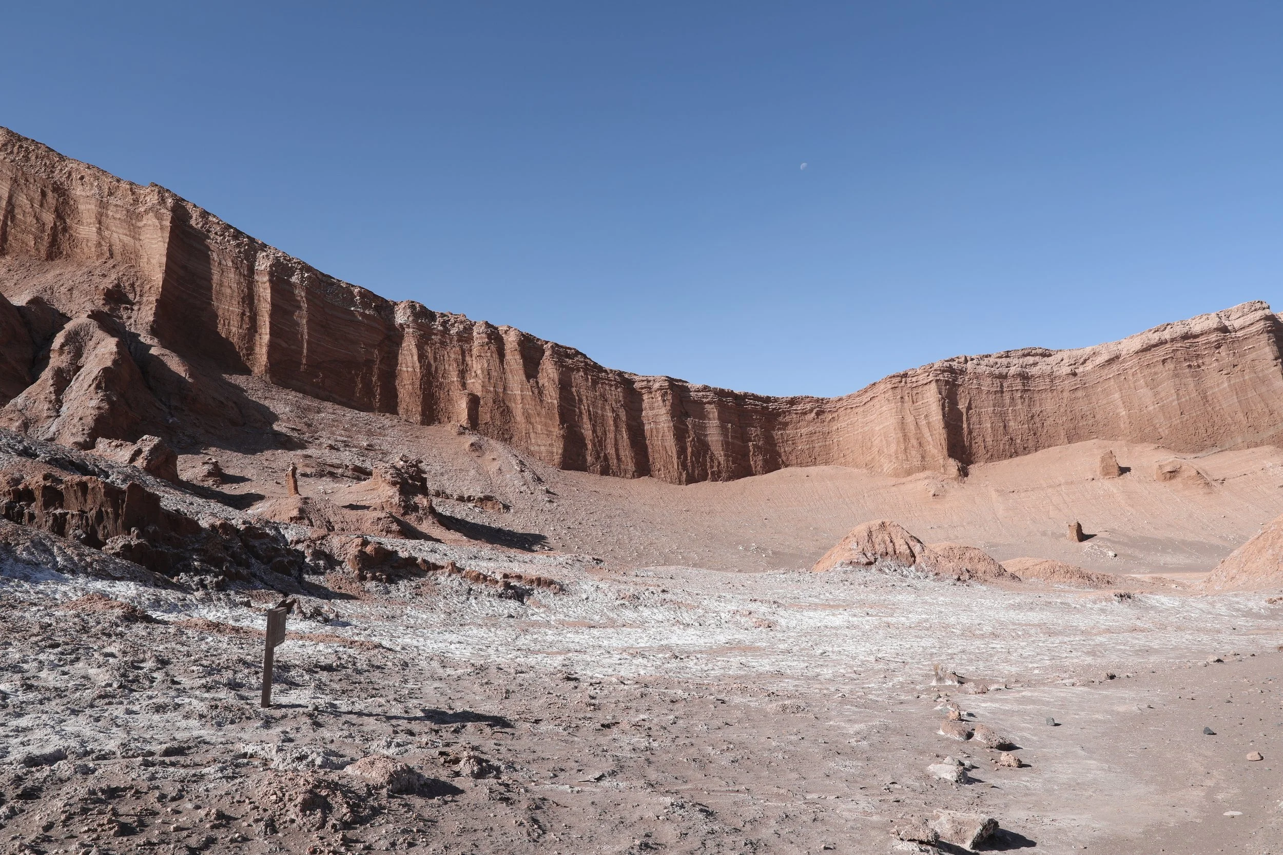
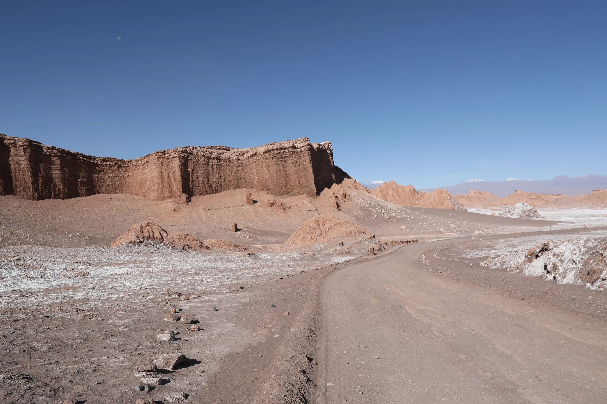
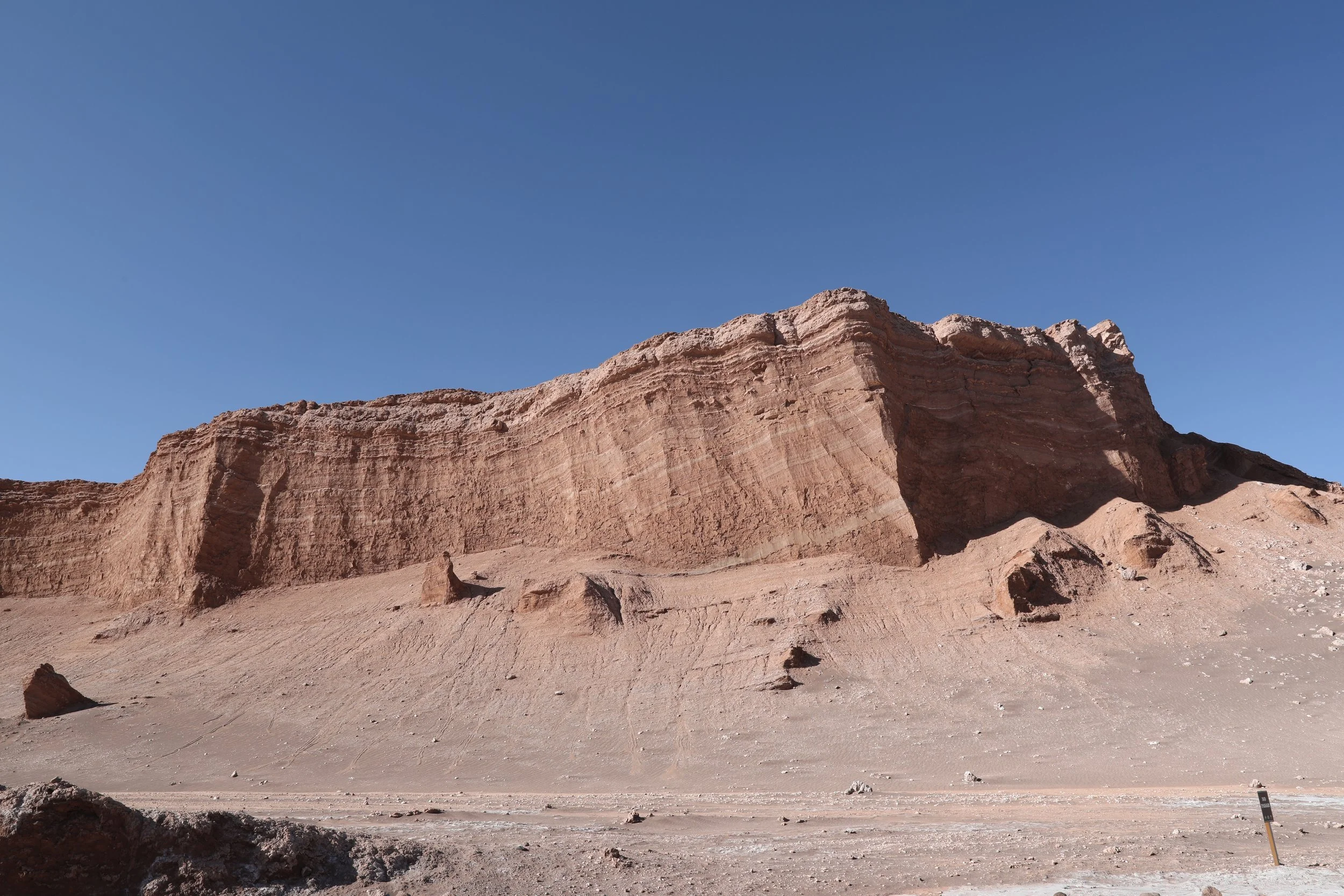
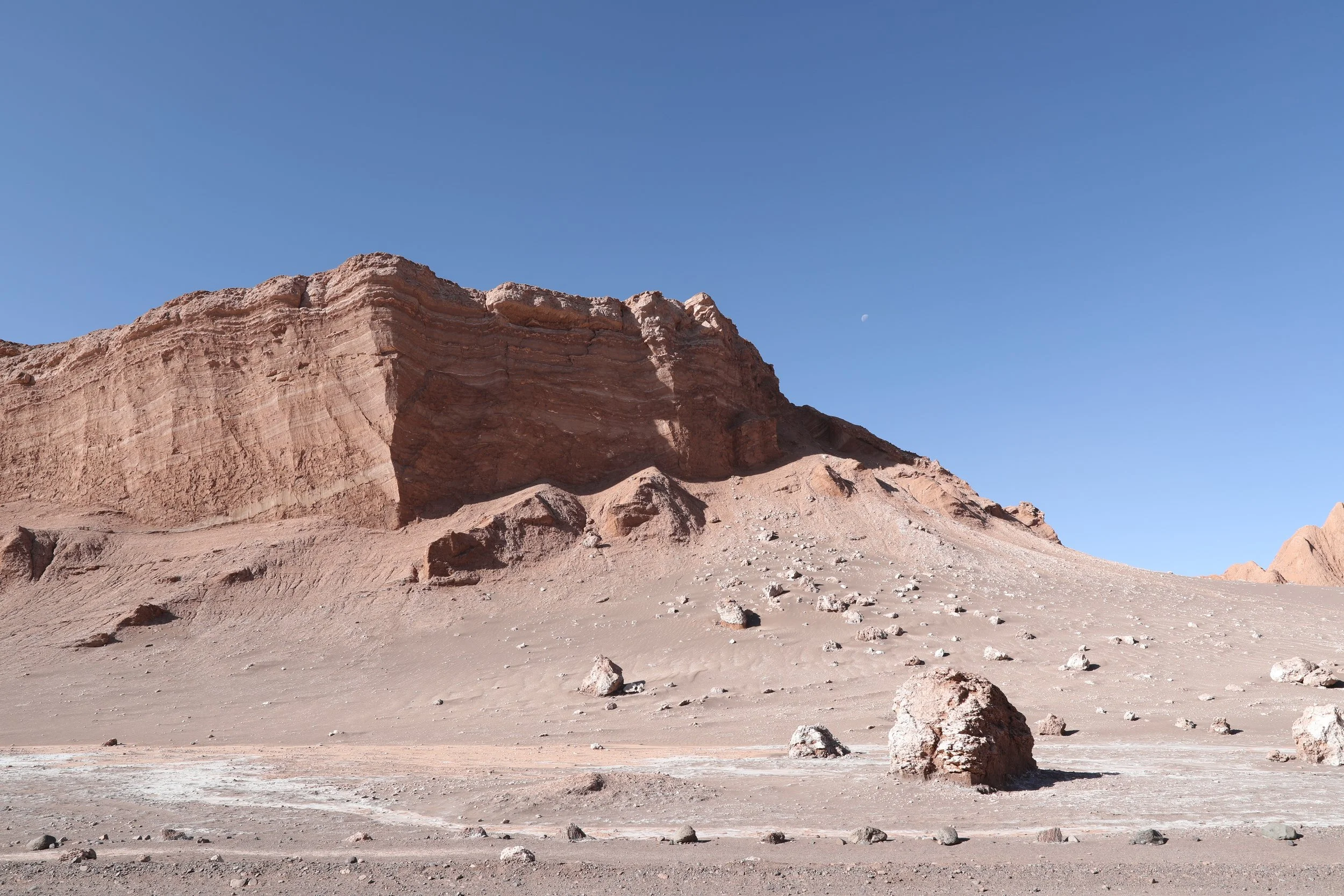
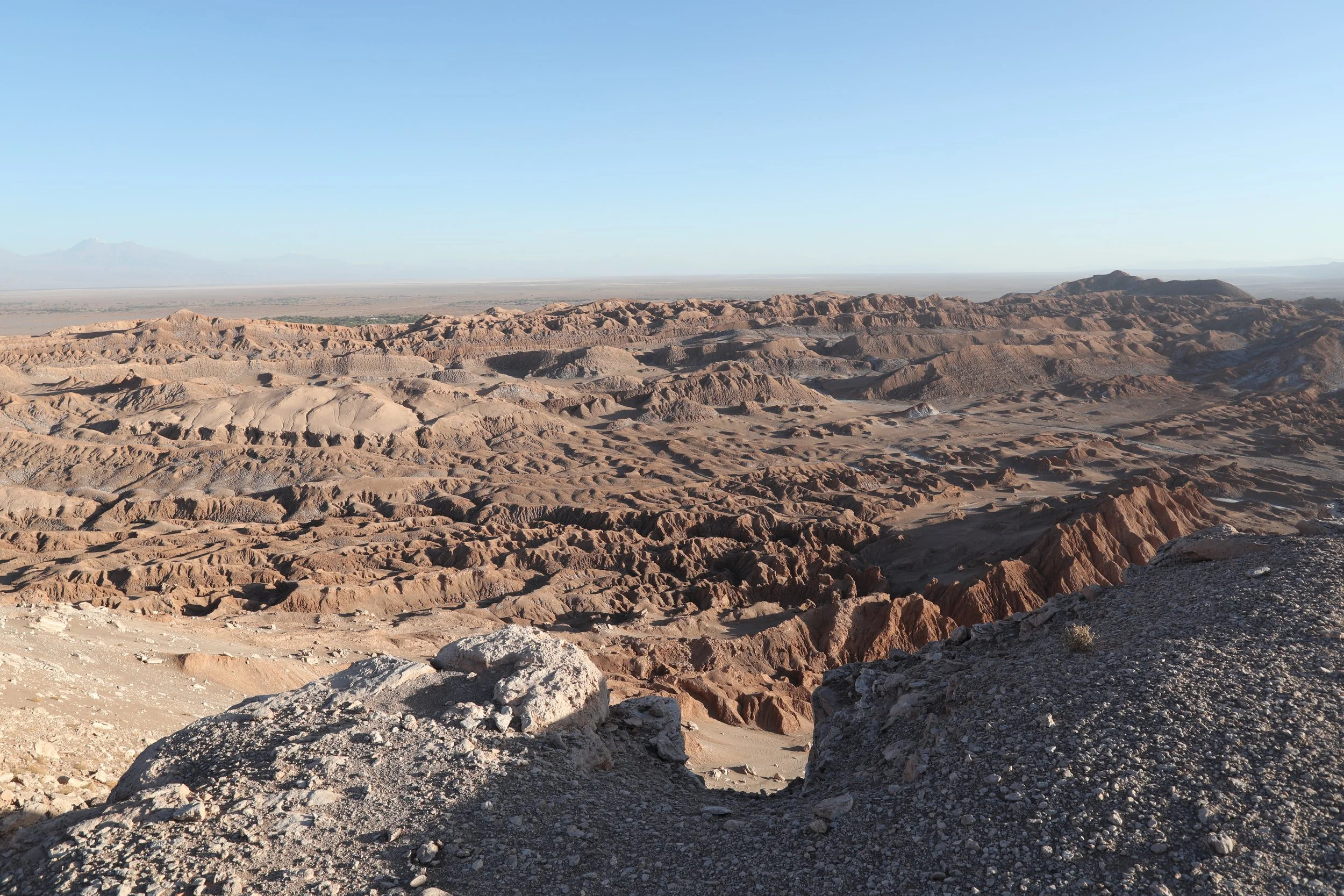
Move into the valley’s Amphitheater, a stunning natural bowl carved into the earth and framed by towering rock walls that swoop around like a stone coliseum. Its lunar, supernatural face and monumental sweep make it one of the area’s most iconic sights. Hikers come here to soak in the drama of the landscape but it’s at sunset — when the sky paints the cliffs in molten gold and rose — that the amphitheater truly steals the show.

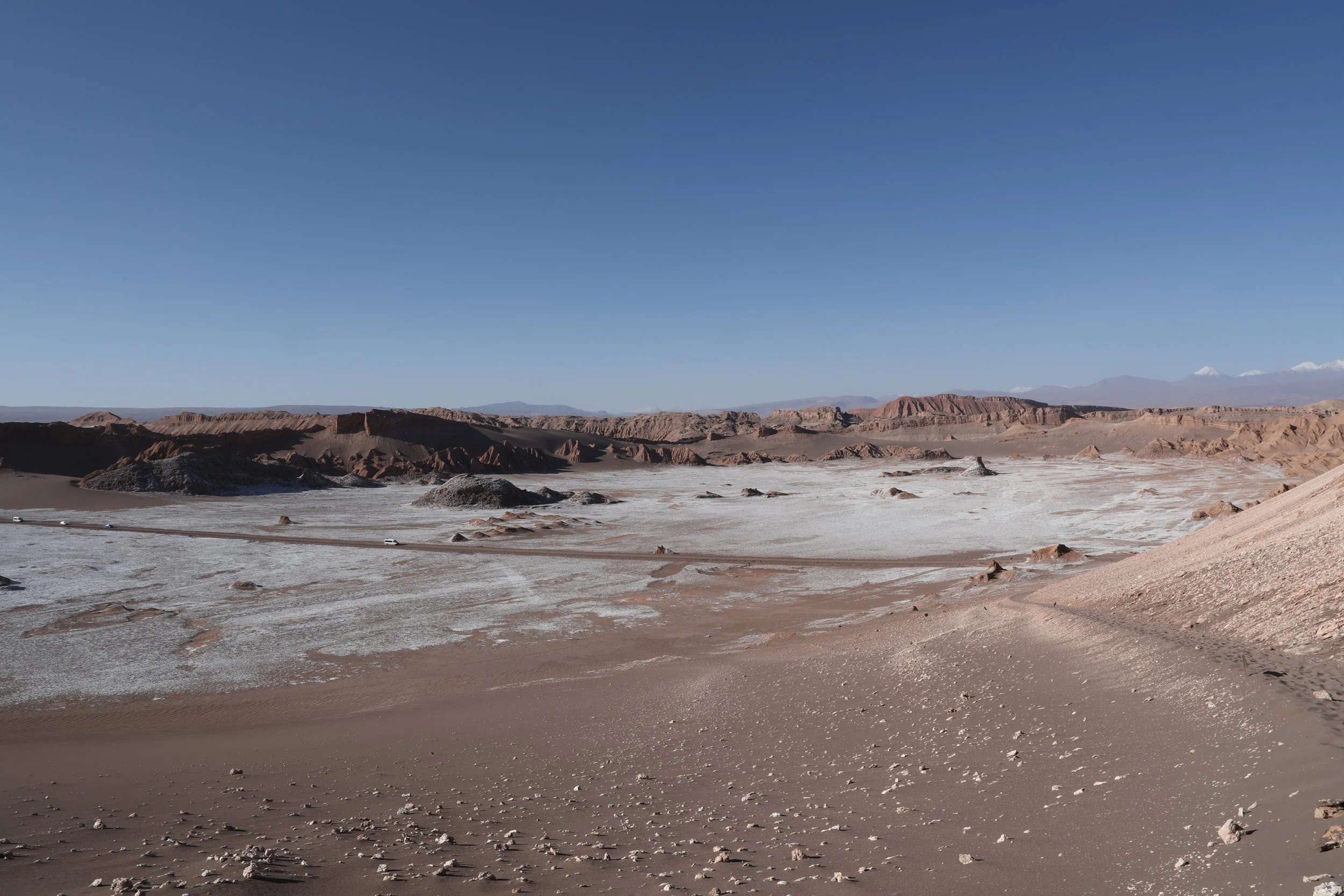
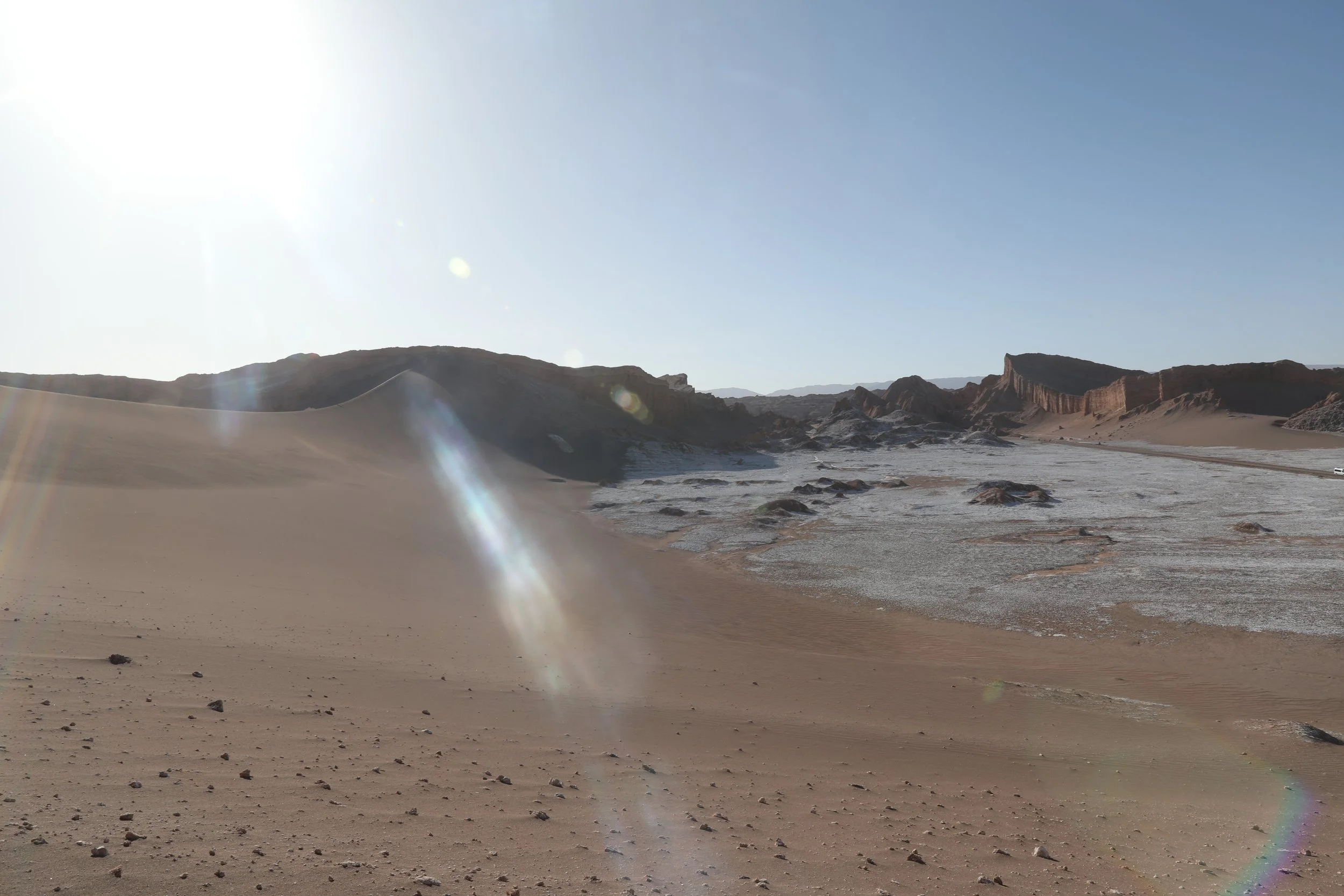
Part of the vast Reserva Nacional Los Flamencos, this valley feels like a secret corner of another planet. Time and elements have carved a dreamscape of lunar-like plains: glittering salt pans, bleached dry lakes and surreal rock sculptures. Inside the Amphitheater, you’ll find towering walls shaped by millennia of wind and water — an otherworldly stage that makes you feel small and wildly alive at once.
Its layered walls — strata of clay, silt and sand — tell a quiet geological story, shaped patiently by wind and water. Over time, those forces have coaxed the soft clay and sandstone into a vocabulary of canyons, razorback ridges and spiky spires that catch the light and cast long, dramatic shadows as the sun crosses the sky.
Walking through the valley, you notice how spare the vegetation is; the near-absence of plant life leaves the terrain exposed and vulnerable to the elements, so every gust and flash of rain leaves a fresh signature on the rock. The result is a constantly evolving landscape: ridgelines weathered to lace, cliffs carved into amphitheaters and solitary pinnacles standing like guards over the dramatic plain. It’s the kind of place where the earth feels both fragile and monumental — perfect for lingering, photographing and letting your imagination roam.

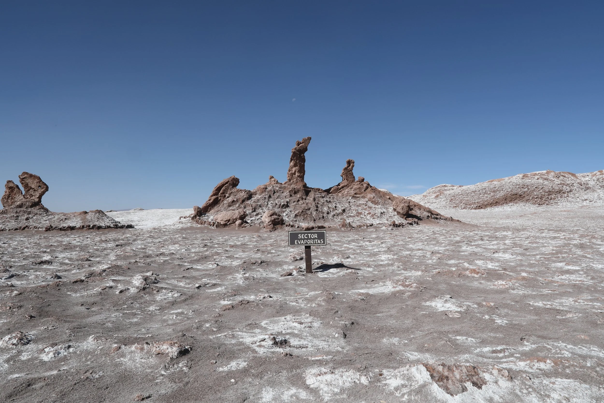
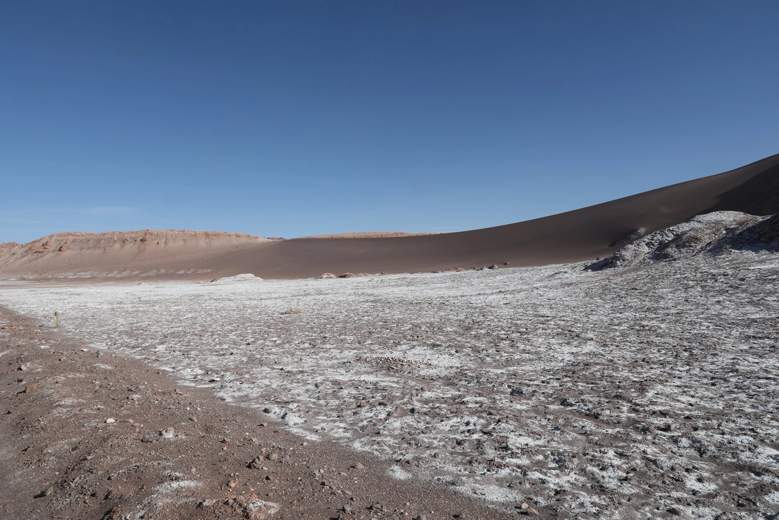
Beyond the winds that carve the dunes and ridges, subtler processes reshape the landscape: chemical erosion. Through reactions that break down rocks, minerals and ancient volcanic beds release elements like sodium and chlorine, which then crystallize into salt crusts that glisten under the sun.
The valley is an endorheic basin, a closed bowl where water has no outlet to the sea. That creates an intimate, almost magical cycle: with each rain, salts dissolve and travel a few meters, only to be redeposited when the water evaporates. In this way, the earth recycles its own minerals over and over, painting the terrain with textures and reflections that shift with the light and the seasons. Walking there is witnessing a living geological laboratory, where chemistry and climate collaborate to sculpt a scene that feels extraterrestrial.
In the past, miners extracted salt from the valley along with other minerals such as copper. Today, however, the salt comes from the sea and the land is no longer excavated in search of veins: the valley’s work belongs to the past. Those salt deposits formed thanks to volcanic activity and the erosion of older rocks, as if nature itself had been carving and concentrating its secrets over time.
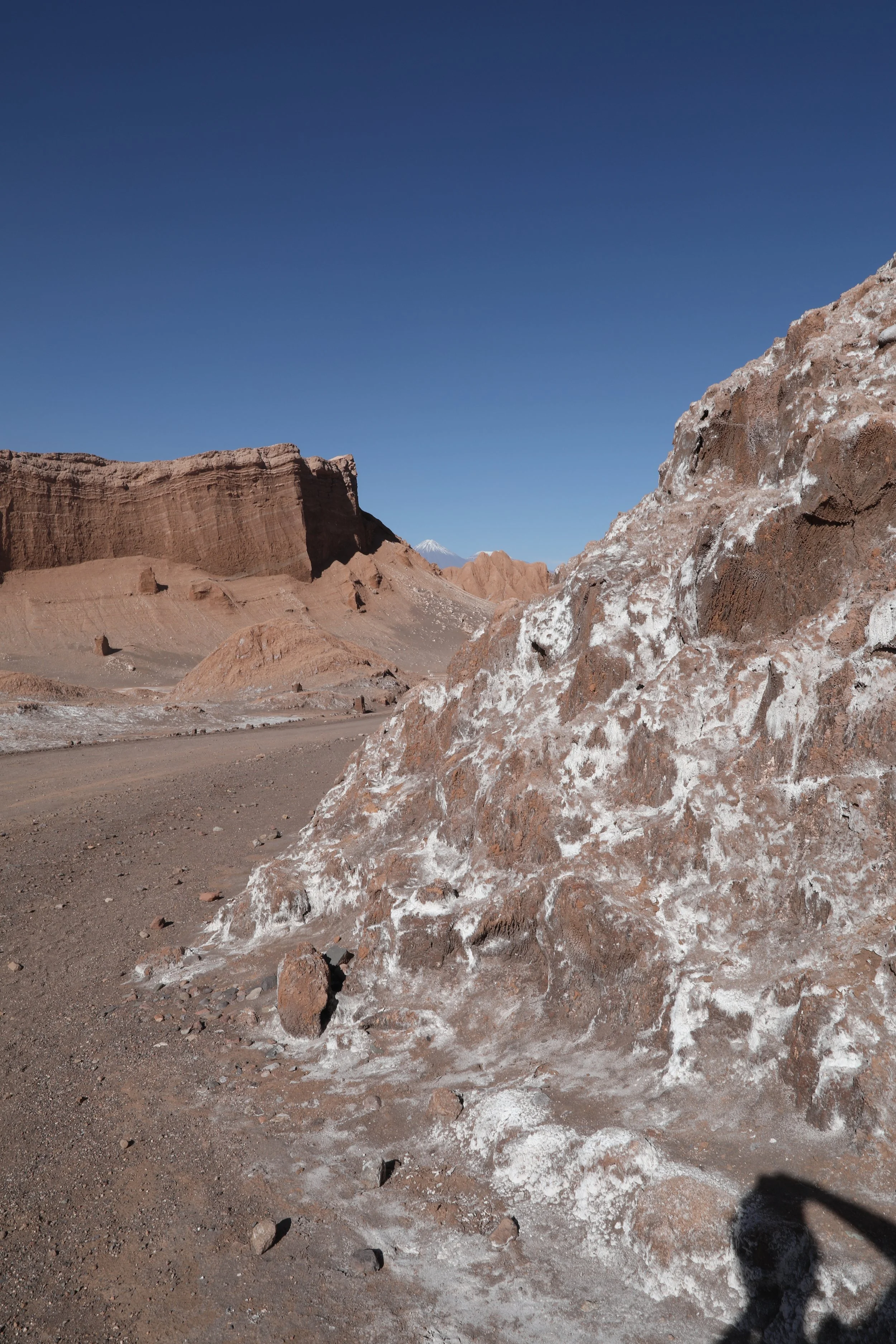
Nestled beneath the soaring Salt mountain range, the valley usually keeps its salt treasures hidden — so spotting those vast, glittering deposits on our visit felt like stumbling on a secret. The Cordillera de la Sal climbs to about 8,609 feet (2,625 meters), born from an ancient salt lake that, layer by layer, folded and hardened until the restless tectonic plates nudged it skyward. Seeing that geologic story laid out before you is one of those small, unforgettable travel moments that make a place feel alive.

A walk through they valley feels like stepping onto another world. Pointed ridges and wind-carved hollows rise and fall like a moonlit skyline, while mounds in shades of gray and ocher catch the light in unexpected ways. The silence here is vast and dry; the ground beneath your boots has an almost mystical hush and you can imagine the muffled footsteps of an astronaut.
It’s no wonder scientists brought Mars to visit — NASA tested rovers and other spacecraft components here, drawn by the valley’s extreme dryness and soil chemistry that whisper of the Red Planet. Standing on a ridge at dusk, watching the long shadows stretch across the cracked earth, you can feel that cosmic connection: this place is both ancient and strangely familiar.


Valle de la Luna is part of a landscape shaped over some 25 million years and is tucked inside what many call the driest place on Earth. Some pockets in this region haven’t seen a drop of rain for centuries and that timeless aridity gives the valley its sculpted, almost theatrical forms.

The Valle de la Luna unfolds a surprising palette of colors and textures: ochres, grays and whites blend as if the earth were painting its own watercolors. There are dry lagoons where salt has formed a whitish crust on the surface, from which saline outcrops rise like sculptures carved by human hands. As the sun begins to set, those shapes come alive: shadows lengthen, reliefs become more pronounced and the whole valley transforms into a quiet geometric stage — perfect for losing yourself for a while and feeling as though you are walking inside a natural work of art.

One last treasure to hunt as you wander Moon Valley: fossilized imprints of ancient marine life. If luck is on your side, you might stumble upon the delicate outlines of creatures that once swam these long-dry seas — tiny time capsules imprinted in stone, whispering a prehistoric story beneath your boots.
Our stroll through the amphitheater was drawing to a close and, just as thoughts of rest began to drift in, the day had other plans.
Moving off the road and into gentler, powdery sand, the guide beckoned us onward and upward, promising views that felt worth every soft step.
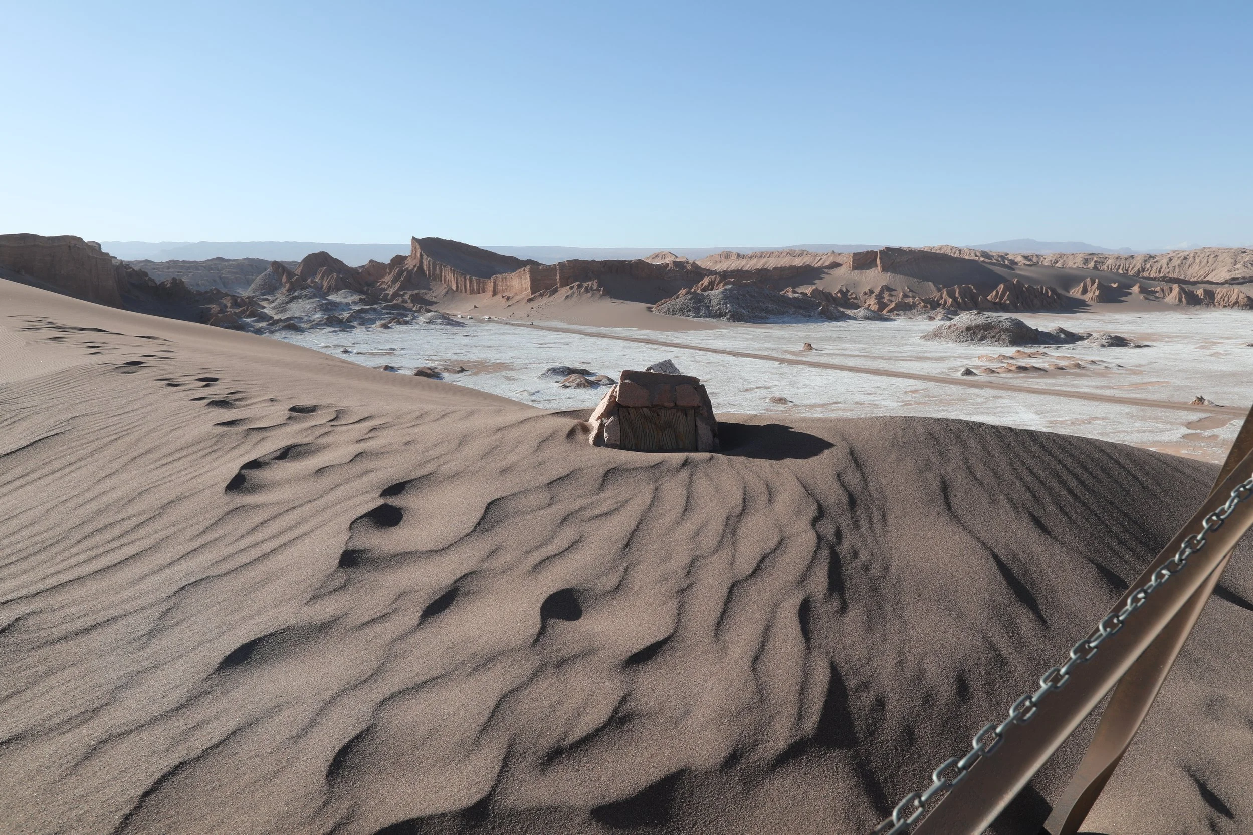
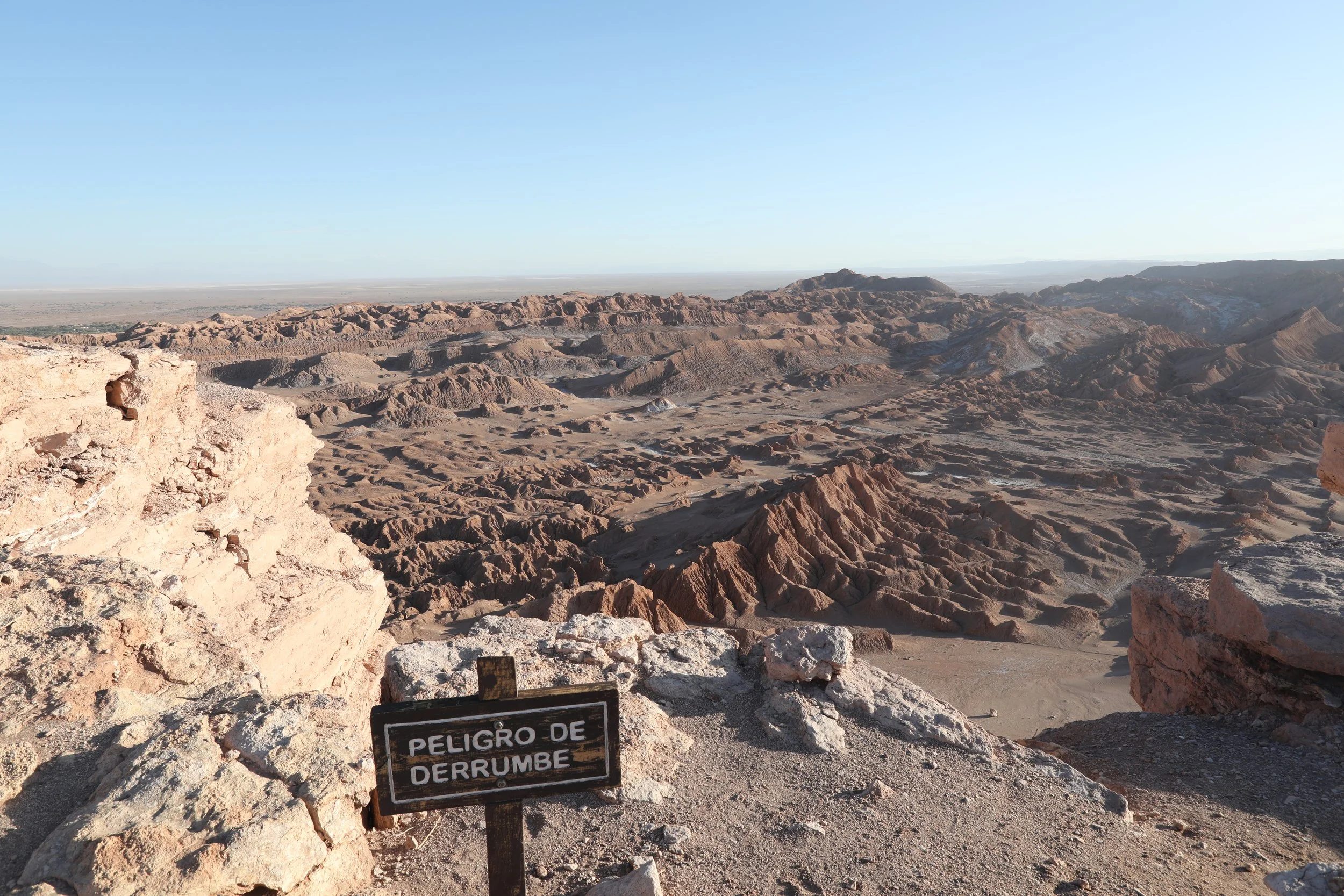
05 | Summit Moon Valley’s Peak for Breathtaking Views
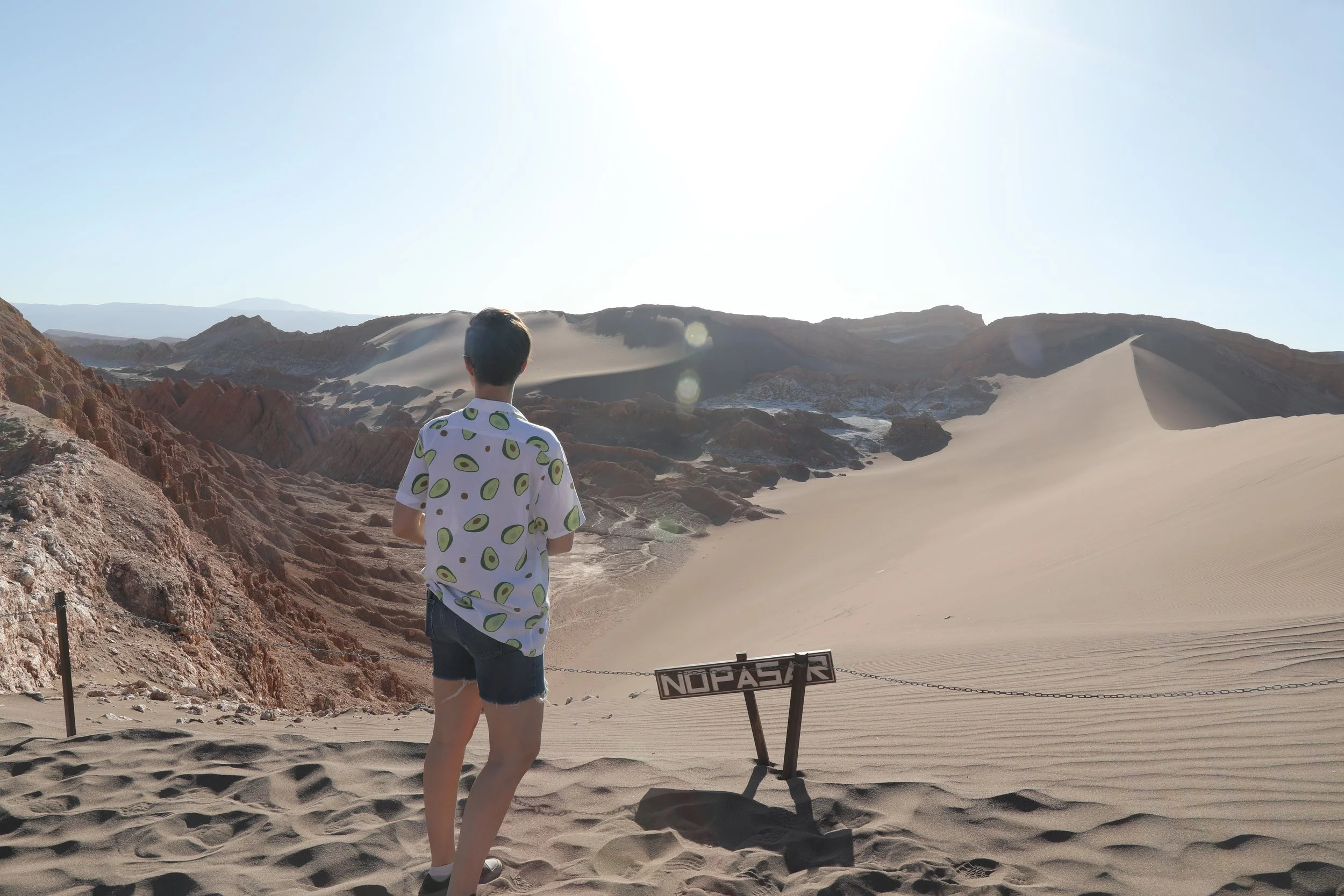
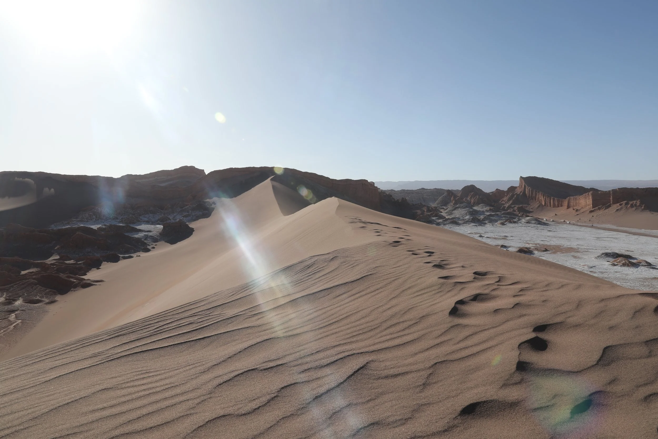
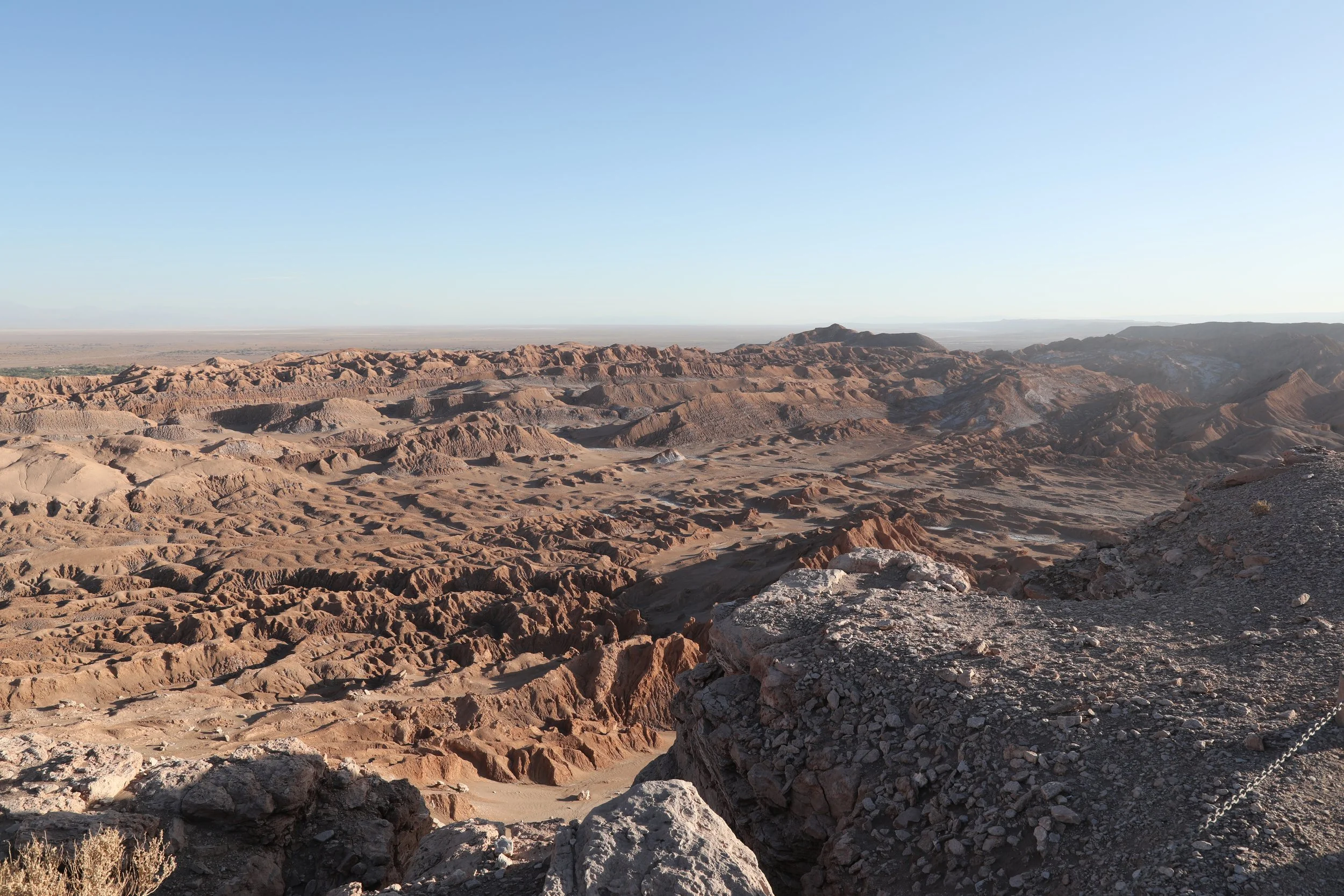
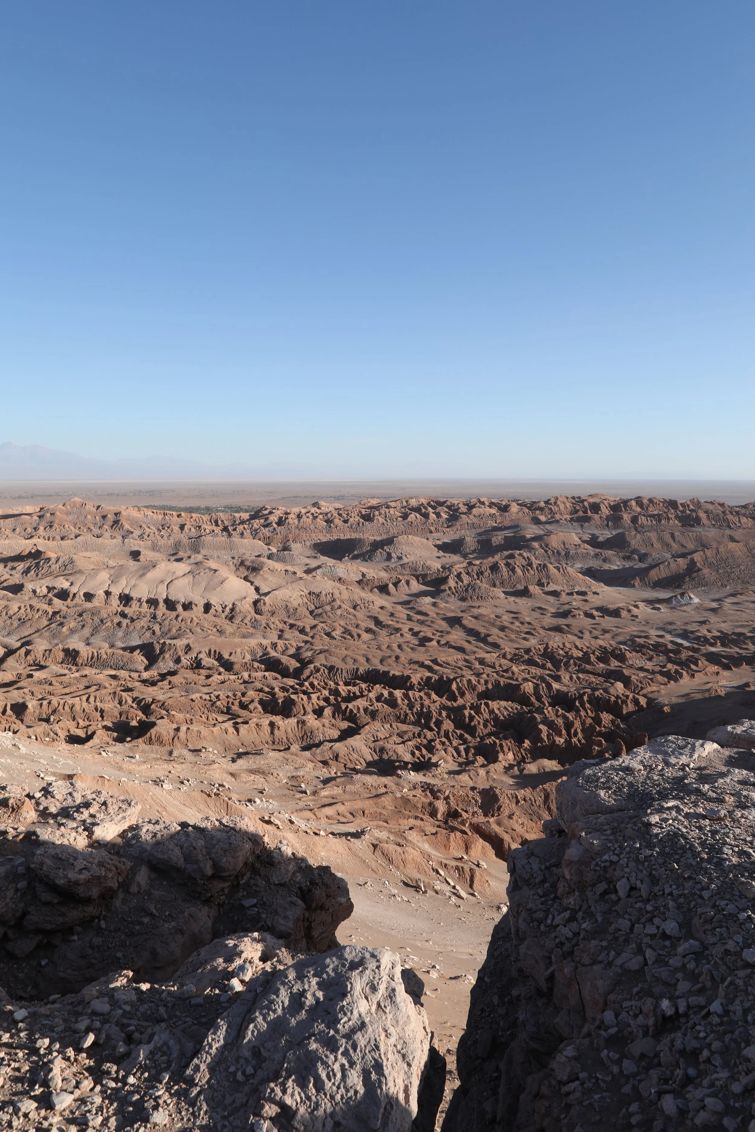
Climb the soft, sun-warmed dunes, each step sinking into powdery sand. At the crest, the world unfurls in a breathtaking 360-degree panorama — rolling ridges, distant horizons and a sky that seems to stretch forever — reward enough for the climb.
It’s a steep, sweltering climb but step by step you’ll reach the summit. On one side yawned a dizzying precipice; on the other, rolling dunes of fine, smooth sand dotted here and there with rocks and remnants that seemed out of place, as if the landscape were play-acting a set. Small wooden posts mark the boundary, reminding visitors that even on that lunar terrain there are rules to follow.
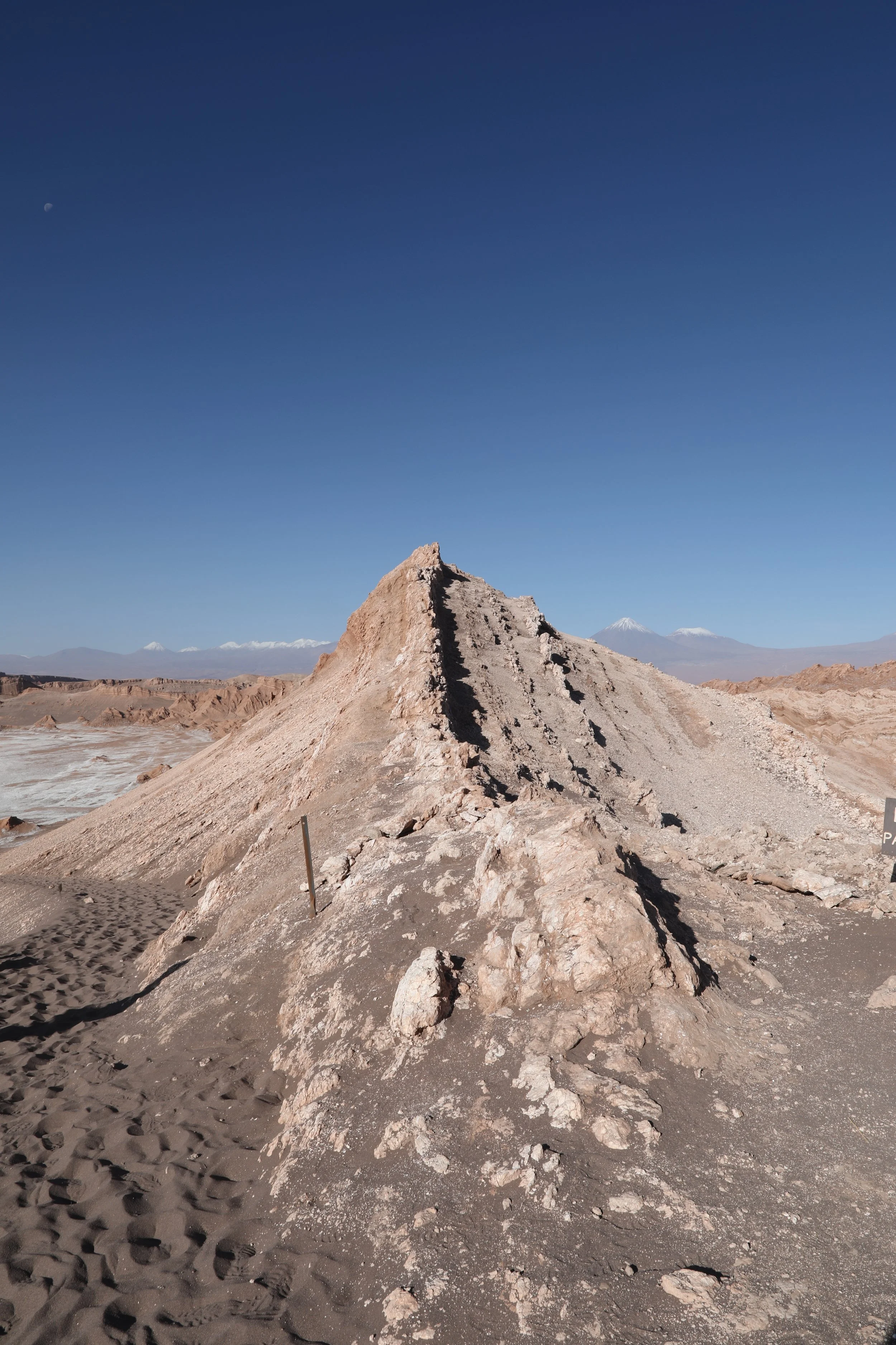
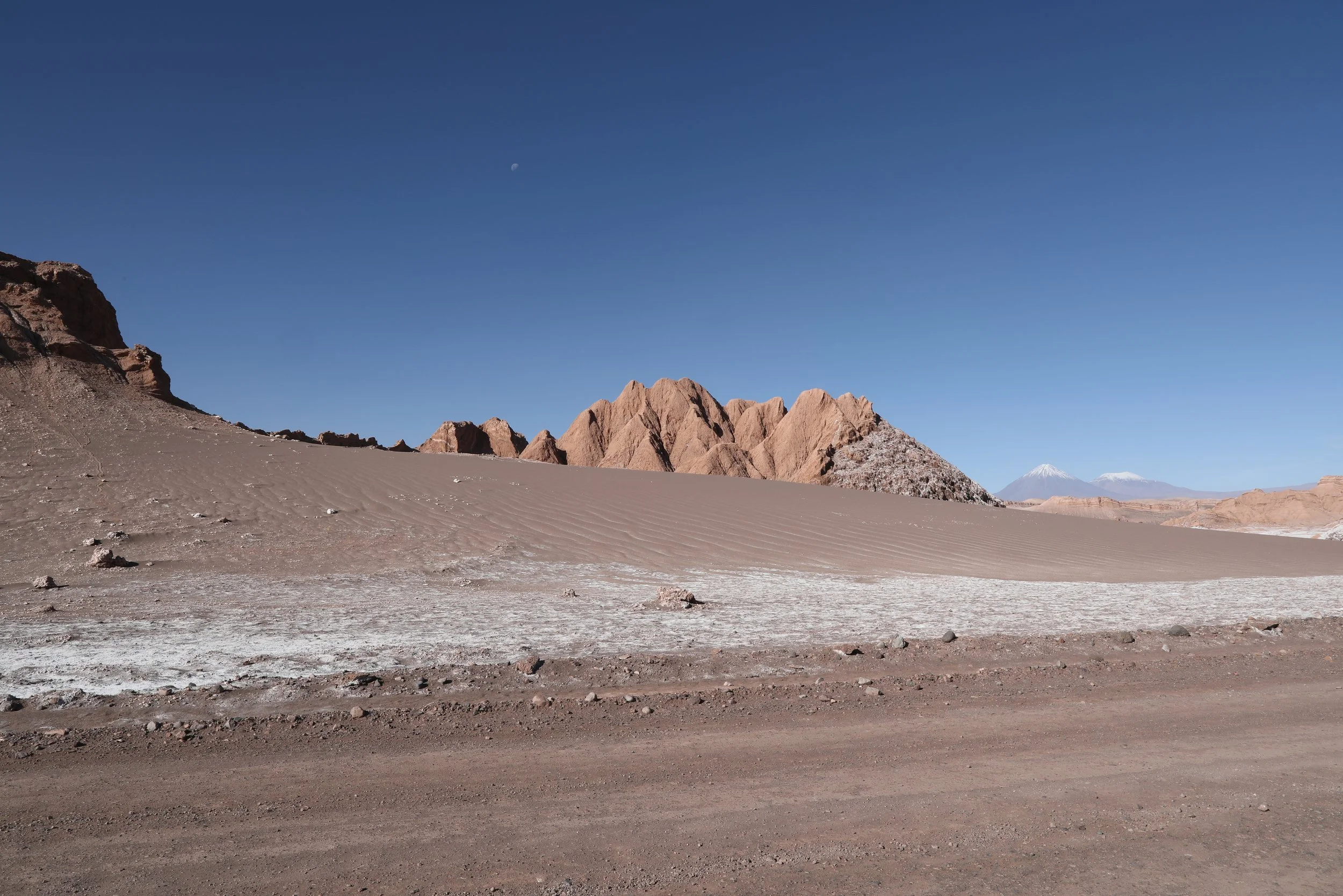
Reaching the summit, it’s easy to understand the Mars comparisons — a rust-colored sea of clay and sand rolls away in every direction, punctuated by pale, salt-like crusts that clung to the flats like old sea foam. The landscape feels unearthly and sparse, its jagged ridges and bleached patches a reminder of why locals call it the Cordillera de la Sal: the rocks here are laced with calcium sulphate, as if someone has splashed them with salt and left the planet to dry.
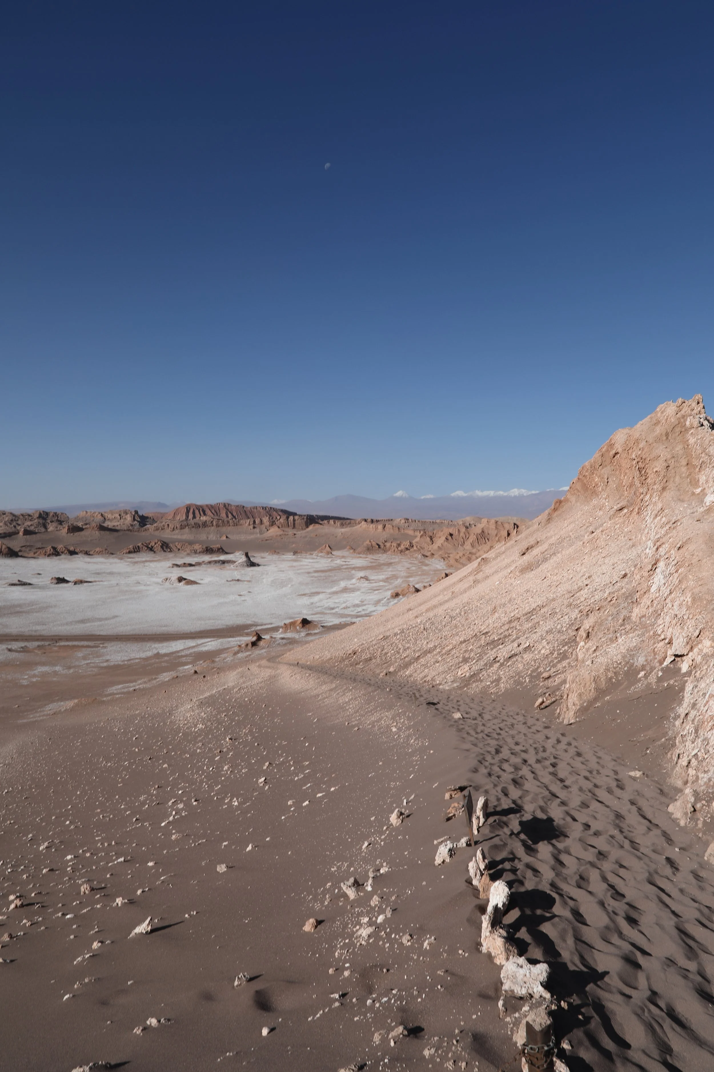
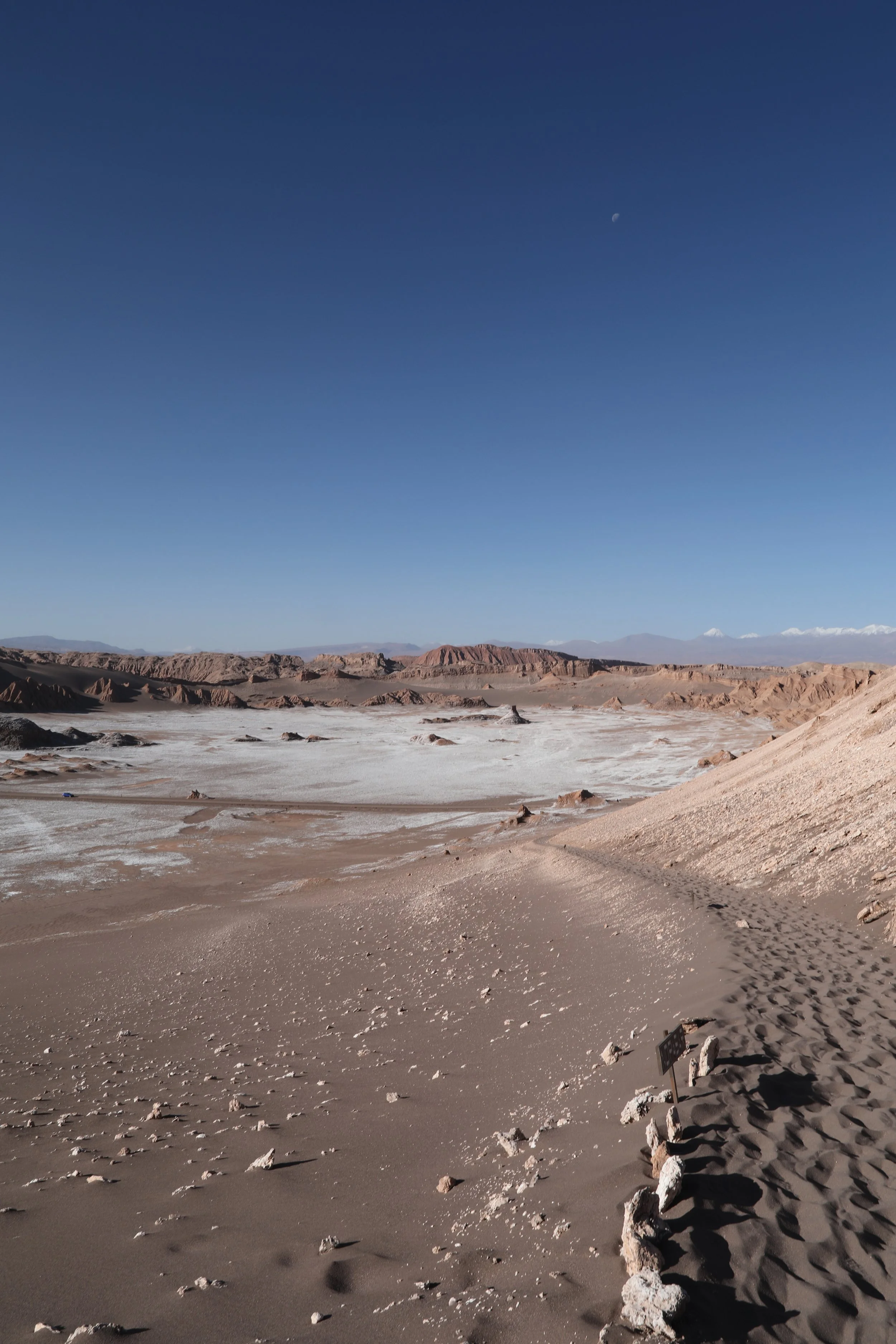
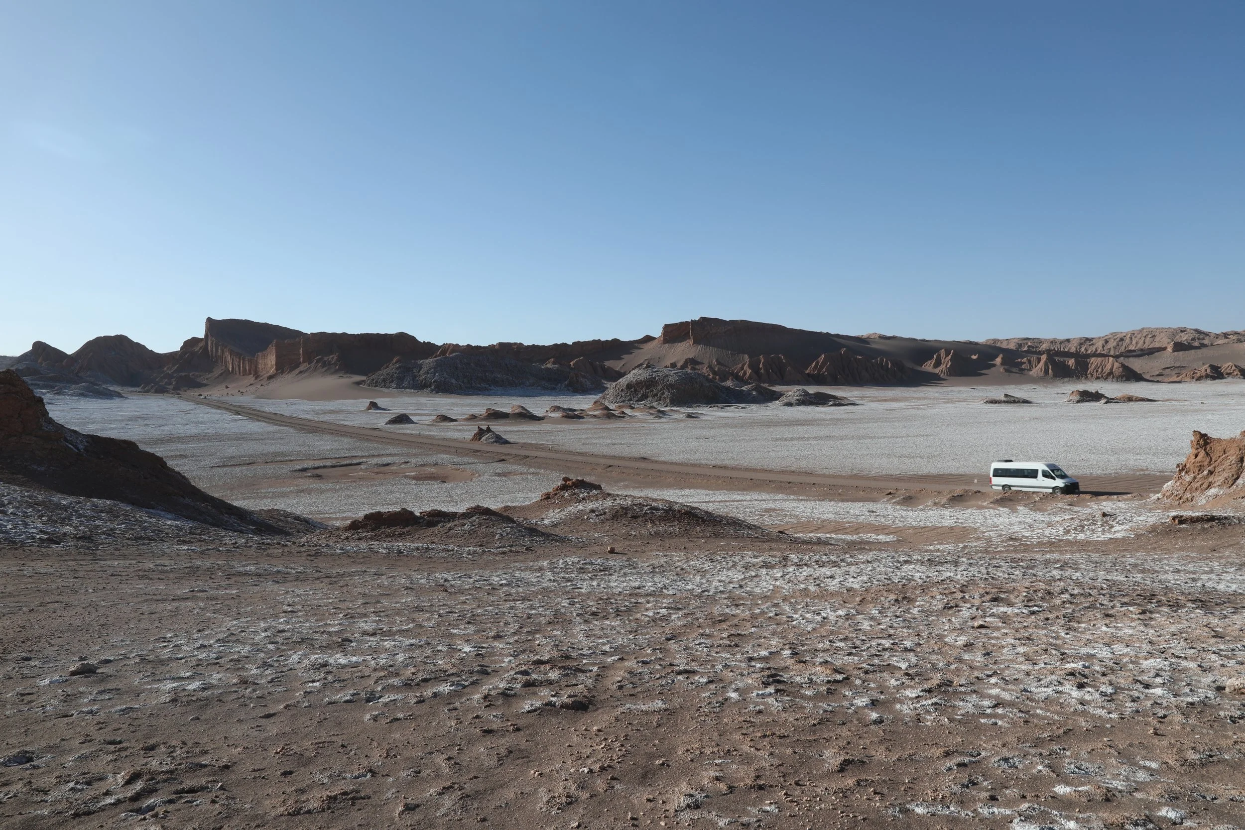
Beyond the valley, the Salt Range rises like a row of patient giants, their white, salty crowns glittering against a flawless blue sky. A solitary road threads the landscape, bisecting the plain like a ribbon of possibility. Closer, a jagged rock formation juts up — a lizard’s spine frozen in stone — each sharp ridge catching the sun and daring the clouds to touch it. The scene feels at once ancient and inviting, as if the land itself is whispering stories.

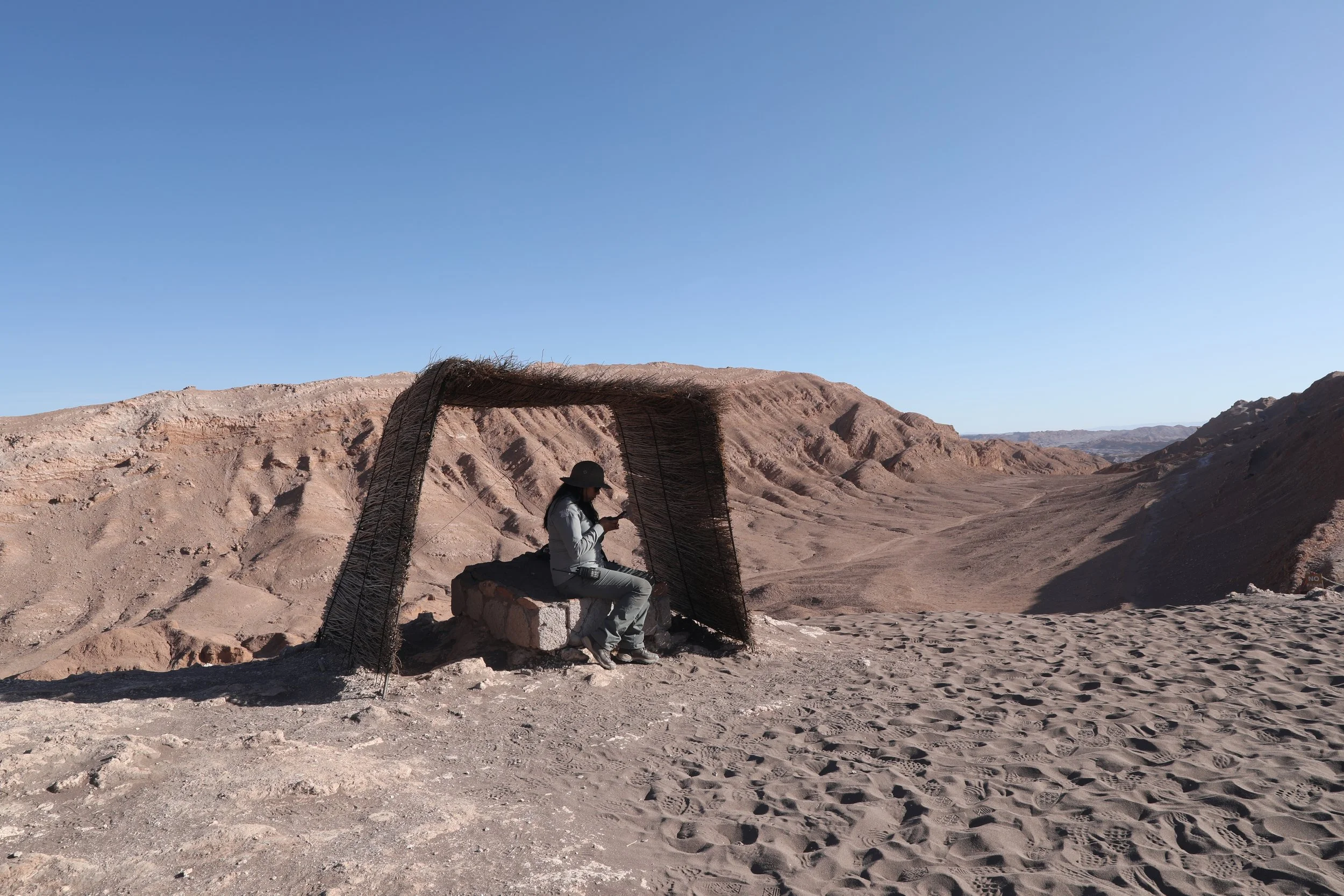
More wooden posts, strung together with weathered chains, trace the rim of the peak like a gentle guardian, guiding wandering feet away from the sheer drops. In the cool shadow of a tiny thatch shelter, a ranger sits serenely, almost part of the landscape — an unhurried silhouette against the bright sky. I found myself curious: what small, steady duties fill her days up here, tending this quiet edge of the world?
A sense of wonder hangs in the air as the landscape reveals itself — rocky spires carve the sky, then give way to dunes that roll like pools of warm cream. The sharp, spiked cliffs and the velvety slopes stand together in surprising harmony, inviting travelers to pause and marvel: what ancient conversation leads these two very different worlds to share the same horizon?
Valle de la Luna stretches across Chile’s Antofagasta Region — a landscape that slowly grew up around a life-giving oasis on the Puna de Atacama, the stark, high-altitude plateau. Long before it became a draw for travelers and photographers, this place belonged to the Atacameños, whose skilled hands wove vibrant textiles and shaped earth into pottery. Walking the lunar ridges today, you can almost feel the echo of their craft and daily rhythms woven into the wind-sculpted stone.


Tip | Take your time — ascend gradually and listen to your body so you can adapt to the altitude comfortably. I’d recommend to take your first day in Atacama easy, so your body can adjust naturally.
Perched at about 8,000 feet (2,435 meters), the town wears its cold-desert charm like a well-loved scarf. The thin air can catch newcomers by surprise — dizziness, sluggishness or a thumping headache are common first impressions — so take your time to settle in. Sip tea on a shady patio, wander slowly through sunlit streets and let your body adjust before tackling any high-altitude hikes, especially during the heat of the day. Your legs (and your lungs) will thank you.
Sun-soaked days here feel gently warm rather than scorching — in summer (December to February) the mercury usually drifts between a pleasant 77–86°F (25-30°C), while winter days (June to August) sit comfortably in the 64–77°F (18-25°C) range. The air is dry and clear most of the year, painting every vista with sharp, golden light. Nights, however, tell a different story: temperatures often plunge below freezing and can dip as low as 14°F in the heart of winter, wrapping the landscape in a crisp, frosty hush.

Though the heat isn’t dramatic, the Atacama’s dry air and high altitude have a way of sneaking up on you. On my very first day, a short stroll through town left the tops of my ears blistered and stinging — a humbling lesson in desert sun. After that, we got smarter: wide-brimmed hats, generous sunscreen and slow, steady steps became part of every outing, turning risky sunburns into easy, comfortable afternoons of exploration.
Tip | Slather on sunscreen and keep a breezy coverup or wide-brimmed hat close at hand — the Atacama's sun is as relentless as it is beautiful.
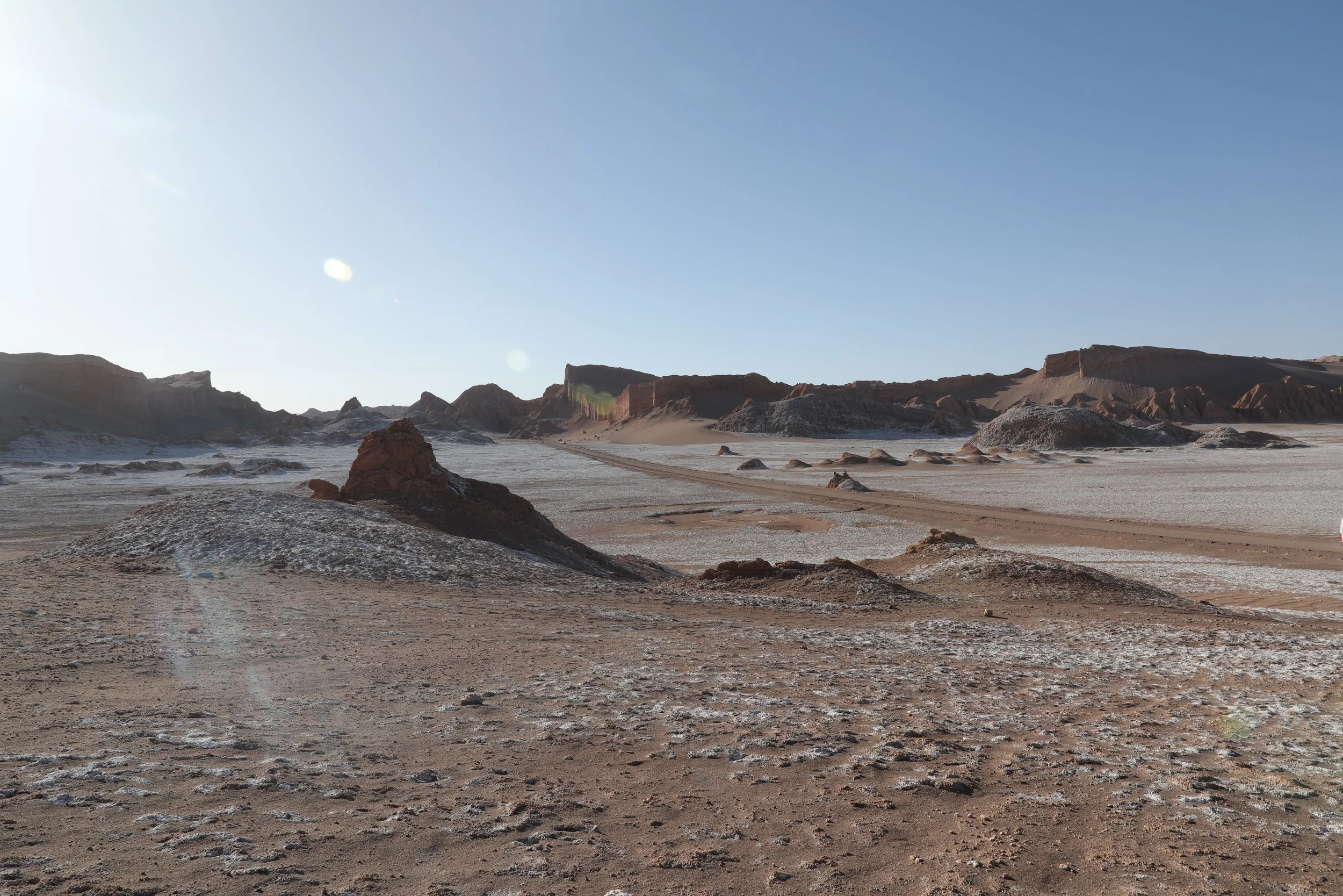

The descent from the dunes feels almost playful compared to the slow, grueling climb up — sand slipping beneath our boots like a whisper. Regroup at the van, faces bright with sweat and anticipation, each eager for whatever the afternoon brings. Valle de la Luna greets you dry, sunbaked and smelling faintly of salt — an alien kind of beauty never encountered before.
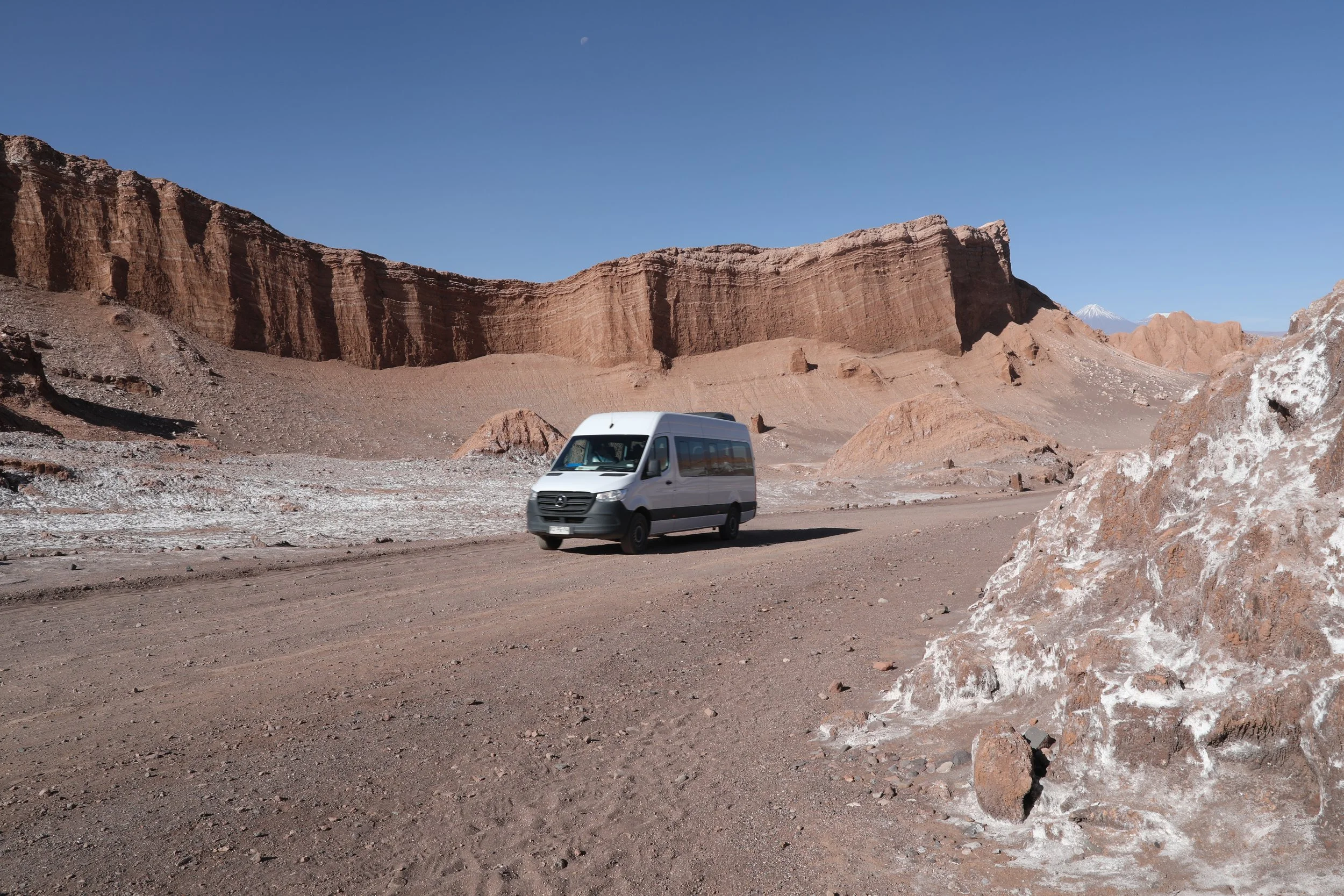
The landscape is achingly desolate and still, disturbed only by the brief whirl of dust as large white vans roll past, leaving behind a ghostly trail.
06 | Catch Panoramic Vistas at Piedra del Coyote
From there, your Atacama adventure continues by van: another 20 minutes north, where the landscape will amaze you once again.
El Mirador de Kari perches at roughly 8,350 feet (2,545 meters) above sea level, one of San Pedro de Atacama’s signature lookout points. Here the wind, water and temperature have teamed up over millennia to carve a ravine that feels almost extraterrestrial — a dramatic, sculpted landscape that steals your breath long before the altitude does. Standing there, you can't help but watch light and shadow chase across the rock faces and imagine the slow, powerful forces that shaped this magical place.

From above, Valle de la Luna feels almost unreal — a jagged, lunar tapestry stretching until it abruptly stops, like someone dragged a giant eraser across the earth and left a clean, flat stage beyond. The contrast is striking: brittle ridges and salt-carved spines give way to a calm, ordinary plain, only to be interrupted again by the distant silhouette of mountains rising like the next act in a surreal play.
Known to locals as Piedra del Coyote, Mirador de Kari rests above the whole valley — a windswept rocky plateau crowned by an overhanging slab of stone that seems to defy gravity. From a distance it looks straight out of a cartoon: the kind of precarious ledge where Wile E. Coyote might stage his next scheme while the Road Runner zips by below. Tourists gave it the nickname but standing there in the quiet, with panoramic light spilling over the valley, the playful comparison somehow feels perfectly fitting.

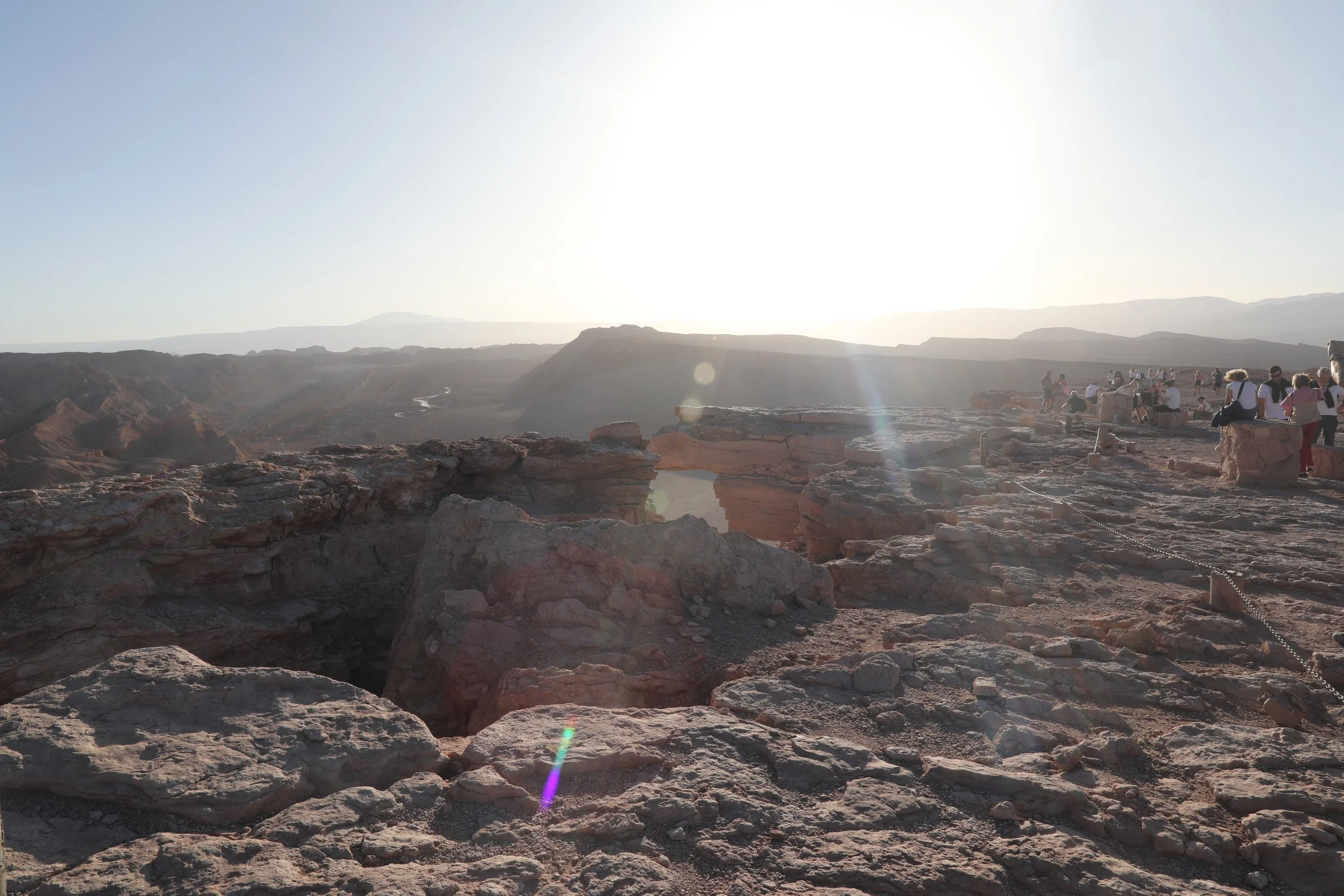
Granular dirt and stray pebbles shift underfoot, threatening to tumble over the lip where the cliff gives its most uncertain smile. Thin cracks spider toward the lookout, whispering that the ground isn’t as honest as it looks — yet the small, worrying sounds are swallowed by the breeze. Nobody seems fazed; they lean forward anyway, drawn by a panorama that steals your breath more completely than any warning ever could.
07 | Relish Sunset Over Valley of Atacama
The perfect finale to your Atacama adventure: sip on drinks, nibble on snacks and watch the desert melt into a glorious sunset.
Sunset in the Atacama Valley can feel like stepping onto another planet. The pale desert shifts through a palette of rose, gold and lavender as the sun sinks behind the Salt Mountain Range — a surreal skyline carved from salt, gypsum and chalk. Wind and time have sculpted the slopes into fantastical ridges and natural sculptures, each shadow revealing a new texture or angle. These formations were once the floor of an ancient lake, lifted and hardened over millions of years, creating the impression of a frozen ocean of mineral and light that tells a story far older than any present observer.


The panorama steals attention — and while eyes drink in the horizon, guides quietly assemble an irresistible spread. Glasses of chilled fresh juice and local wine catch the light; bowls brim with sun-ripened fruit and briny olives; wedges of creamy cheese sit beside crunchy nuts. A platter of pita chips waits for scoops of vibrant guacamole, transforming the moment into an impromptu tasting that tastes as much of place as it does of flavor.


The sun slides low behind the jagged spine of the Atacama, and suddenly the whole range takes a breath. Peaks that moments before looked stern and ochre soften into a blushing line — pale pink spreading across crags and salt-flaked ridges like watercolor seeping into paper. Tiny salt crusts along the summits catch the last light and flare white against the pink, as if the mountains themselves wear frosted crowns.

Standing there, wind in my face and the desert humming around me, the sunset felt almost deliberate — a slow, quiet ceremony that turned a harsh landscape into something unexpectedly tender. As the evening softened, we drove back toward town, anticipation humming beneath our steps — later that night, the Atacama would unfold its star-studded sky for our astronomical tour.
The Valle de la Luna tour felt like stepping onto another planet — satin dunes, craggy salt formations and sunsets that paint the desert in impossible colors, leaving you breathless and oddly peaceful all at once.