Tikal: Echoes of an Ancient Maya Civilization
Explore Tikal’s lost kingdom & jungle echoes with this travel guide.

Why Visit Tikal: Reasons to Fall for Guatemala’s Ancient Jungle City
Tikal is nothing short of magical — a vast Pre-Colombian city rising like stone islands from the emerald canopy of northern Guatemala. Once a powerhouse of Maya economics, politics and military strategy, its impressive ruins now punctuate Tikal National Park, a swath of jungle that spills into Mexico and Belize and is often called the Maya Forest. Walking among these towering temples, you feel the pulse of a civilization that thrived here from the 6th century BC to the 10th century AD.
The park itself is one of those rare places honored by UNESCO for both natural and cultural significance. How often do you get to stand inside an archaeological masterpiece while flocks of howler monkeys and bright birds perform an entirely different kind of ritual above you? The biodiversity is astonishing: ceiba and ceiba-like giants, orchids clinging to trunks and a chorus of jungle life that makes the stones seem alive.
Architecturally, Tikal delivers drama and scale. Pyramid temples thrust skyward, their steep stairways worn smooth by time. Grand plazas and palace compounds sit in careful alignment, stelae and altars still whispering names and events to those who look closely. Climbing one of the main pyramids at sunrise — mist lifting, sunlight sketching the city in gold — is a small, breathless pilgrimage. From the summit you can trace causeways, spot hidden ballcourts and watch the jungle swallow and protect what was once a bustling urban center.
Beyond the big monuments, the site rewards slow wandering: a half-buried structure glimpsed through vines, a carved lintel catching light, the sudden call of a toucan. Guides (and the placards) help stitch the story together — dynasties, trade routes, rituals — but the best part is allowing yourself to be quietly stunned by scale, craft and the layered silence of centuries.
One-Week Travel Itinerary
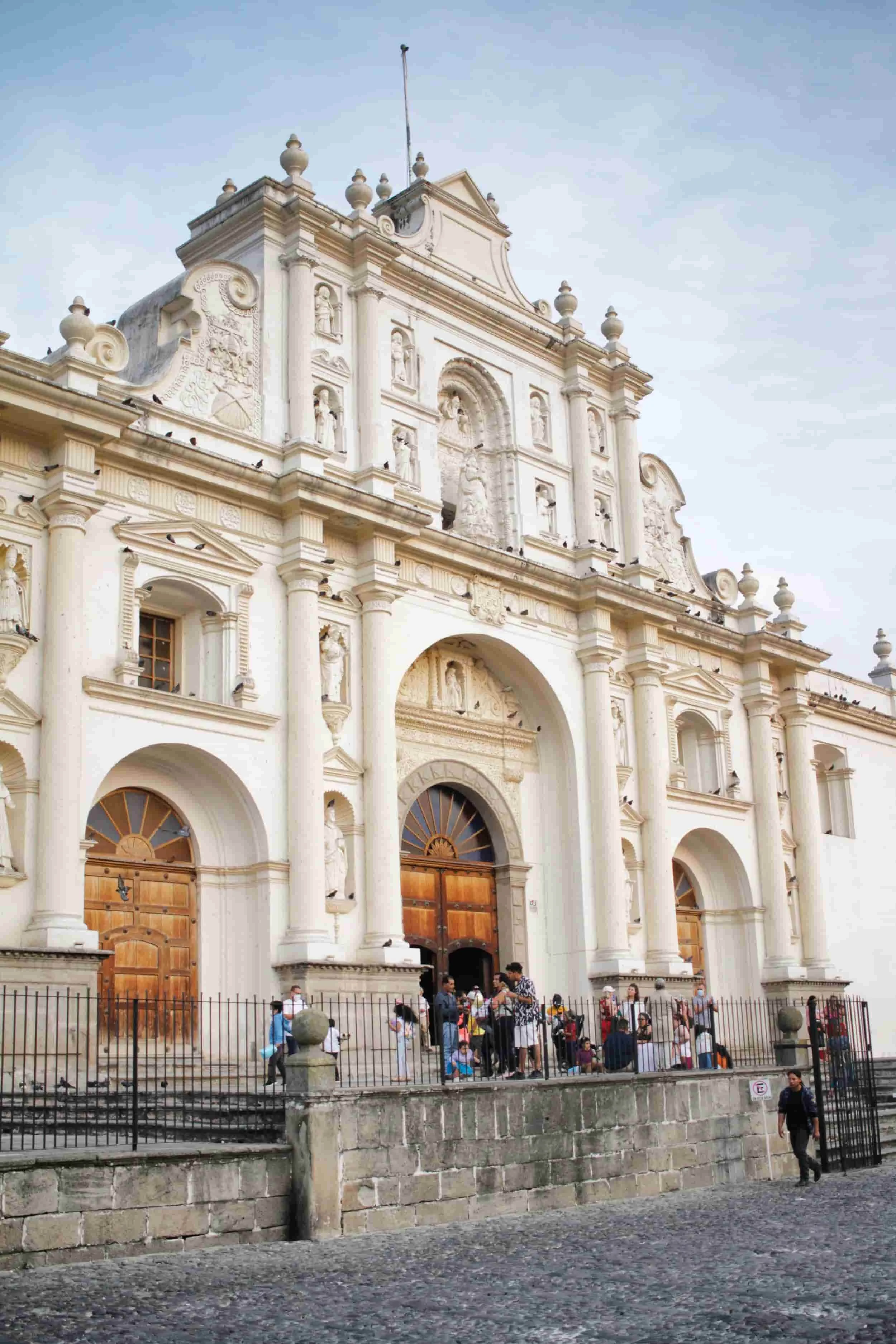
Arriving in Guatemala felt like the start of a story I hadn’t quite earned. A missed flight and more runs to LAX than I’d like to admit set the tone but stepping into Antigua made every hassle evaporate. The city is a painter’s palette — colonial facades in peppermint, coral and sunshine hues framed by volcanoes — and it welcomed me like an old friend.
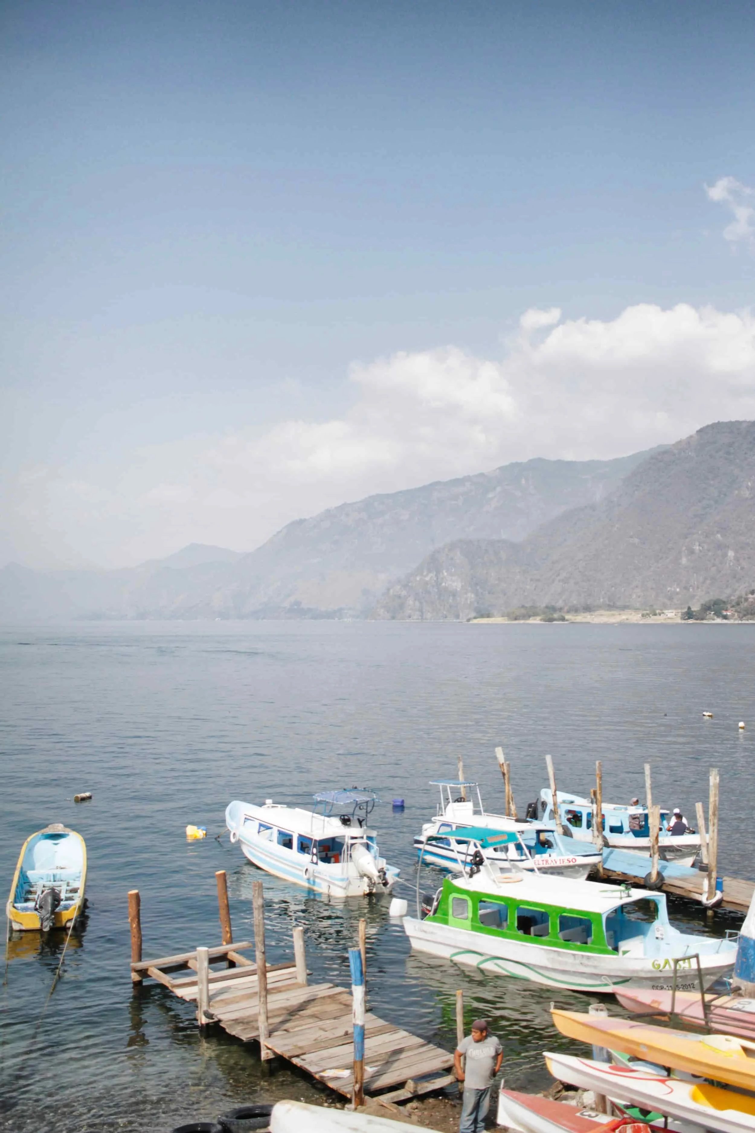
From Guatemala City, Antigua is an easy under-an-hour taxi ride, which makes it a perfect first stop. I spent days losing myself on its cobblestone streets, lingering in shaded plazas and sampling street-side coffee. One afternoon, I booked a day trip to Lake Atitlán and was rewarded with a postcard-perfect panorama: volcanic silhouettes mirrored in glassy water and tiny Mayan villages clinging to the shoreline like treasures.
Back in Antigua, I teamed up with a local guide to wander the surrounding villages. We hunted for macadamia nuts, ducked into tiny textile shops where colors hummed off the shelves and ate like locals — thick, comforting plates that felt handmade and rooted in tradition.
For the finale, I flew north and used Flores as my jumping-off point into the rainforest. Meeting friends there, we ventured into Tikal in the morning. The ancient stones rose through the mist like the ribs of a giant and wandering those vast plazas, you can almost hear the echoes of a civilization that once filled them.
It wasn’t the smoothest start but Guatemala delivered reward after reward: color, warmth and a very particular kind of wonder that stays with you long after the airport lines.
What’s Inside | Roadmap
01 | Arrive in Flores: gateway to Tikal’s timeless jungle adventures; book domestic flights here & grab dinner at La Casa de Enrico
02| Breakfast at Panela in the heart of Tikal’s rainforest; Tikal National Park
03 | Uncover Tikal’s lost city & begin your adventure through ancient ruins
Twin Pyramid Complex
Temple IV
Talud Tablero Temple
Lost World Pyramid
Temple III
Temple V
Central Acropolis
North Acropolis
Temple II
Temple I
04 | Savor sunset flavors at Bistro Puertas del Cielo in Flores
Read On | Discover more of Guatemala with the guides: Guatemala Travel Guides
Tikal National Park: Unmissable Adventures Among Ancient Mayan Giants
Step into the mist where jungle drums still seem to whisper and stone steps remember ancient footsteps. Tikal is not just a ruin — it’s a living story carved in limestone, where sunrise floods twin plazas with gold and howler monkeys provide the soundtrack. This piece will invite readers to experience Tikal as both archaeology and adventure: climb temple terraces at dawn, trace glyphs on shaded stelae and sip cooling agua de jamaica while a local guide translates myths older than cities.
01 | Arrive in Flores: Gateway to Tikal’s Timeless Jungle Adventures
Flores makes a perfectly pleasant base for visiting Tikal. The town sits a short, scenic hour from the park, so you can avoid the higher prices and limited options inside Tikal itself while still arriving early for the ruins. From Antigua, a quick one‑hour flight drops you in Flores — a simple walk from the tiny airport brings you to a modest apartment or guesthouse and the town’s relaxed riverside vibe.
A practical note: domestic flights in Guatemala have a reputation for running late, so build in extra time if you have tight connections or onward travel plans.
Evenings in Flores are quietly delightful. For dinner, try La Casa de Enrico, a restaurant that leans into local ingredients and sustainability. Eating on the rooftop under twinkle lights and among potted greenery is one of those small travel pleasures: warm air, gentle chatter and the sense that the world has slowed down. Start with a frozen pozole — a chilled take on the classic corn stew, bright with spices and a touch of milk — then move on to traditional Mayan plates. Bollos de chaya arrive as tender corn dumplings folded with chaya leaves, sauced with tomato and topped with fresh cheese. Pollo en kol comes in a rich roasted tomato and habanero sauce, spiced with regional aromatics and paired with mashed rice and corn. Each bite highlights the region’s flavors in a comforting, rustic way.
For a morning trip to Tikal, arrange a round‑trip taxi from Flores; expect to pay around $70 USD for the convenience and flexibility.
Tip | Arrange a sunrise ride to Tikal in advance so you can greet the ruins as the day awakens.

Rise before dawn and meet the driver by the mist-kissed shore of Lago Petén Itzá. Shimmering like a vast, tranquil mirror, the lake drops to 520 feet at its deepest — Guatemala’s third-largest, after Lake Izabal and Lake Atitlán — and the morning light paints the water in soft, inviting hues.

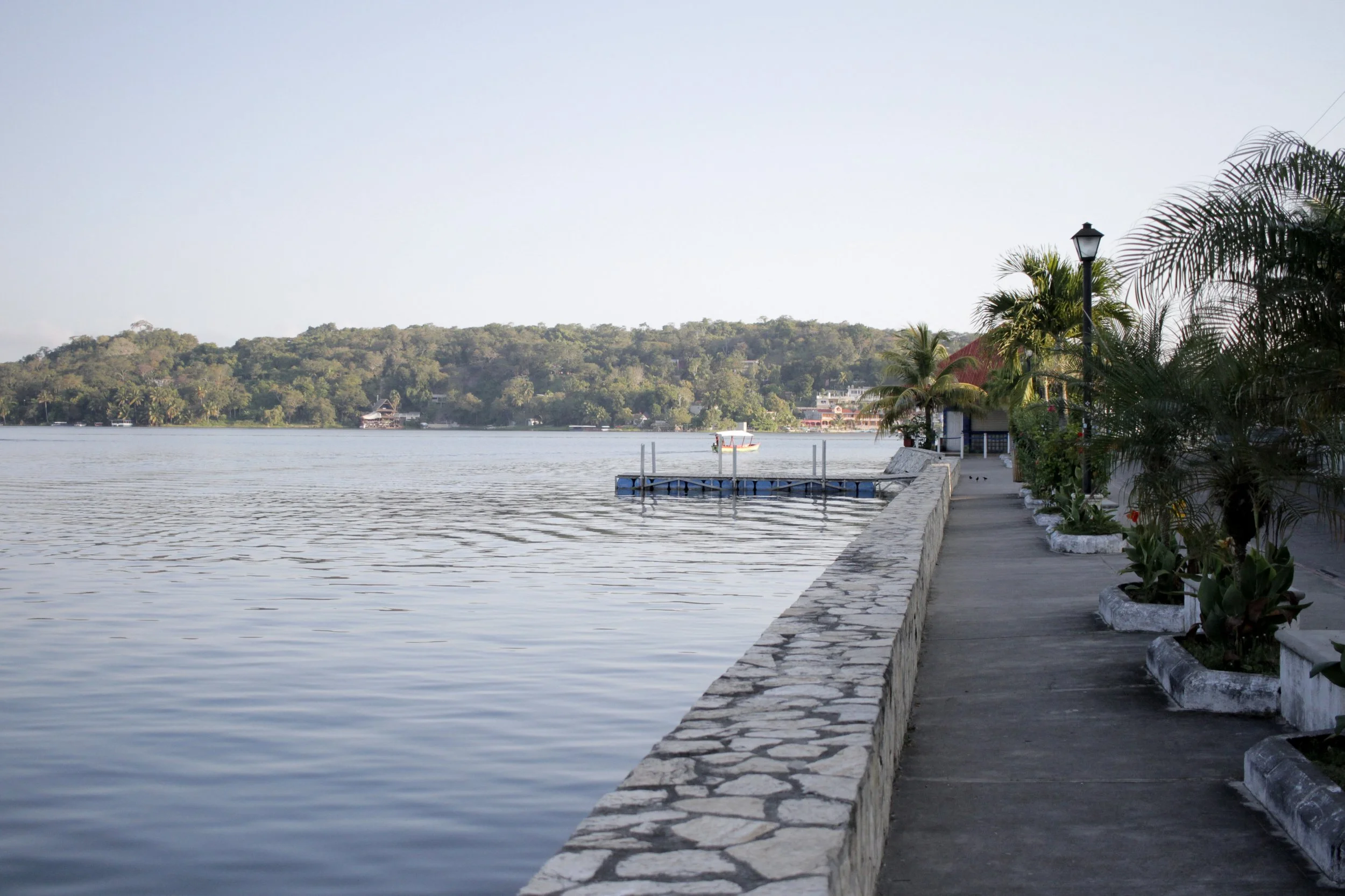
A serene lake stretches beneath a wide sky, dotted with tiny islands that beg to be explored by boat or by a refreshing dip. While the water invites leisurely swims and gentle paddles, the true magic of the place lies along its shores: scattered ruins and ancient stones whisper stories of the Maya civilization, turning every stroll into a quiet journey through time.

Around the lake, about 27 Mayan sites dot the landscape, each a whisper of antiquity waiting to be discovered. Near the bustling island town of Flores lie the ruins of Tayazal, where sun-baked stones and mossy terraces hint at stories of a long-vanished world. Encircling these ancient remnants, a patchwork of tropical rainforest and fertile farmland unfurls — swaying sugarcane, glossy cacao trees, fields of grains and bursts of bright tropical fruit — painting a lush, timeless backdrop that makes every ruin feel like a secret revealed.

Soft, glassy waters stretch out in the cool morning light, a deep, velvety blue. All is peaceful until the quiet is punctuated by the hum of a motorboat; a few men start it up and offer a quick, friendly wave, a small human ripple across an otherwise perfect seascape.
02 | Breakfast at Panela in the Heart of Tikal’s Rainforest
My trip to reach Tikal — at 7 a.m. on the dot, a driver arrives to carry me northeast along the lake toward Tikal National Park. There’s a little logistical dance to coordinate with friends arriving from across the border in Belize but the route is calm and the morning light is soft. By 8:30 a.m., the park’s ancient silhouettes appear on the horizon and I pull into Tikal right on schedule.


Panela at the Jungle Lodge Hotel feels like a little tropical oasis for breakfast. The dining area has a relaxed, resort-like vibe and is tucked into lush greenery, so you can sip and watch leaves sway while the morning unfurls. A bright fruit juice and a creamy latte arrive first, followed by a hearty plate: two fried eggs crowned with red onion, tomato, bell pepper and avocado, plus sweet fried plantains and a generous helping of black beans.
With the meal finished and time to spare, it’s easy to stroll over to the park entrance to buy a ticket. Adult foreign visitors pay 150 GTQ (roughly $20 USD) and receive a wristband on entry. Arriving early means skipping any long waits — there are often no lines at that hour — though many travelers still recommend buying tickets online to be safe.
Tip | If long lines worry you, grab your park tickets online ahead of time — a tiny bit of planning saves a lot of standing around. If you prefer to buy at the gate, aim to arrive early for a smoother start. And if you’re coming from the Belize side, allow extra time for the border crossing, so your day gets off to a relaxed pace.
Tip | Booking a guide for Tikal is easiest if you arrange it ahead of time through your stay in Flores or El Remate (another base for Tikal) or when you book your transport — expect to pay about 100 GTQ (roughly $13 USD) per person. You can also hire knowledgeable guides at the park entrance; their stories and expertise bring the immense, mysterious ruins to life.
03 | Uncover Tikal’s Lost City & Begin Your Adventure Through Ancient Ruins
Tikal feels like a dream you can walk through. Tucked deep in the emerald rainforests of northern Guatemala, this majestic ruin — once likely called Yax Mutal — rises above the jungle canopy in a series of stone peaks, temples and plazas that whisper stories of a civilization at the height of its power.
Wandering the vast archaeological site of the Petén Basin, you quickly sense why Tikal is one of the largest and most important centers of the pre-Columbian Maya world. Declared a UNESCO World Heritage site in 1979 and protected today as Tikal National Park, the city’s ruins stretch across the forest, where ceiba trees and ceaseless birdcalls stitch the stones back to life.
Tikal was the capital of a conquest state that became one of the Maya’s great kingdoms. From roughly AD 200 to 900 — the Classic Period — the city flourished, dominating the region economically, politically and militarily. Some architecture at the site reaches back even further, hinting at human activity as early as the 4th century BC. At its peak, the city not only controlled nearby territory but also connected with distant Mesoamerican powers: archaeological evidence suggests lively ties with places like Teotihuacan in the Valley of Mexico and even hints that a powerful dynasty in Tikal may have had roots in Teotihuacan during the 4th century AD.
Explore the plazas and you’ll find sprawling temples, grand palaces and ballcourts — once the focal points of vibrant civic life. Imagine markets and processions, the creak of wooden scaffolding as new monuments rose. Then, as the Late Classic Period waned, the city’s pulse changed: construction slowed, some important palaces show signs of burning and the population — estimated by scholars anywhere from 10,000 to perhaps 90,000 — began a steady decline. After a rapid population surge between AD 700 and 830, the population collapsed and people finally abandoned the city by the end of the 10th century.
Today, visiting Tikal is both a walk through spectacular ruins and an invitation to listen. Monuments sit framed by jungle growth; morning light spills across stairways once climbed by kings. How many hands smoothed these stones? How many voices once filled these plazas? Standing among the temples, surrounded by the sounds of the forest, those questions linger — and make the place unbearably, wonderfully alive.
Twin-Pyramid Complex
When my friends turned up, I was delighted to discover they'd brought a guide — lucky me. Willie wore his role like a badge of honor and led us confidently into the jungle, down a path that felt as if few had walked it before.
Tikal’s ruins unfurl across the tropical rainforests of northern Guatemala, rising from rich, fertile upland soils. Towering Kapok trees — sacred to the Maya — stand sentinel beside stately tropical cedars and Honduras mahoganies, their trunks and canopies knitting together a living cathedral.
Wildlife here reads like a naturalist’s storybook. Agoutis — rabbit-sized rodents — dart among the leaf litter while white-nosed coatis, kin to raccoons, poke inquisitive snouts into the undergrowth. I spotted gray foxes slipping through shadows and heard the distant chatter of Geoffroy’s spider monkeys and the deep, echoing roars of howler monkeys. Overhead, harpy eagles and falcons wheel and the flash of toucan beaks and green parrots adds bursts of color to the canopy. On the forest floor, industrious leafcutter ants march in patient lines, and ocellated turkeys and guans (turkey-like birds) forage among the trees. Locals whisper that cougars, jaguars, and ocelots still prowl these woods — mysterious presences that only add to the place’s ancient, powerful magic.


Jungle still cradles most of Tikal, so much of the ancient city remains veiled and waiting — its residential neighborhoods largely uncut, unmapped and unexcavated. The core site itself stretches across more than six miles and contains nearly 3,000 visible structures but a 2016 survey funded by PACUNAM revealed an astonishing secret: beneath the green canopy, about 61,000 structures lie hidden across an 800–square–mile swath.
From the swampy lowlands rise a series of parallel limestone ridges, with the grandest temples and plazas perched on the higher ground. Raised causeways bridge the wetlands, connecting those architectural islands like ancient avenues through the forest. The whole landscape is protected as Tikal National Park — some 220 square miles of preserved jungle — the very first protected area in Guatemala, established on May 26, 1955 under the care of the Instituto de Antropología e Historia. Walking here feels like stepping into a living mystery, where every rustle of leaves might be the echo of a city that time almost forgot.
Emerging from the green hush of the jungle, our guide led us into a clearing and we blinked at Group Q — a twin-pyramid complex that feels like a secret theatre set into the heart of Tikal. Two identical flat-topped pyramids face each other across a small plaza, like silent twin guards holding a ritual conversation. To the north, a walled enclosure cradles a stelae-altar pair, and to the south a long range building frames the space. Much of this impressive complex has been painstakingly restored, its stones and monuments coaxed back upright and it stands as one of Tikal’s largest and most evocative ensembles.
Twin-pyramid groups are a distinctly Maya invention: architectural stages built specifically for timekeeping ceremonies. This one — Group Q — was raised by Yax Nuun Ayiin II in 771 to mark the end of the 17th k’atun. In Maya reckoning a k’atun equals 7,200 days, roughly twenty years, and these twin pyramids served as the ceremonial backdrop for the k’atun’s ritual cycle. Standing there, with the jungle sighing around us, it’s easy to imagine the drums and incense, the pageant of time unfolding on that plaza centuries ago.

In front of the eastern pyramid, a small assembly of stelae and altars gathers like an audience waiting for a story. The stelae — short, rounded stone pillars — bear carved scenes and looping hieroglyphs across their flat faces. Once, these slabs stood in for living royalty: miniature stages where courtly rituals were set in stone, even thought to hold a spark of a ruler’s presence. Paired beside them, the low altars complete the scene, quiet companions that hint at offerings, ceremonies and the ancient hands that once moved between these monuments.

Likely easy to miss without a guide, Willie showed us a scatter of ancient structures hiding just beneath the surface. Cloaked in soil, vines and even full-grown trees, these ruins wait patiently to be rediscovered. Some rose in gentle, pyramid-shaped mounds; others were swallowed by thick forest, only the tips of weathered stones peeking out like the crowns of forgotten kings.

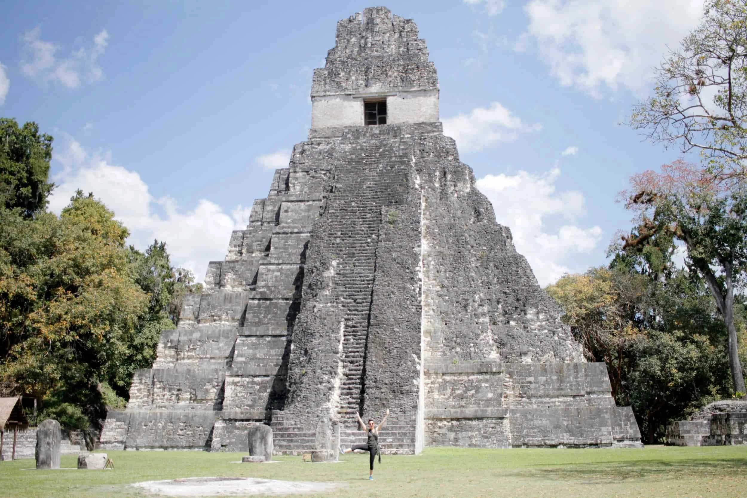
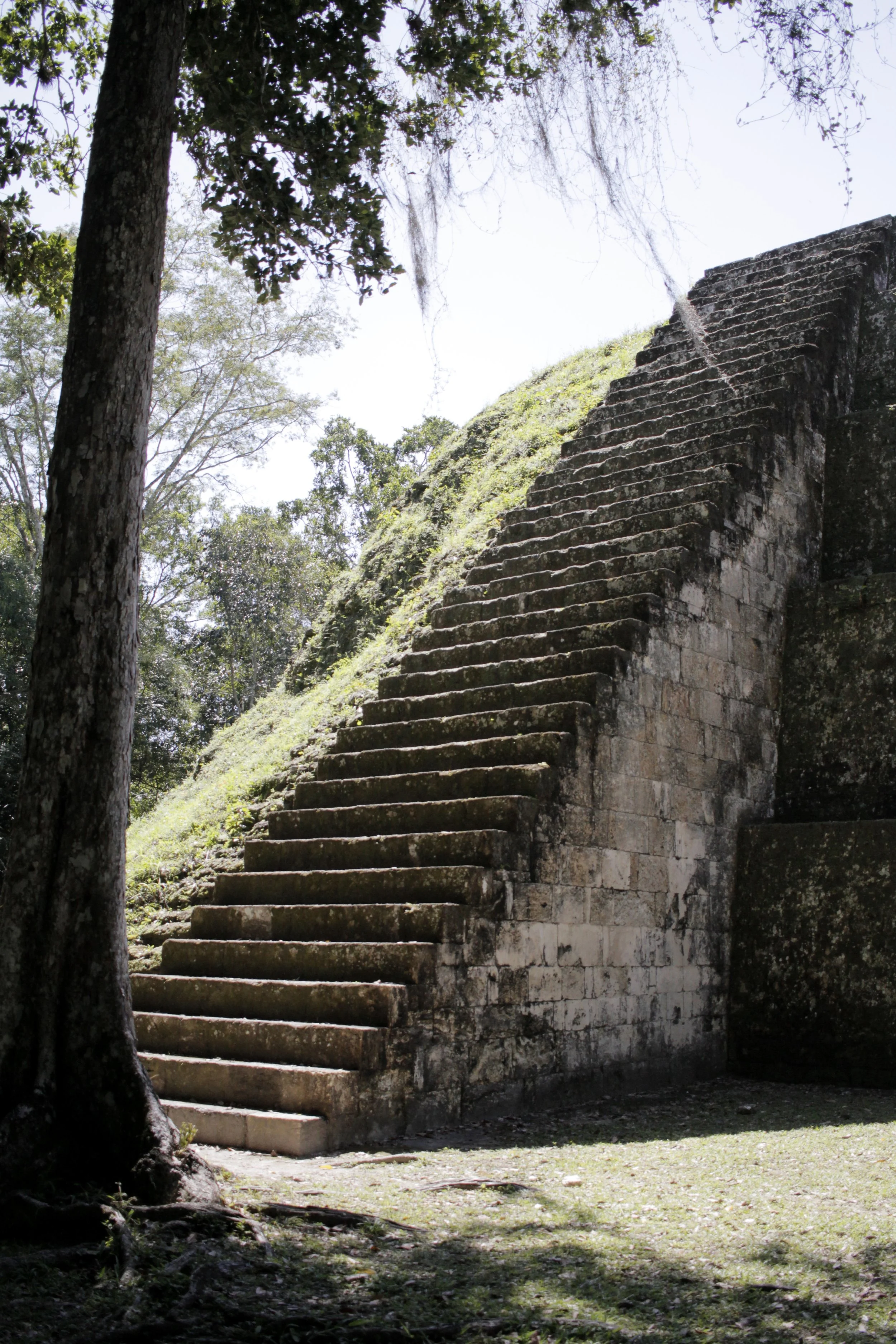
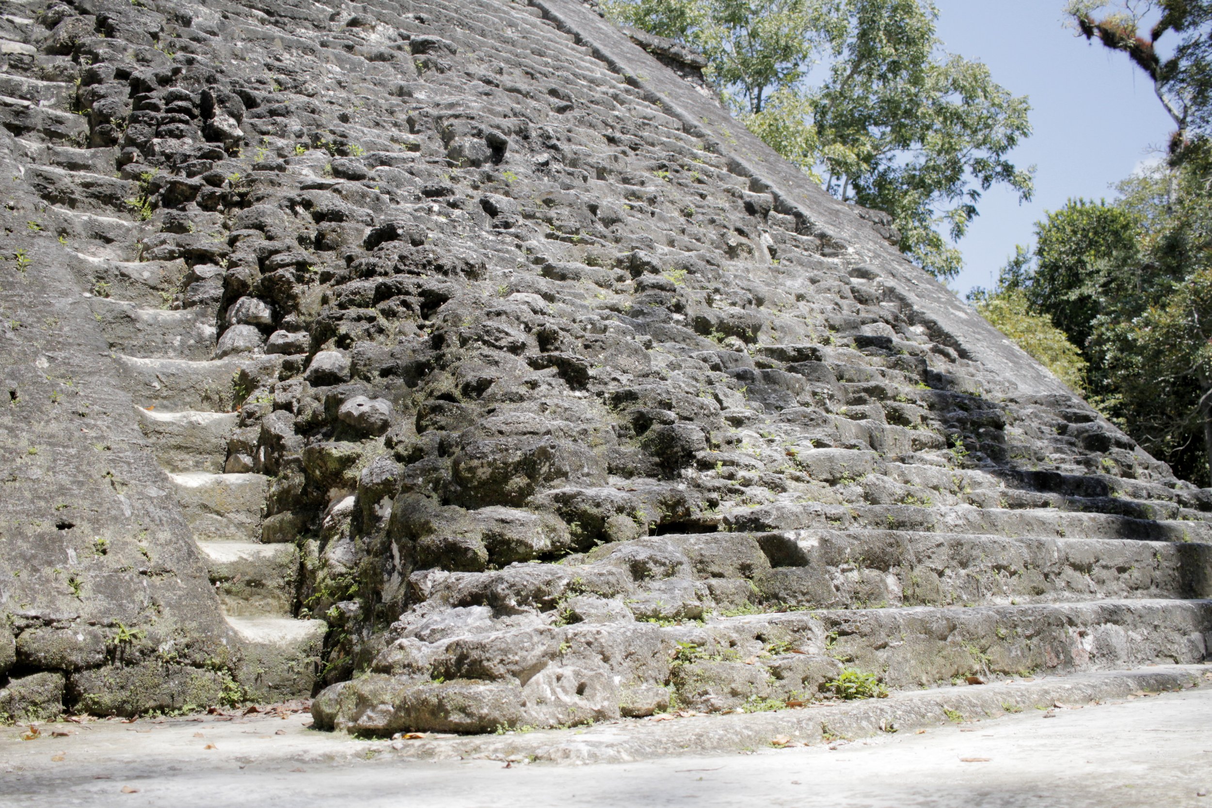
After decades of archaeological labor, most of Tikal remains hidden beneath jungle and time — only about 15% has been excavated. Even so, the portion we can see is breathtaking: six towering pyramids, known simply as Temples I–VI from the earliest surveys, rise above the canopy, each crowned with a temple at its peak. Imagine teams of ancient builders raising these monumental structures so quickly that some scholars estimate a single major temple could have been completed in as little as two years — a reminder of both the skill and urgency that shaped this lost city.

Once one of the great powerhouses of the Classic Maya world — and among the largest cities in the Americas — this vast site has been lovingly uncovered through work by the University of Pennsylvania and Guatemala’s conservation efforts. The ruins rise from the forest floor in sun-dappled limestone: quarried on-site centuries ago, those blocks became temples that pierce the canopy, royal palaces, smaller pyramids, homes, administrative houses, raised platforms and carved stone monuments that still whisper stories.
Stand at the base of a temple and look up — some climb to more than 230 feet — feeling the scale and ambition of a civilization that planned its city with both ritual and civic life in mind. Among the ruins you’ll also find intriguing everyday details: an enclosed building that likely served as a jail, and, surprisingly for Mesoamerica, seven ballcourts. The Mesoamerican ballgame has been played here for millennia, a tangible thread connecting you to people who lived and loved and competed on this very ground as far back as 1650 BCE.
Temple IV
Rising like a secret whispered through the jungle canopy, Temple IV is a showstopper. Built in the 8th century, it’s not just the tallest temple in the complex but one of the grandest pyramids ever constructed across the Maya world — and among the tallest pre-Columbian monuments in the Americas. From the plaza floor to the tip of its ornate roof comb it climbs about 230 feet, a dramatic silhouette of seven stepped levels crowned by a three-tiered, crown-like roof comb that feels every bit as ceremonial and theatrical as it looks.

Perched atop the jungle skyline, this temple dates back to AD 741 — a Late Classic tribute to Yik'in Chan K'awiil, the 27th ruler of Tikal. Some say it was raised while he still reigned; others whisper it was built as his funerary monument. Either way, the mystery remains: archaeologists today suspect his tomb may still lie hidden beneath the stone, waiting to be revealed.

On the western edge of the site’s core and gazing eastward, the temple greets the sunrise like a familiar companion. Above the doorway that grants access to the pyramid’s summit, two delicately carved wooden lintels quietly record the temple’s birthdate, a small, intimate signature from the past. Decades of careful restoration have coaxed Temple IV back to the form you see today — a place where history and patience meet, ready to reward anyone who climbs its steps with a timeless view.
Talud Tablero Temple
Structure 5C-49, tucked into the heart of the Mundo Perdido complex, is often called the Talud-Tablero Temple — an affectionate nickname born from its striking architecture. The talud is the bold, steeply sloping wall that gives the building a sense of dramatic incline, while the tablero is the flat, table-like panel that juts out with crisp right angles. Together, they create a rhythm of slope and plane that feels both ancient and intentional. This talud-tablero pairing is most famously linked to the monumental architecture of Teotihuacan, the vast, mysterious city northeast of Mexico City, and seeing it here is like spotting a familiar signature in a new artist’s work — familiar yet full of local flavor.

This temple stands out from the rest — its unfamiliar style has scholars and travelers whispering about visitors from afar. Many think it bears the stamp of Teotihuacan, as if artisans or patrons from that great city left a piece of themselves here. Across Mesoamerica, such cultural echoes weren’t rare: Maya builders are thought to have left traces at Xochicalco and Zapotec craftsmen may have worked at Teotihuacan. Standing before this lone, different temple, you can almost feel those ancient exchanges — a quiet reminder that long-distance friendships and influences have always shaped the places we love to explore.

A broad stairway climbs the pyramid, leading to a summit shrine tucked beneath three corbel-vaulted chambers and a decorative roof comb that once crowned the structure. Before archaeologists began their careful work, the vaulted ceilings and the roof comb had tumbled into the two lower chambers, hiding their secrets beneath rubble. Today, the ruined temple still rises an impressive 72 feet; you can almost imagine how much more commanding it must have felt when its summit shrine and roof comb were whole, reaching even higher into the sky.

Rising from the jungle like a layered storybook, the pyramid’s exterior reveals three clear stages of growth that began in the late 3rd century BC. Over centuries, the structure expanded: new platforms were added, a grand stairway was carved into its face and finally, a summit shrine crowned the top — complete with three vaulted chambers and an ornate roof comb that catches the light like a woven crown.
Its last major transformation happened around the same time Temple V came to life, one of Tikal’s first great temples. After AD 700 the pyramid took on a quieter, more intimate role as a burial place for likely members of the royal family. Archaeologists have uncovered three interments there — two men and a woman — accompanied by delicate ceramics and treasures fashioned from shell, conch and mother-of-pearl. These tombs have been dated to the reign of Yax Nuun Ayiin II (AD 769–794), connecting the stones beneath your feet to a very human past: rituals, status and the small, personal objects chosen to travel with the dead.
Standing before the pyramid today, you can almost trace those centuries of change with your eyes — each layer a chapter, each ornament a clue — and feel the hush of history that still lingers in Tikal’s air.
Lost World Pyramid
Sprawling across nearly 15 acres, the Mundo Perdido Complex unfolds like an ancient city frozen in time. Thirty-eight structures cluster here, among them the distinctive Talud-Tablero Temple and the towering Lost World Pyramid — also known as the Great Pyramid (Structure 5C-54). As Tikal’s largest ceremonial hub from the Preclassic period, Mundo Perdido bears the traces of generations: rebuilt and reshaped again and again, its earliest foundations reaching back to the late Middle Preclassic.

The heart of the Lost World began life as an ancient astronomical center called E-Set. From the east staircase of its pyramid, observers once stood like patient skywatchers, timing the first rays of sunrise at equinoxes and solstices from three original temples on the East Platform. Today, those same stones still hold a quiet sense of purpose.
Approaching the pyramid from the west, you climb a broad stairway flanked by enormous stucco masks — their eyes once turned skyward to follow the stars and the movements of the solar system. The pyramid itself has a slightly theatrical symmetry: twin stairways rise to the summit on the east and west faces, while the north and south sides stop after eight of the ten levels, as if the structure were designed to direct your gaze toward the horizon where light and sky meet.


The heart of the site is the Lost World Pyramid and spreading out from it is a broad plaza that feels like the city’s living room. To the west, a ceremonial platform is neatly split into two distinct spaces — the High Plaza, which hugs the pyramid, and the quieter Low Plaza beside it. Recent work by Proyecto Nacional Tikal has refined that picture, sketching the complex into four linked plazas: North, East, West and the central space, each named for the way it frames the Lost World Pyramid and the stories that seem to radiate from its stones.

Rising 102 feet into the jungle canopy with a broad base stretching 221 feet across, the Lost World Pyramid feels like a sleeping giant reclaimed by the forest. Walking up to it, you can still make out the enormous masonry blocks — some nearly six feet long — that builders hauled into place centuries ago. The pyramid’s bold lines and sheer scale also carry echoes of Teotihuacan, whose architectural influence reached deep into the Maya world. Standing there, surrounded by chirping birds and sunlight filtering through leaves, it’s impossible not to imagine the hands that raised those stones and the lives lived around this monumental, whispering relic.

During this era the Mundo Perdido Complex grew into one of Tikal’s heartlands, rivaled only by the solemn North Acropolis. Hints suggest it may once have served as a royal necropolis, a quiet stage for the city’s most sacred rites. Rebuilt again and again across generations, the present version is the fifth, tracing its origins to around AD 250. Time has worn the once-expressive masks on its façades to ghostly outlines but flecks of stucco still whisper their secrets: the building was at one time washed in blue and red, a bright splash of color against the jungle.

Reaching the summit felt like a small victory — each step rewarded with breathless anticipation. Once above the forest canopy, the view unfolded into a tapestry of green punctuated by ancient stones: temple tops and crumbling facades rising like secret islands, some poking dramatically through the trees, others tucked gently among the foliage as if someone had scattered relics from the sky. The sight made the jungle feel alive with stories waiting to be discovered.
Temple III
From my perch on the Lost World Pyramid, the skyline of Tikal is punctuated by a single elegant spire: Temple III, the Temple of the Jaguar Priest. Slender and proud, it was the last of Tikal’s great pyramids, its stones set in an era long ago — around 810 AD, according to the hieroglyphs. Rising about 180 feet, its silhouette feels almost like a lookout watching over the jungle.
Up close, Temple III keeps a few secrets. Unlike the other main temples with their three-chambered summit shrines, this one is modestly intimate: just two rooms. Inside, a damaged but intricately carved roof lintel hints at the temple’s ceremonial life. The worn relief is believed to show Dark Sun, a little-known king, caught mid-ritual — perhaps in a solemn dance whose meaning only the jungle remembers.

Built during the Late Classic period, Temple III feels like a quiet, sun-dappled whisper from the past. Likely raised as his funerary temple, its construction at the start of the 9th century hints that this was once a time of relative political calm — before everything changed.
Temple III was the last pyramid to pierce the skyline at Tikal. By the end of that same century, the city had already begun its slow decline, swallowed little by little by the surrounding rainforest for the next thousand years. The collapse wasn’t the result of a single event but a tangle of pressures: disease, famine, overpopulation and environmental stress. Water sources were compromised — droughts, polluted reservoirs and even runoff from building materials may have introduced toxic mercury. Local agriculture strained under the weight of a huge population and the long rivalry with Calakmul only made matters worse.
Today, Temple III is only partly restored; restorers focused on the summit shrine and its dramatic roof comb. The main pyramid rises in nine stepped levels, with an east-facing stairway inviting the morning light. Inside the summit shrine, the doorway between two chambers is crowned by one of Tikal’s rare original sculpted lintels: a striking carving of a plump figure wrapped in jaguar skin. It’s one of only two lintels still in situ at the site and seeing it feels like a direct, intimate connection to the people who once worshipped here.
Time has not been gentle. The roof comb and the outer chamber bear the scars of lightning strikes, including a four-inch crack running down the eastern wall. Temple III is closed to visitors and, intriguingly, hasn’t been the focus of detailed archaeological investigation — so it still holds mysteries waiting for future explorers and researchers. Standing nearby, watching how the jungle light spills over weathered stone, you can almost imagine the hum of a city that once was — grand, fragile and forever in dialogue with the forest.
Temple V
Temple V rises quietly on a ridge south of Tikal’s Central Acropolis, a mortuary pyramid for a ruler whose name has been lost to time. Pottery found nearby pins its construction to the second half of the 7th century, during the reign of Nun Bak Chak but the identity of the person it honors remains a mystery — adding to the site’s hush of secrets.
At 187 feet, Temple V is one of the Maya world’s most massive monuments and the second tallest temple at Tikal, eclipsed only by the towering Temple IV. It sits in the southern heart of the site core, sharing the ridge with the atmospheric Lost World Complex, the Plaza of the Seven Temples and the South Acropolis. Right in front of the temple platform is a natural depression that once served as one of the city’s reservoirs — a serene, practical feature that today helps explain the temple’s unusual isolation.
By the Late Classic period, access to Temple V was tightly constrained by that reservoir and the surrounding buildings. Unlike most of Tikal’s major structures, which are linked into the city by causeways, Temple V seems to have become cut off. That isolation has led archaeologists to wonder whether the temple had already been abandoned and left to decay while others flourished — a possible reason for its comparatively weathered appearance.
Visiting Temple V feels like stepping into that unanswered question. The scale is breathtaking but there’s also a quiet melancholy: a grand monument partly reclaimed by its landscape and the passage of time, holding stories it may never tell.

The pyramid greets you with broad balustrades sweeping down either side of the main stairway and soft, rounded corners that hint at older architectural traditions still whispering through the stones. From the northwest corner you can make out its seven stepped tiers, leading the eye upward to a small shrine crowned by an impressive roof comb — a quiet, sculpted flourish that marks the site’s sacred centerpiece.
Scattered nearby are fragments of everyday ritual: earthenware bowls, ceramic vessels and perforated shells once worn as jewelry and five charcoal-blackened incense burners that suggest the air here was often perfumed with offerings. The place carries an intimate, human echo as well — two burials were found close to the structure. One is a teenage girl laid in a fetal pose, her teeth intentionally pierced as a form of decoration. The other is a young man, aged about 18–22, whose skull shows deliberate cranial shaping and whose teeth were both filed and perforated. These personal traces lend a poignant, almost hushed presence to the stones, reminding you that this monumental architecture was also the setting for private lives, rituals and memories.
Central Acropolis
We slipped through what felt like a long lost back door of the Central Acropolis, led by Willie as if he were ushering us into a hidden chapter of the city. Pushing past thick green vines, the jungle suddenly peeled back and an entire architectural world appeared as if conjured from the undergrowth.
The Central Acropolis sits just south of the Great Plaza but here it feels like its own little kingdom — a cluster of stepped terraces, quiet courtyards and worn stairways that invite you to explore. Its story stretches far back: first realized in the Late Preclassic (around 50 BC to AD 250) and occupied until roughly AD 950. Over the centuries it served as both a seat of administration and a place of residence, so every stone and passage seems to hum with both public purpose and private life.
Wandering between the structures, it’s easy to imagine messengers crossing the courtyards, elders deliberating under shaded colonnades and families going about daily routines. The jungle reclaims edges where roofs once stood, softening the lines between human design and wild growth.

Nicknamed “Maler’s Palace,” Structure 5D-65 feels like a small theatrical set perched on the edge of the acropolis. From below, its western façade doubles as the retaining wall for the southwest slope, a sturdy backdrop that somehow manages to look elegant. A doorway on the west side opens out above that wall and step inside to find a surprising trick: a deeply recessed false doorway facing the exterior entrance. It’s a clever bit of ancient stagecraft — designed to conjure the illusion of a temple for anyone looking up from the plaza, as if the building were inviting you into a miniature shrine built for show.


The Central Acropolis stretches along an east–west axis, a layout set early in its story. Over the next five centuries it didn’t spread outward so much as rise — layer upon layer of new architecture was added on top of the old, creating a stacked, timeworn skyline. Once the home of Tikal’s royal families, the site began as a royal residence and evolved into a grand palace complex. Today, you can wander among 43 structures clustered around six courtyards, each set at a slightly different level, like chapters of history arranged one above the other.


Beneath the weathered stones of the Central Acropolis, archaeologists found only a handful of burials — except for one surprising cluster: four graves tucked beneath a single structure. In lowland Maya towns it was common to bury family members beneath their homes, so the absence of burials under most buildings here hints that they weren’t everyday family residences. Instead, imagine a quieter, more ceremonial rhythm: these rooms may once have housed roving priests, served as classrooms where knowledge was passed down or offered retreat and ritual space for those seeking solitude and spiritual focus.


Our guide led us through the heart of the Central Acropolis, weaving between weathered stones and sun-dappled courtyards and then up the worn steps into the quieter, wind-swept terraces of the North Acropolis.
North Acropolis
The Great Plaza is the heartbeat of Tikal — a sweeping open space framed by two monumental temple-pyramids to the east and west, with the North Acropolis rising like a throne to the north and the Central Acropolis settling quietly to the south. Stand in the middle and you can almost hear the city reassembling itself around you: processions, ceremonies, the scrape of sandals on limestone.
The North Acropolis and the Great Plaza together are among the most studied and evocative architectural ensembles in the Maya world. Archaeologists from the Tikal Project dug a massive trench through the complex to peel back layers of time, revealing a slow, vertical history written in stone. What began around 350 BC in the Preclassic period gradually became a dynastic necropolis — a sacred bookshelf of sorts, where each new royal burial was capped with another temple, building upward and outward through centuries.
Walking those terraces today you pass over stacked generations of rulers. Excavations have opened several royal tombs, matching bones to names and restoring faces to the city’s long-departed kings. It’s a humbling place: the ruins feel alive with stories and every step invites you to listen for echoes of the people who shaped this remarkable city.


Sometime after AD 400, builders began to layer the site with a new voice: a row of tall pyramids that gently tucked the older Northern Platform out of sight, as if honoring the past while moving forward.
The 6th century brought a burst of architectural personality — eight temple pyramids rose up, each crowned with an elaborate roof comb and a grand stairway guarded by the carved masks of gods. These faces watch over the plaza, half-hidden in shadow until the right light pours down and makes them come alive.
By the 9th century, the North Acropolis had become a curated gallery of memory: 43 stelae and 30 altars stood like anchors in the stonework, 18 of them engraved with hieroglyphic texts and striking royal portraits. Even after the great centers of power shifted, the acropolis remained a sacred place — people continued to bury their dead here into the Postclassic period, weaving new layers into the site’s long story.
You can feel that accumulation of time — each step up a stairway, each carved face and weathered monument, a page in a living chronicle. It’s the kind of place that rewards slow wandering and quiet curiosity.
Temple II
Perched on the west side of Tikal’s Great Plaza and facing its twin, Temple I, Temple II feels like a quiet, sun-washed companion. Built around AD 700 in a graceful Late Classic style that nods to earlier traditions, it was raised by Jasaw Chan Kʼawiil I as an offering to his queen, Lady Lahan Unen Moʼ. Her evocative name — “Twelve Macaw Tails” — hints at a woman of color and distinction; she lay entombed beneath Temple I and was mother to the king’s heir. When that son, Yikʼin Chan Kʼawiil, took the throne, he saw to the completion of Temple II, sealing a family story in stone that still whispers across the plaza.

The Pyramid of Masks — often called the Temple of the Masks — rises from the jungle like something half-remembered from a dream. Stocky and monumental, it stands about 125 feet tall and is the most lovingly restored of Tikal’s great temples. Three broad, stepped levels carry your eye upward until the summit shrine perches at the top, a small house of stone holding centuries of stories.
Two enormous, weathered masks guard the upper platform, one on either side of the stairway. Time has softened their features, but their presence is unmistakable — it’s these faces that earned the temple its evocative name. Climb the steps and the shrine’s three chambered doorways come into view; wooden lintels still span the openings and the central lintel bears a carved likeness believed to be the queen herself.
Temple I
Temple I, often called the Temple of the Great Jaguar, rises from the heart of the Petén like a stone hymn to an ancient king. Built around AD 732 in the classic stepped limestone style of the region, its name comes from a carved lintel showing a ruler perched on a jaguar throne — a fierce, elegant image that lingers in the mind. Some people call it the Temple of Ah Cacao, after the monarch buried within.
This is a funerary temple to Jasaw Chan Kʼawiil I, who reigned from AD 682–734. Archaeologists discovered his tomb deep inside the structure — the builders laid the burial chamber first and then lifted the temple over it, layer by careful layer. One detail that surprises: the temple sits on the eastern edge of the Great Plaza. That placement broke with local custom, since funerary monuments were usually set north of the plaza in the North Acropolis. Standing before Temple I, you feel both the intimacy of a royal resting place and the boldness of a conscious departure from tradition — a powerful reminder that even in stone, rulers made choices meant to be seen.

Temple I rises in nine solemn terraces, each step a reminder of the Maya belief in the nine levels of the underworld, until it crowns the Great Plaza at about 180 feet. From below, you notice the crisp grooved moldings and angled inset corners that give the pyramid a sculpted, almost architectural elegance. A steep staircase pierces the center, leading you up to the summit shrine where a graceful roof comb and funerary pavilion frame the sky.
Up close, the details feel intimate and surprisingly delicate. The wooden lintels — carved from local sapodilla — still whisper their stories: one washed in a faded red, another showing a seated figure with an enormous serpent rearing overhead. Time has softened the lines but you can still make out, carved into the high roof comb, the seated king Jasaw Chan K'awiil, watching over the plaza as he did centuries ago.
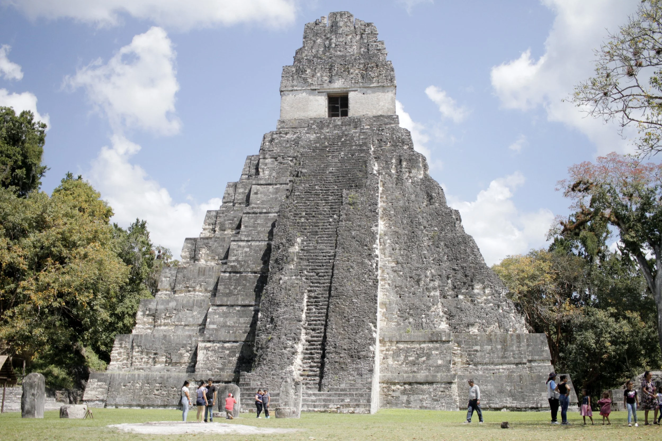
In 1962, a team of archaeologists climbed into history by tunneling down through the base of a temple stairway and slipping through the roof to uncover the tomb of Jasaw Chan K'awiil I. What they found felt less like an excavation and more like stepping into a carefully arranged scene from the past: a lofty vaulted chamber, dominated by a massive bench where the king’s body lay upon a simple woven mat.
The tomb was anything but spare. Surrounding the monarch were lavish offerings that spoke to power, ritual and craft — soft jaguar skins, strings of pearls, glinting jade, finely made ceramics and rare shells harvested from distant coasts. Mirrors and delicate works of art caught the light and the imagination, each object a small testament to the courtly life that had been.
Most arresting was the king himself, swathed in jade. His body was draped with pieces of that luminous stone, culminating in an enormous necklace of 114 beads — a weighty, dazzling crown of commerce and belief, tipping the scales at more than eight and a half pounds.

By 2 p.m. our little adventure wound down. Willie steered us to a tucked-away café where we ordered comforting plates of chicken and vegetables with mixed rice, sides of fries, warm tortillas and tall, refreshing lemonades — exactly what hungry legs begged for after nearly five miles of walking. Along the way we’d met the jungle’s usual residents: spider monkeys swinging through the canopy, stately wild turkeys and curious, raccoon-like critters peering from the underbrush.
Willie favored the “back trails,” narrow paths that felt secret and a little wild; he moved through them with the easy confidence of someone who knows every root and stone. Each time we stepped out of the trees, the ruins would reveal themselves anew, more dramatic than the last — a small, disbelieving gasp from our group, then silence, everyone taking it in.
Finding my driver in the parking lot proved comically difficult — the crowds, the scattered vehicles and my post-hike haze made for a short game of hide-and-seek — but eventually we reunited and headed back toward Flores as the afternoon melted into evening, the day’s memories settling in like warm light.
Tip | After you finish exploring Tikal, make reconnecting with your driver part of the adventure. Before you set off, snap a quick photo of the vehicle (license plate and any unique details), note nearby landmarks or gate numbers and agree on a meeting point and time. If possible, save the driver’s number and share your own and consider taking a photo of the driver so you’ll recognize them more easily. Service can be spotty, so having visual cues and a simple plan will turn a stressful search into a smooth, confident return.
04 | Savor Sunset Flavors at Bistro Puertas del Cielo in Flores
Back in Flores after a day of wandering ancient ruins and sunlit alleys, sink into the warm glow of Hotel Petén’s pool and let the fatigue melt away. As evening settles, wander to Bistro Puertas del Cielo for dinner, where the usual formality of menus disappears. The chef approaches with a friendly smile, asks what flavors you love and sets to work.
For me — I was served a perfect fillet of white fish bathed in a bright citrus sauce, accompanied by tender seasonal vegetables — simple, fresh and made just for that night. It’s exactly the kind of place where you trust the kitchen to surprise you and you leave grateful for the small, delicious gamble.